Snitz’s Sedona photo/hiking adventure
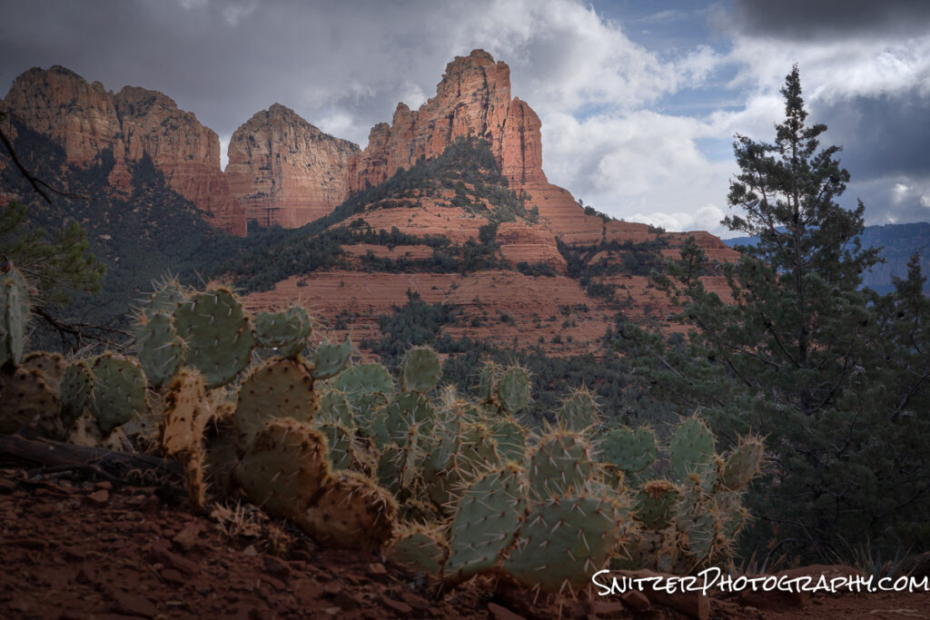
Sedona, Ariz is one of my fav places to hike. Gorgeous scenery, awesome weather (excepting summer), and little driving required (most hikes 10 mins from town). It’s also a great place for nature photog! Some of my favorite places to shoot include:
Crescent Moon Picnic Area: Great views along Oak Creek overlooking Cathedral Rock. https://www.alltrails.com/explore/trail/us/arizona/crescent-moon-ranch-at-red-rock-crossing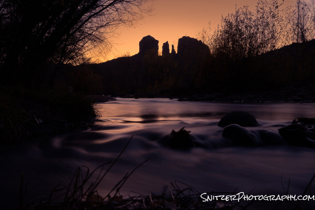
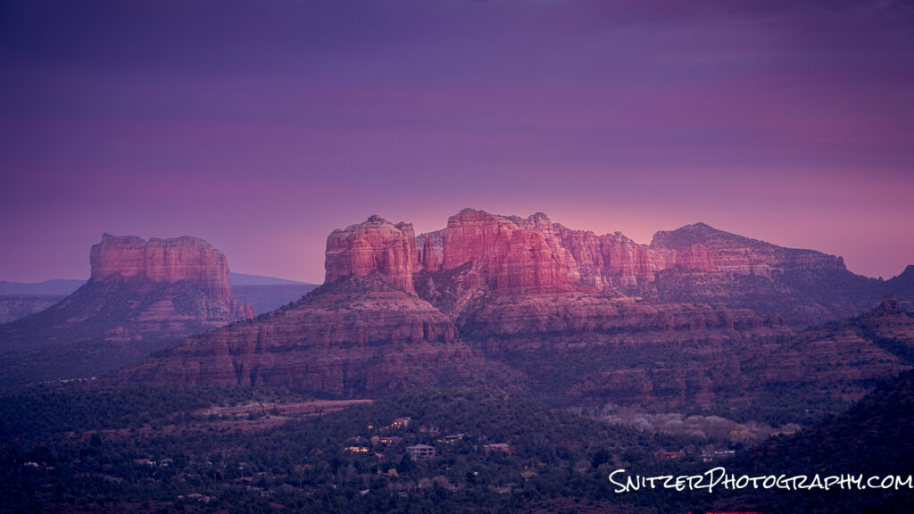
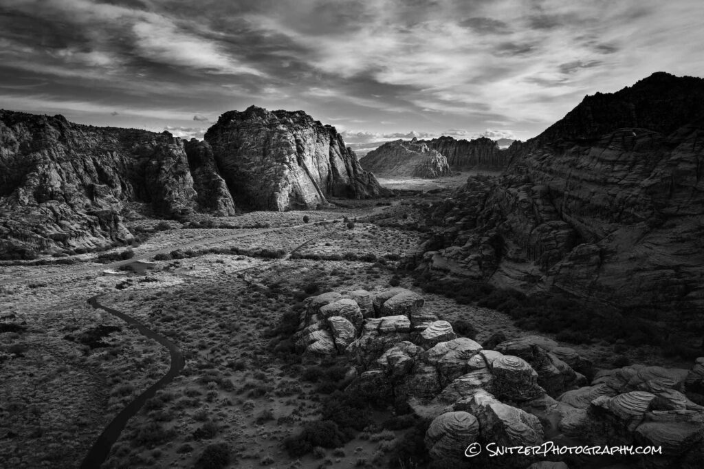
Upper Red Rock Loop: Several awesome pullouts provide a view of Cathedral and Bell Mountain.
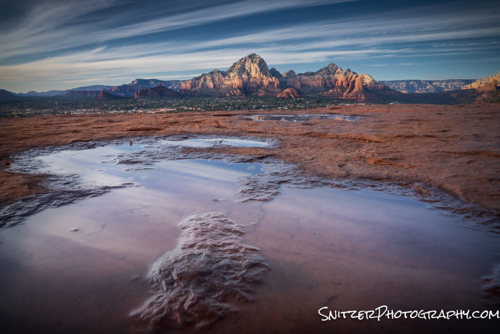
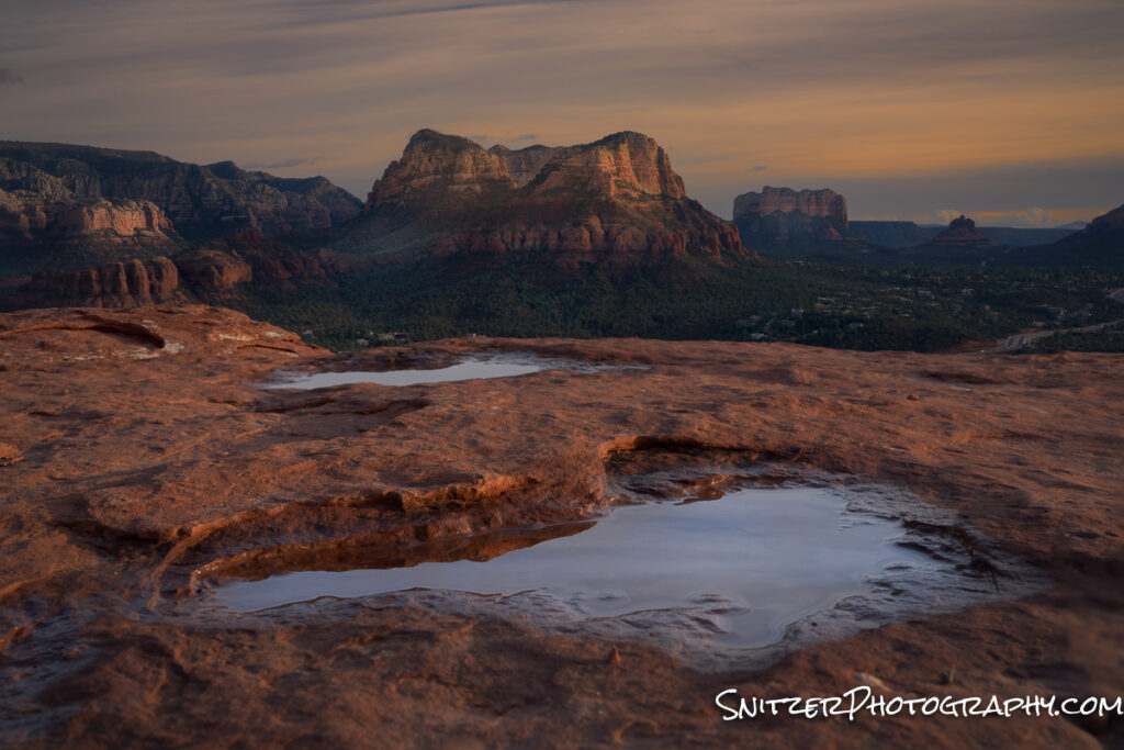
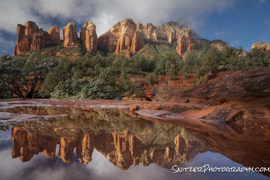
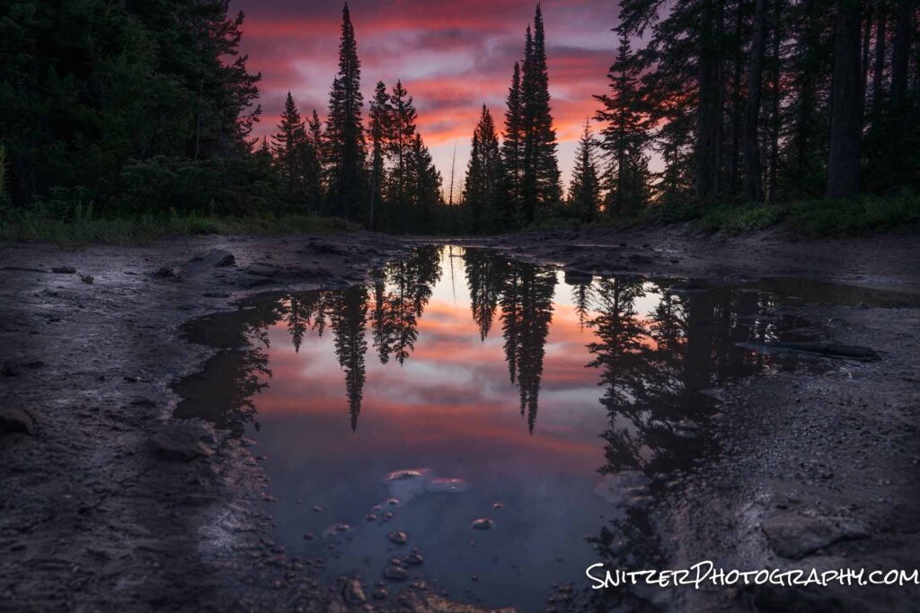
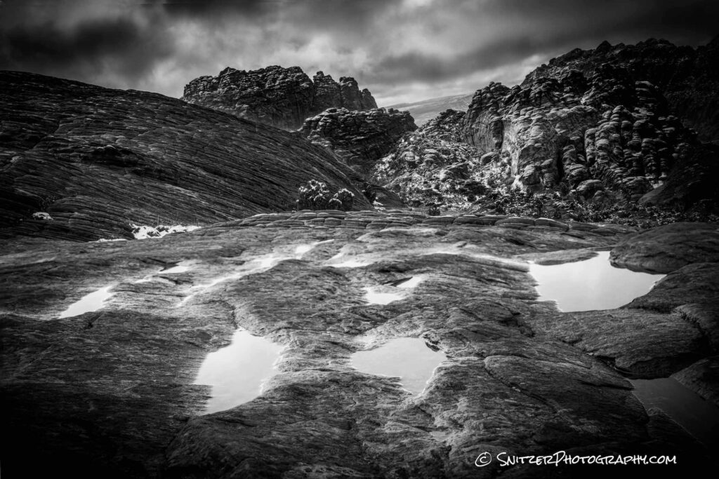
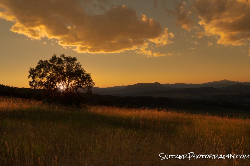
Airport Mesa Viewpoint (& attached trail): Not to be confused with the airport viewpoint above. This hiking spot has only about 8 parking spaces. It provides trails with 360-degree panoramic views of the entire valley! After a rain, reflecting pools form on the rock face providing great ops to shoot low and reflect the mountains. https://www.alltrails.com/explore/trail/us/arizona/sedona-airport-loop-trail
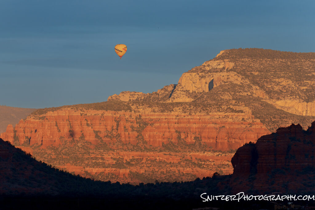
Don’t be afraid to use your telephoto lens to capture some far-away action. This shot was taken shortly after dawn with a 300mm lens.
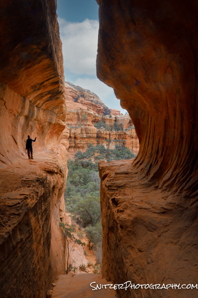
Boyton Canyon to the Subway: The Subway is a detour off the main path that while impressive may prove a bit hair raising for some hikers. Requires a good level of fitness and some climbing experience. https://www.alltrails.com/explore/trail/us/arizona/boynton-canyon-trail
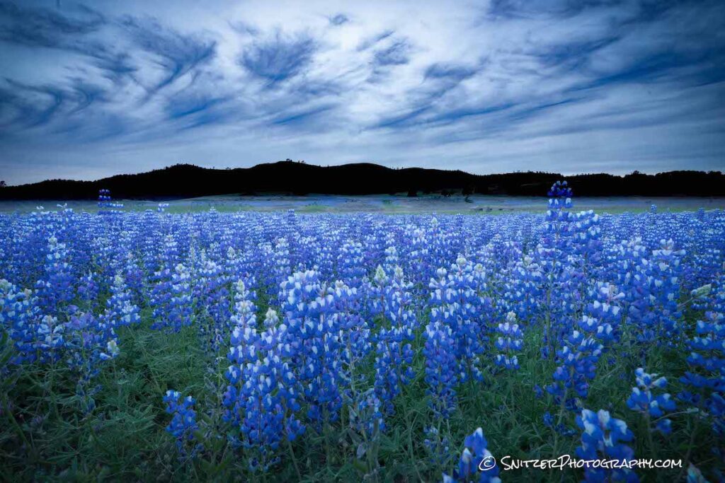
Seven Sacred Pools hike. Great foregrounds. After a rain look for reflecting pools (shoot low). https://www.alltrails.com/explore/trail/us/arizona/soldier-pass-to-brins-mesa-loop
Some of my favorite hikes also include:
Easy/Moderate
Doe Mountain Loop https://www.alltrails.com/explore/trail/us/arizona/doe-mountain-loop-trail
Long Canyon, Deadman’s Pass, Mescal Loop https://www.alltrails.com/trail/us/arizona/mescal-mountain-long-canyon-deadmans-pass-mescal-loop
Secret Slickrock (easy short/great for sunset) https://www.alltrails.com/trail/us/arizona/secret-slick-rock-trail?ref=result-card
Sugarloaf Loop https://www.alltrails.com/trail/us/arizona/sugarloaf-loop-trail
Moderate/Hard
Hangover Trail https://www.alltrails.com/trail/us/arizona/hangover-trail-out-and-back
Sterling Pass https://www.alltrails.com/trail/us/arizona/sterling-pass-trail
Devil’s Bridge via Chuck Wagon Trail (great view, overrun with tourists…everyone flocks to this, I’d skip) https://www.alltrails.com/trail/us/arizona/devils-bridge-via-chuck-wagon-trail
Hard
Bear Mountain https://www.alltrails.com/trail/us/arizona/bear-mountain
Click here to see my original gallery photos: https://www.snitzerphotos.com/Other/Galleries/Sedona-2021/n-XpLtXs/
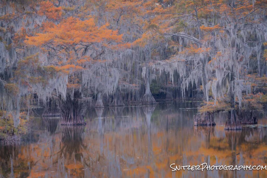
Caddo Lake: Apocalypse Now?
Caddo Lake, located in Northern Texas, is becoming one of the most photographed Cypress Forests in the United States. This unique landscape is both gorgeous and pretty darn mysterious looking.
The wetland lake area is massive encompassing over 25,000 acres and stretches into Lousiana. By the way, since 1965 apparently, there have been literally hundreds of Bigfoot sightings on the lake. Not kidding!
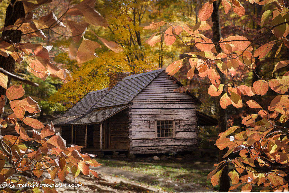
Each fall (Mid November down there), as the colors of the Cypress trees change, legions of leaf-peeping photographers converge on this place… including T Snitz Esq!
There are essentially two ways to view the lake. The first is from shore, inside the Caddo Lake State Park.
20 minutes before sunrise.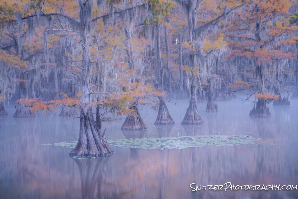
Five minutes before sunrise.
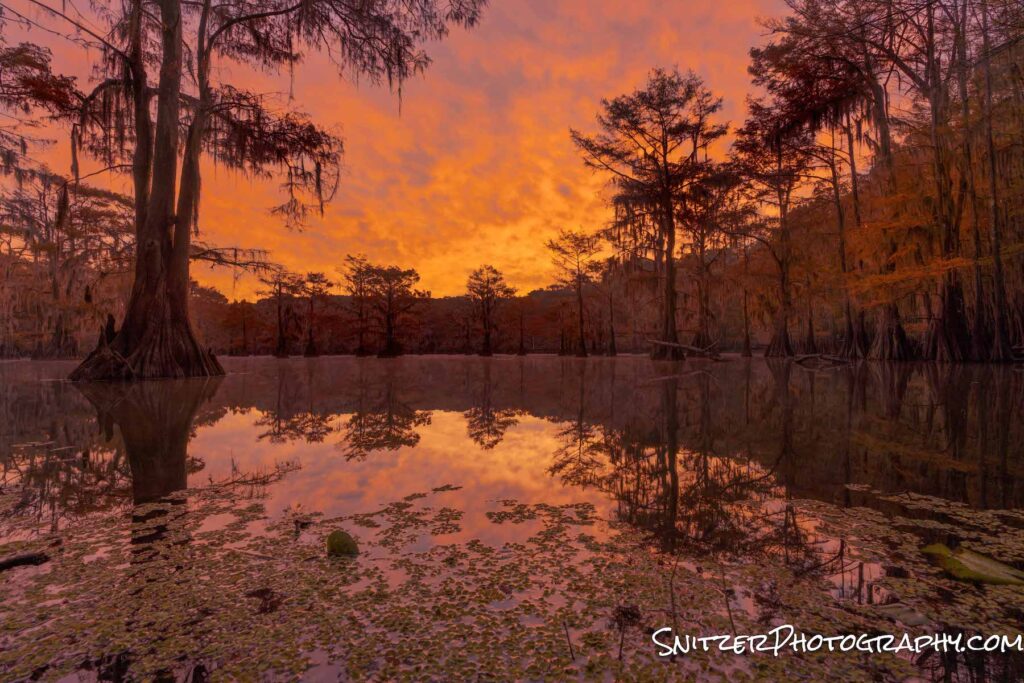
The background forest begins to glow about one hour later! Badabing.
Occasionally you’ll see some folks out paddling in the park.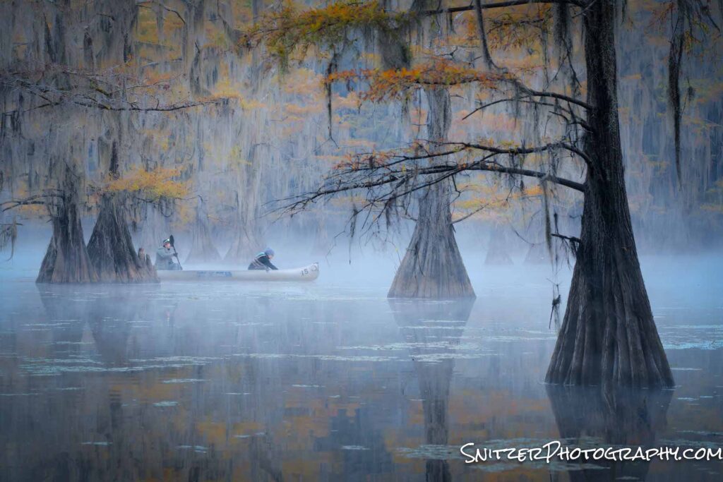
To view the main lake, you need to be on a boat. It’s difficult to view from the shore in most spots. Dawn patrol. Fisherman locked and loaded (with Coors Light)!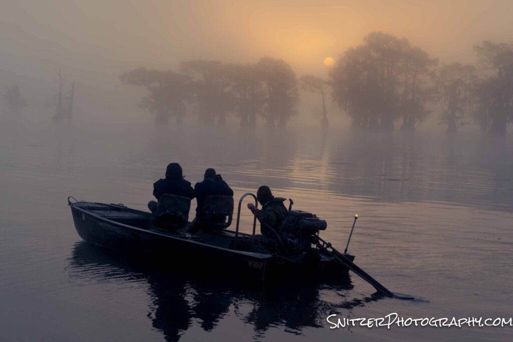
It’s pretty spooky out here.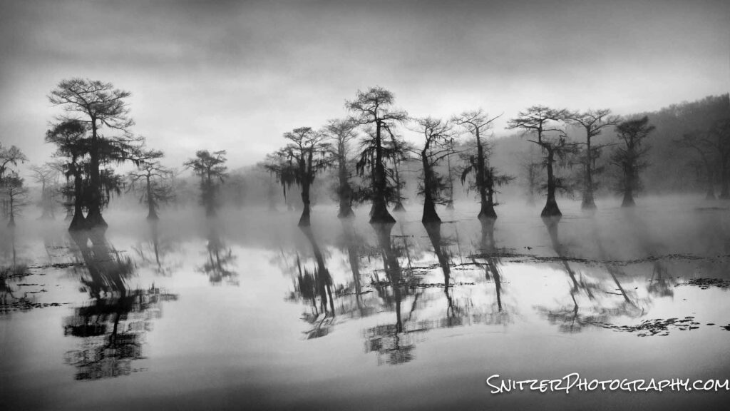
The colors really pop when the sun is obscured by clouds!
An Egret keeping watch.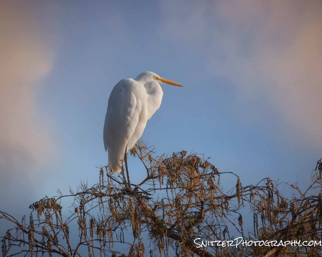
Saying goodbye to the Bayou, I had the op to drive through the Ozarks on route home to Illinois. Armed with a Mavic II Pro drone…got a great vantage point to view the fall color.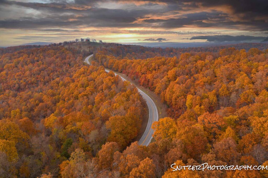
See the rest of my pics by clicking the link: Link to the photo gallery
A final word of caution: Caddo Lake is rapidly getting discovered. Motorized boat rentals which typically come with a guide (lake can be difficult to navigate) are already getting booked up for next fall!. For serious photographers looking for a guided experience, many photo workshops for next fall (2022) are likewise already full. Ergo, plan your trip now!
Fall colors explode over the Rockies
Every fall the Colorado Rockies erupt with bright colors, making late Sept & early October prime viewing. It’s hard to pin down the exact week for peak color in advance as the previous winter’s snowfall, rain and fall temps all impact when/how the leaves turn color.
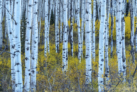
Three primary ecosystems produce the amazing light show. Large groves of Aspen trees turn yellow, with Cottonwoods typically morphing into an orange or bright red. Bushes and ground covers often can create a yellow, orange or dark red carpet which enhances the foliage display.
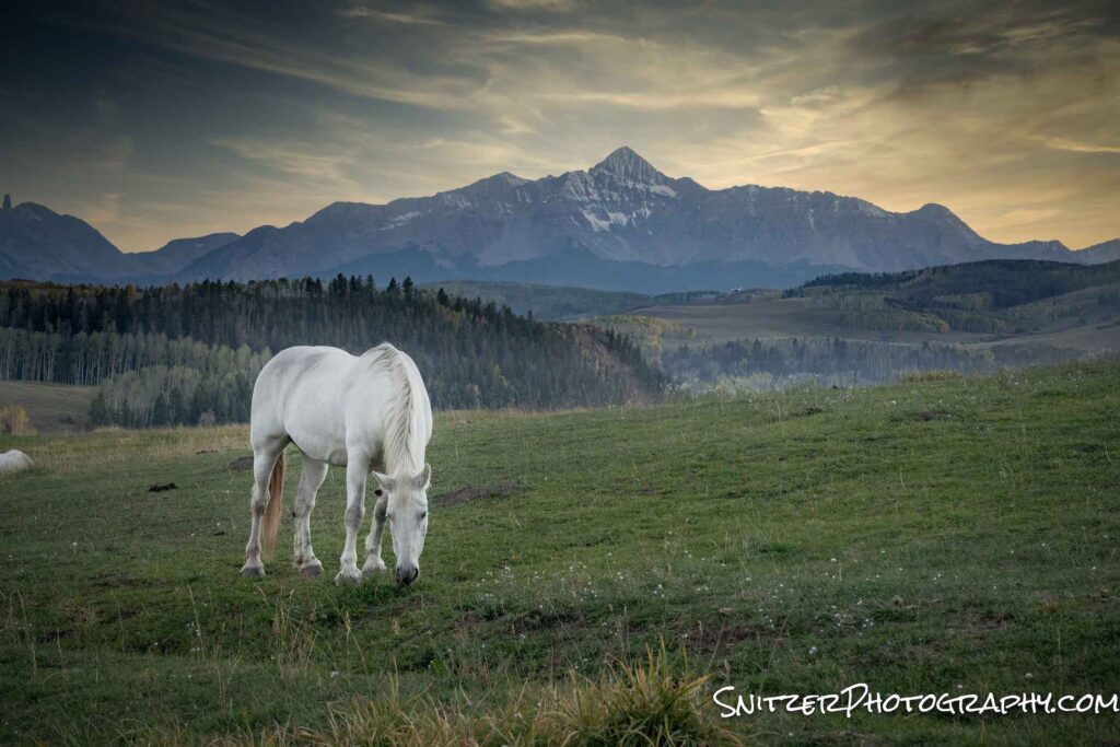
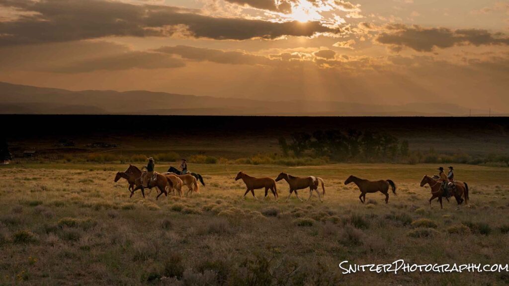
We started our travels in Steamboat Colo. The ski area is surrounded by hundreds of farms and there are great ops to grab photos of horses, cattle, and such.
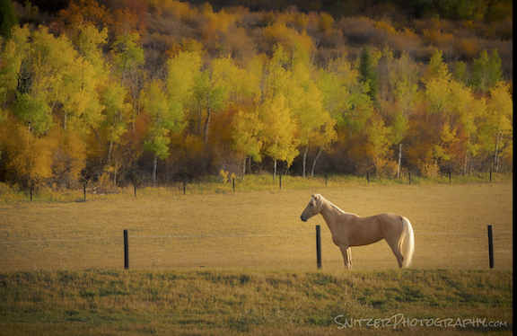
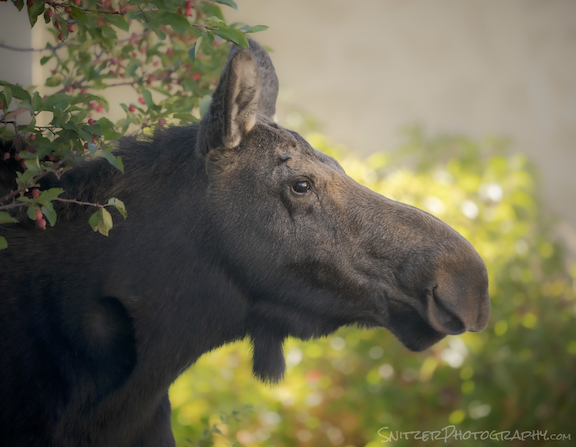
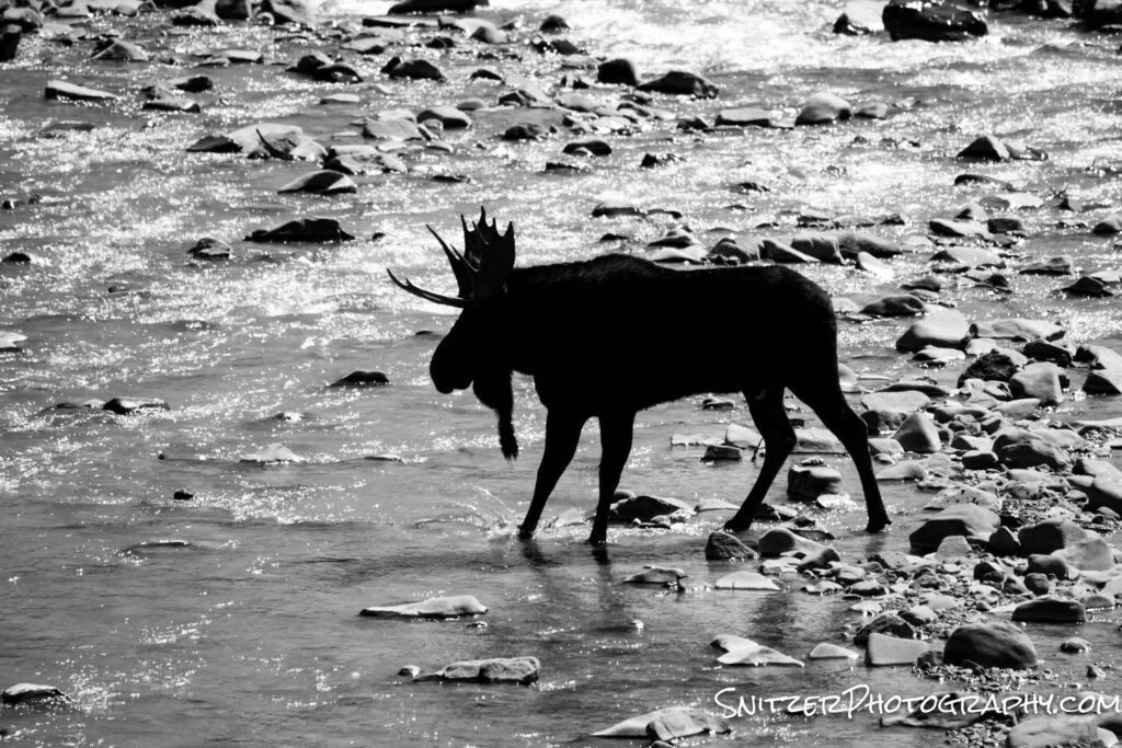
Speaking of animals, Bullwinkle here was not photographed in the wild. The photo was taken in the backyard of our Steamboat townhome!
Numerous hikes in the area feature Aspens against the background of changing underbrush.
BTW, a clear sky provides a great op to produce star stars. For our photos buffs, the trick is to reduce your aperture to F22 and position the sun so it’s just peaking around a stationary object (like these trees).

My hands-down fav place to photograph in Steamboat during fall is the top of Rabbit Ears Pass. The photo below was taken with the help of a Mavic II Pro drone. I’m finding that drone photography is a game-changer. Aeriel photography allows the capture of views that were impossible before (unless you rented a chopper or fixed-wing aircraft).
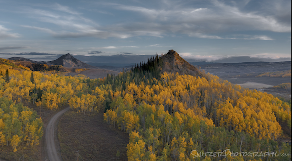
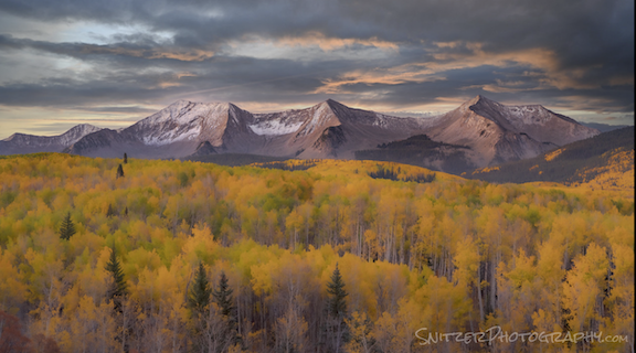
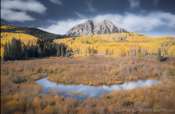
This year, for the first time, I decided to explore fall color in Crested Butte. The area is home to some of the largest Aspen groves in the US. Ground zero for viewing is the dirt road that rises over Kelber Pass. The best shots were also taken with a drone (often flown one or even two miles away!), which allowed me to position the camera exactly where I wanted it!
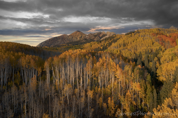
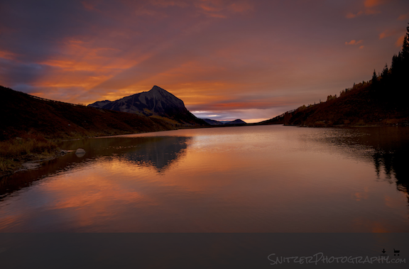
Sometimes, rising before or at sunrise is required to view exceptional color. Both these shots were also taken at Crested Butte.

DON’T STOP NOW. CLICK THE LINK TO SEE MORE PHOTOS!! Link to more PHOTOS!
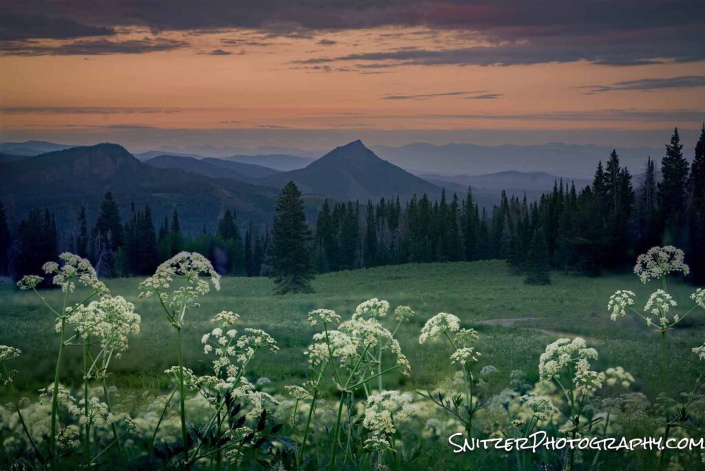
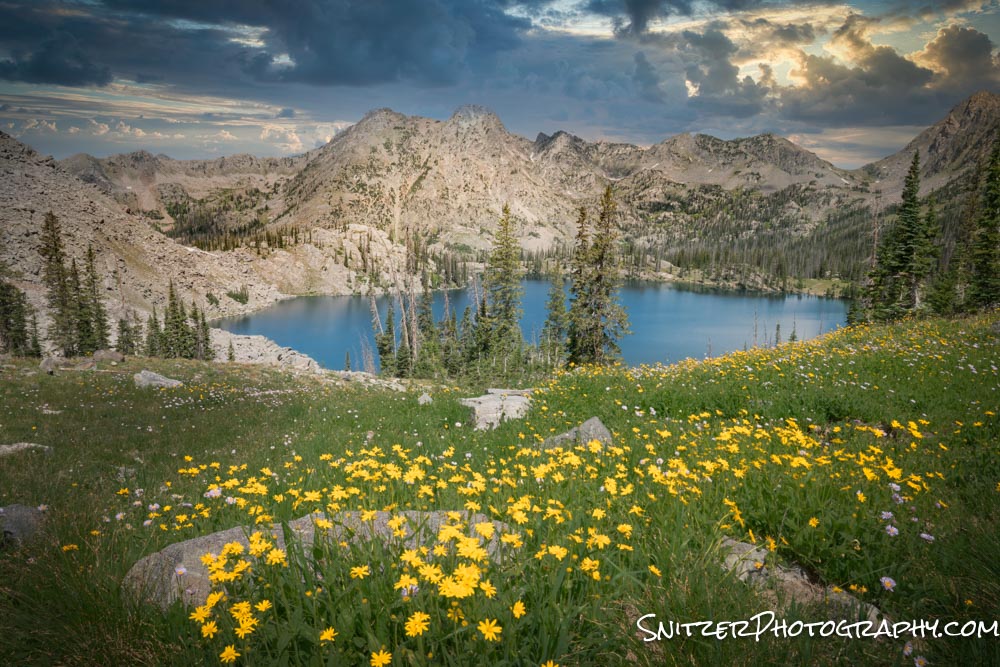
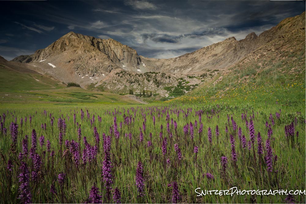
Wildflower Explosion in Colo’s Rockies
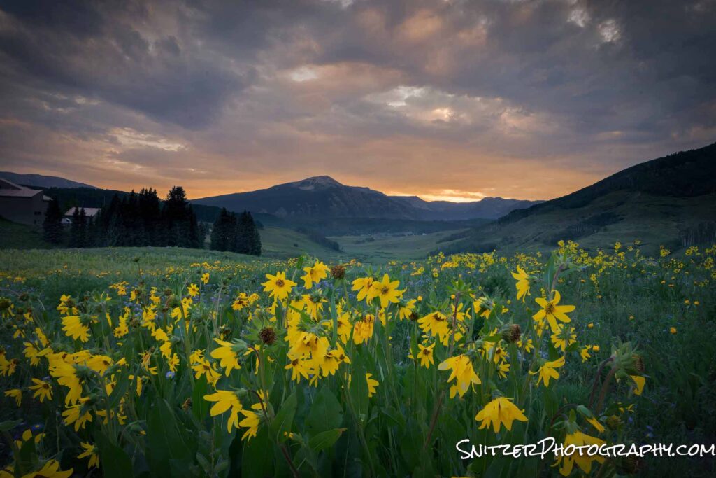
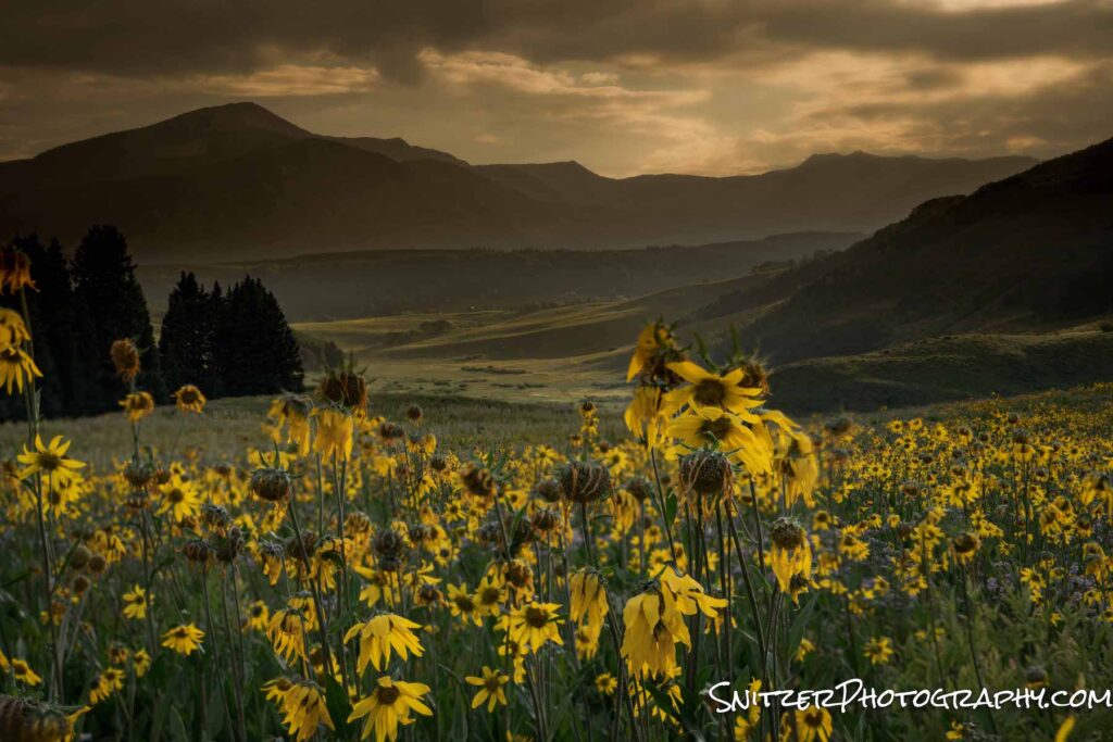
Each summer, the upper elevations of Colorado’s Rocky Mountains come alive with spectacular wildflowers. The exact timing is dependant on the previous winter’s snowmelt and Spring rains. Generally speaking mid to late July provides a 2-3 week window of bomber viewing.
The images below come from our home base in Steamboat Springs, Colo. My favorite viewing spot is the trail up to Rabbit Ears. And my favorite time? Err…20 minutes before dawn (aka 5 am). If you want to catch the best light, be prepared to drill it early.
On route up the trail.
The first wildflower meadow about 20 minutes into the hike.
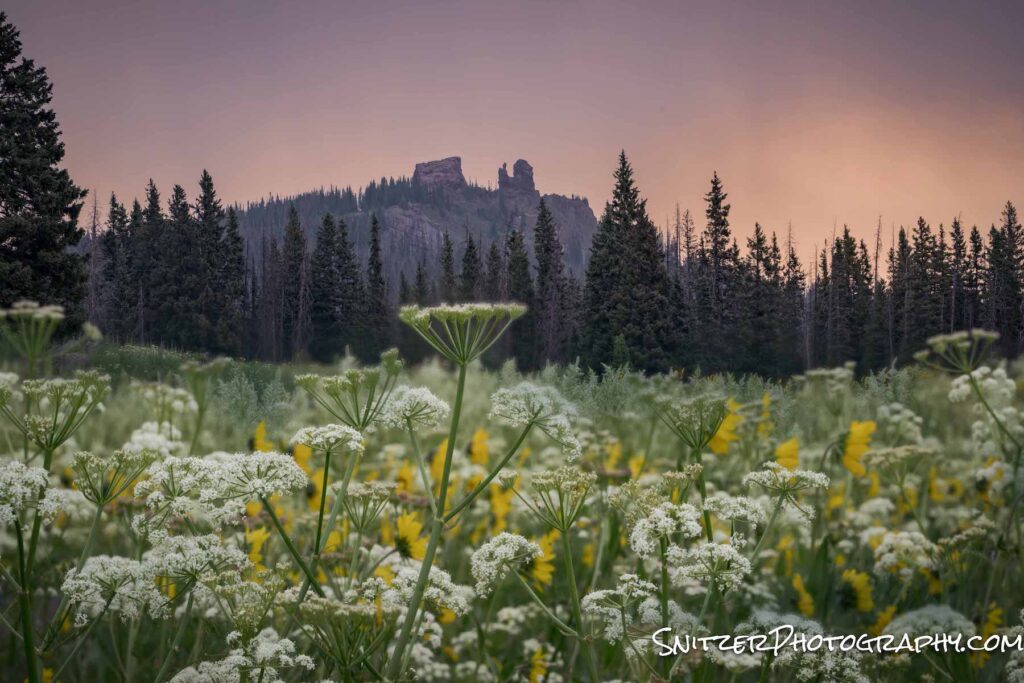
Rabbit Ears in full glory!
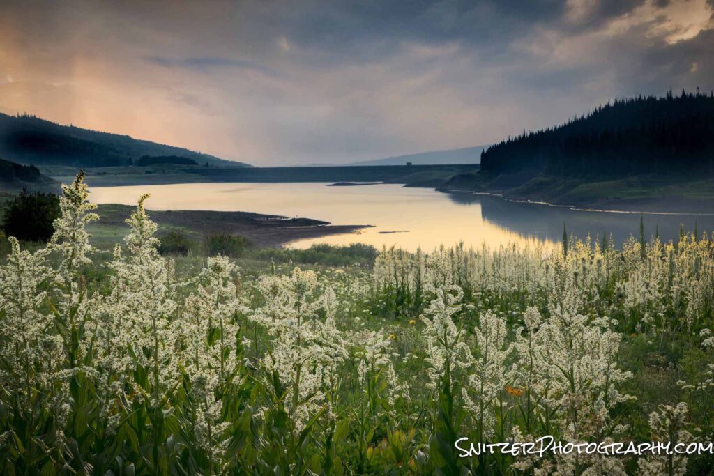
Let’s not forget the Flattops Wilderness area, a 50 minute drive Southwest of town.
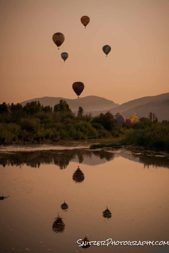
July is also the time to catch Steamboat’s annual Balloon Rodeo .
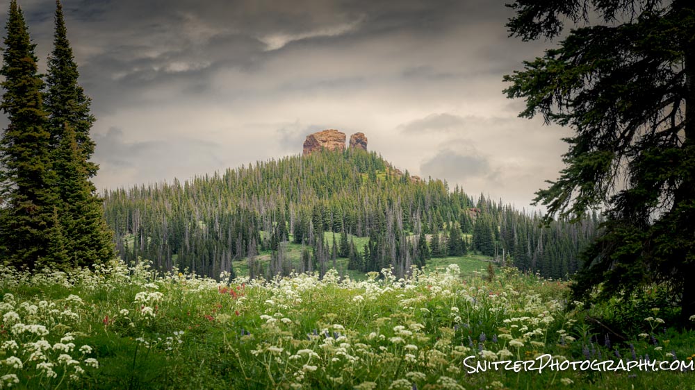
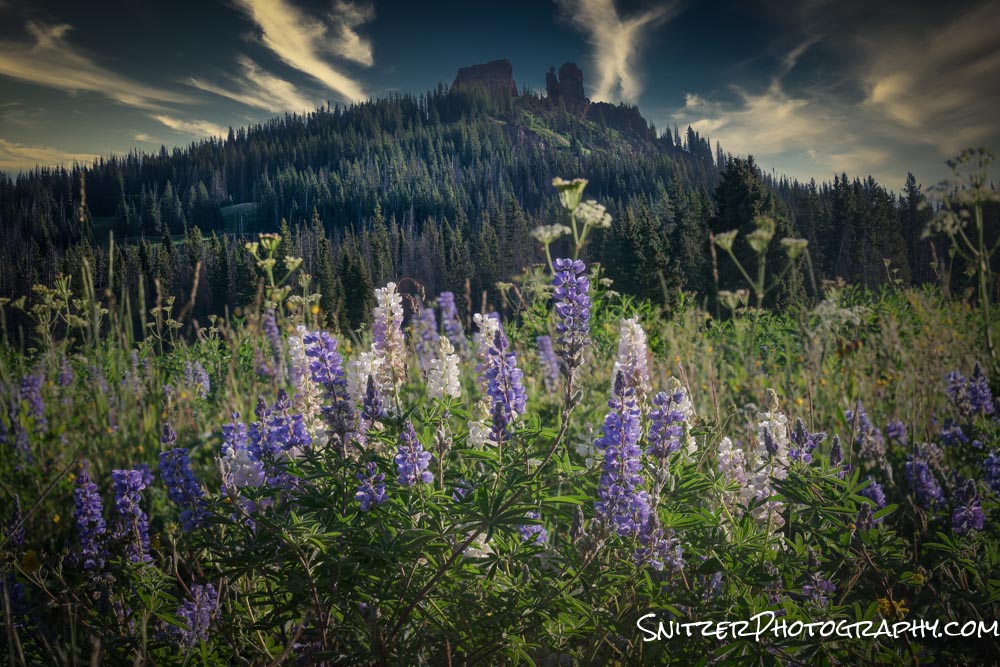
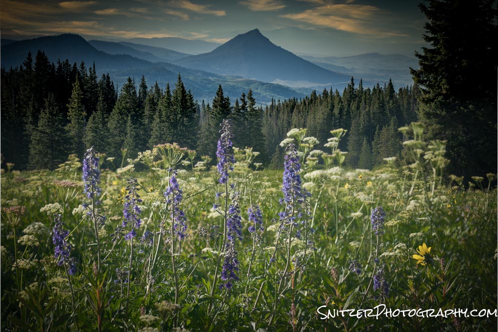
Our next stop is considered by many to be the epicenter of Colo wildflowers; Crested Butte. There are too many awesome spots to mention, but high on my list is the meadow just outside the riding stables.
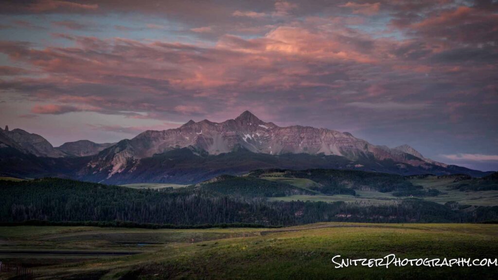
Telluride doesn’t have the plethoria of wildflowers but still has among the best mountain peaks in the state!
Next July, you owe yourself the op to take advantage of Colo during the bloom! Don’t miss it. More photos! See the link below!
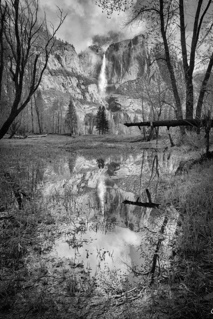
Spring in Yosemite!
Exploring Yosemite in late April provides blooming wildflowers and waterfalls running at full power! It also means smaller crowds, especially if you go mid-week (highly recommended).
Combining those flowers with a breaking storm and the iconic “Tunnel View” is bomber! BTW, for our photo buffs: I captured these images using a technique called “photo stacking”. I take multiple photos (one focusing close up on the flowers, then a second focusing on the mountains in the background) and combine them digitally into one perfect sharp image (Photoshop).

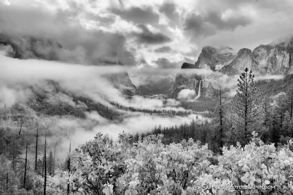
“Valley View” is another fav vantage point in the park.
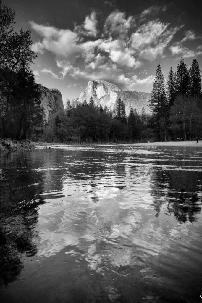
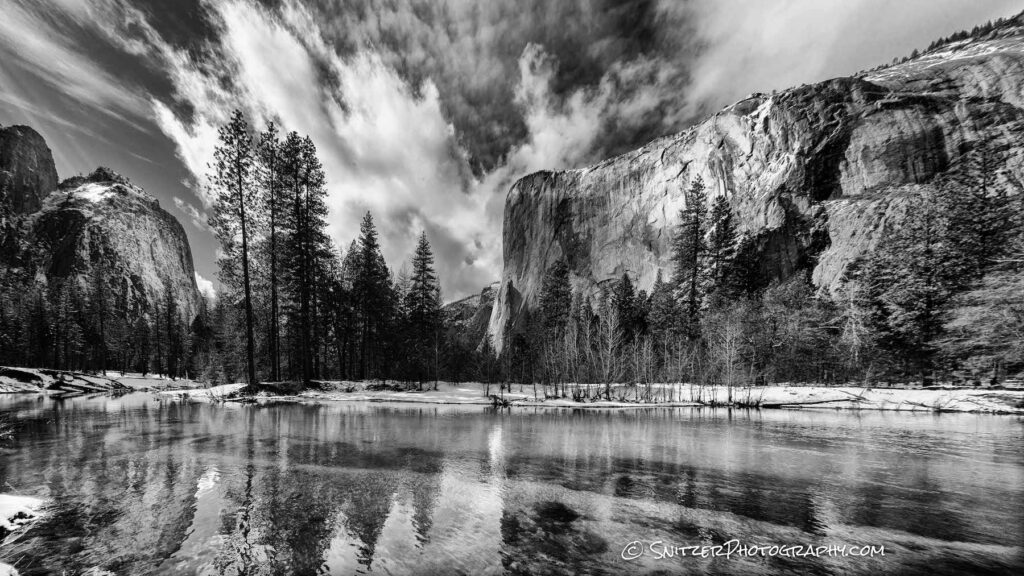
Half Dome (below) along with El Capitan (2nd below, taken on an earlier trip) are the two most well-known landmarks in the park.
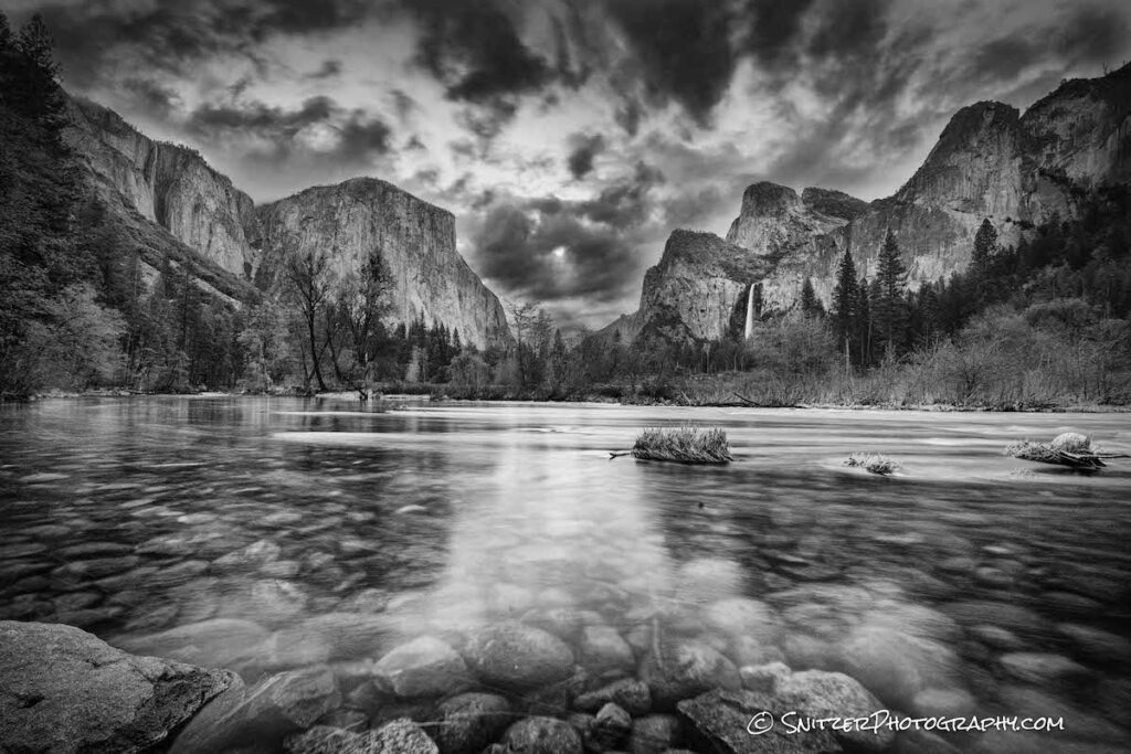
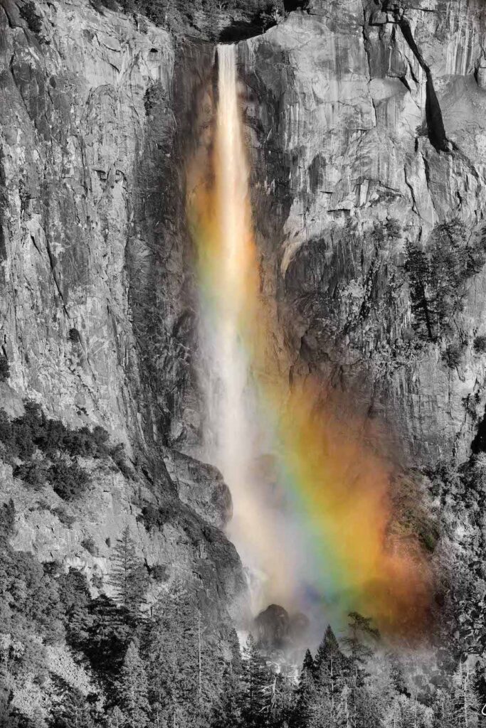
The park’s two most photographed waterfalls are Bridalveil (shown framed by a rainbow below) and Yosemite which drops over 2,400 ft. Click photo or link at the bottom for high res versions of these images (& to see the entire gallery).
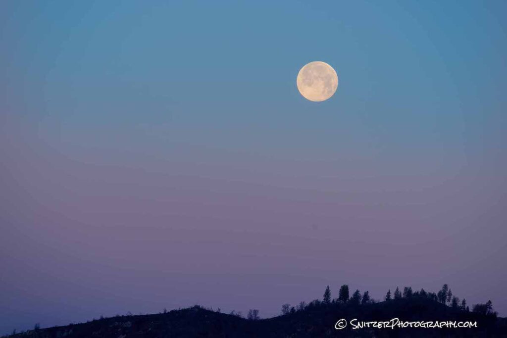
The full moon shown below was captured about 10 minutes before sunrise. The alpenglow lighting produces some amazing colors, yes? Light at a low angle (pre-dawn or post-sunset) reflects off particles in the atmosphere to create this phenom. Click photo for high res image & full gallery.
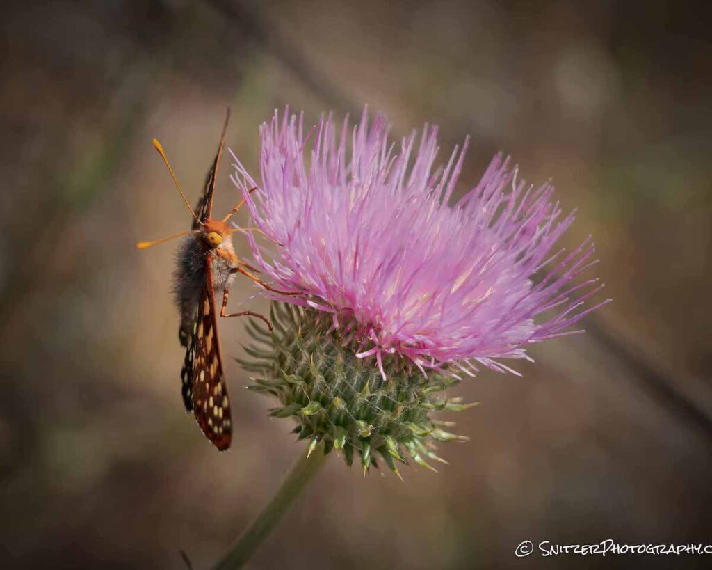
The Hites Cove Trail, approx 10 miles outside the park features a boatload of poppies and an airforce of colorful butterflies.
What kind of flowers below? Lupine!
Click the link below to see more photos(see them in high resolution)! https://www.snitzerphotos.com/Nature-Travel/Galleries/Yosemite-2021/n-L2MW9h/
Snitz hits Death Valley & points West!
I just returned from my first trip to Death Valley. I also had the op to visit some bomber places on my drive out there!
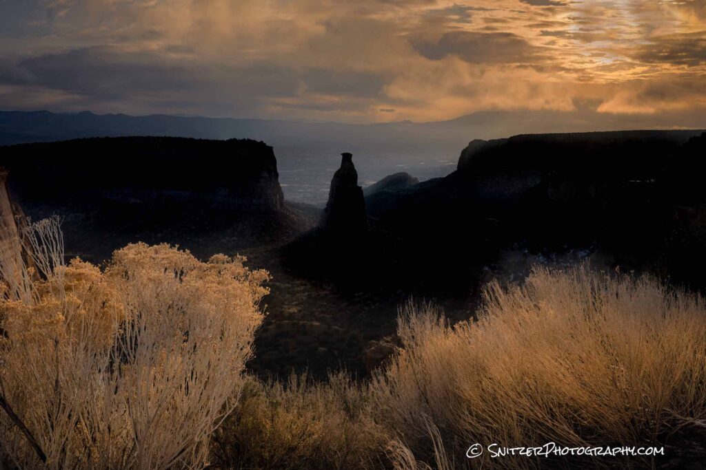
The trip began in Steamboat Springs, Colo. About three hours Southwest lies the Colorado National Monument, located in Fruita. The 23-mile scenic drive has a series of spectacular vistas. Absolutely worth checking out as you venture West on I70.
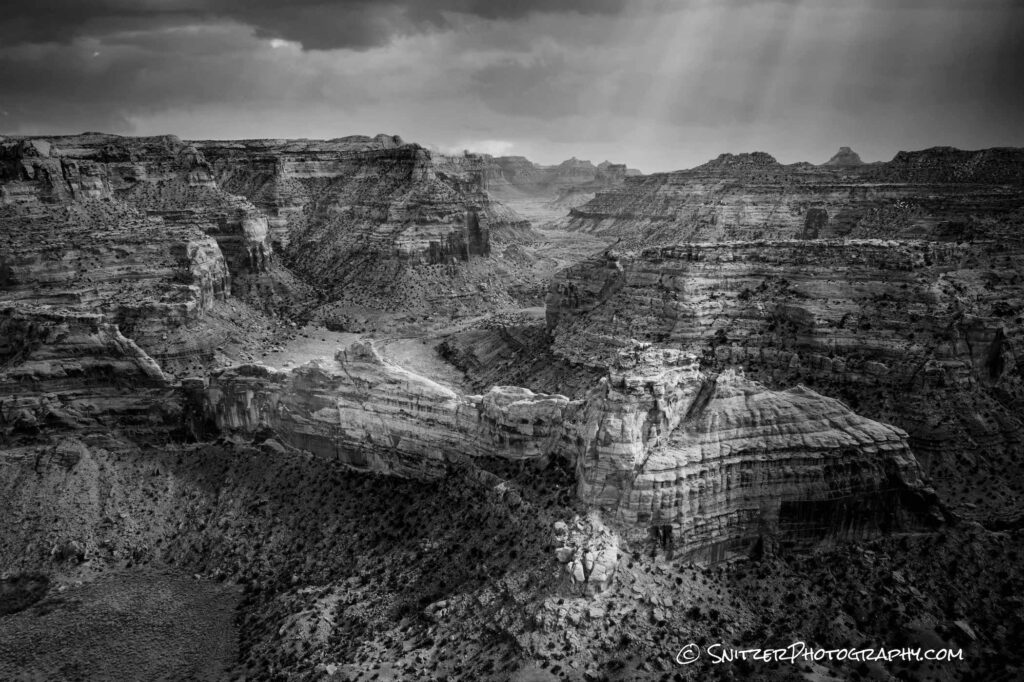
The following day, I took some remote jeep roads into the mountains to explore the San Rafael Swell. Accessed off I70 this area is known for an amazing overlook referred to as “The Wedge”. The image below was taken immediately after a breaking snowstorm with a drone. The best part of the canyon can only be shot effectively remotely. I flew about 1 mile into the canyon to get this perspective.
Day three (& another 3 hours West) lies the town of St George, Utah, and Snow Canyon (often referred to as the little sister of Zion Nat Park). This uncrowded State Park features interesting pools of water that form immediately after a good rain or snowstorm.
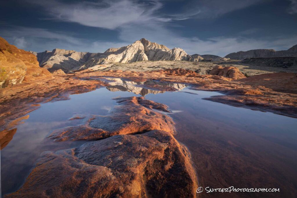
The image below was taken with a drone, looking North.
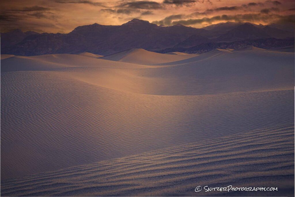
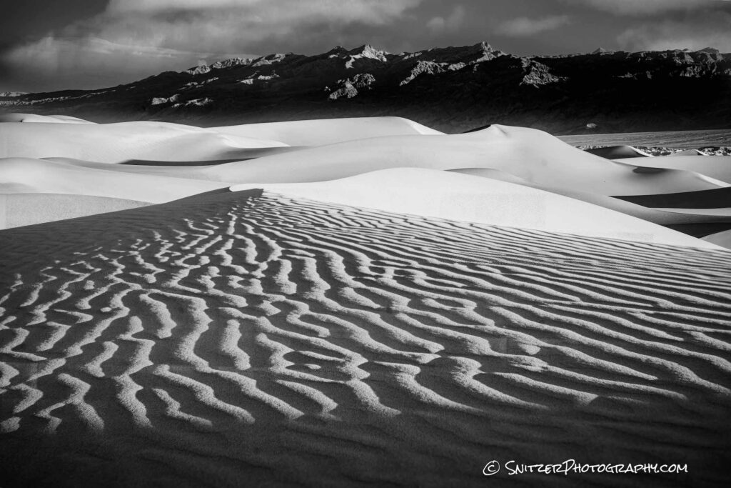
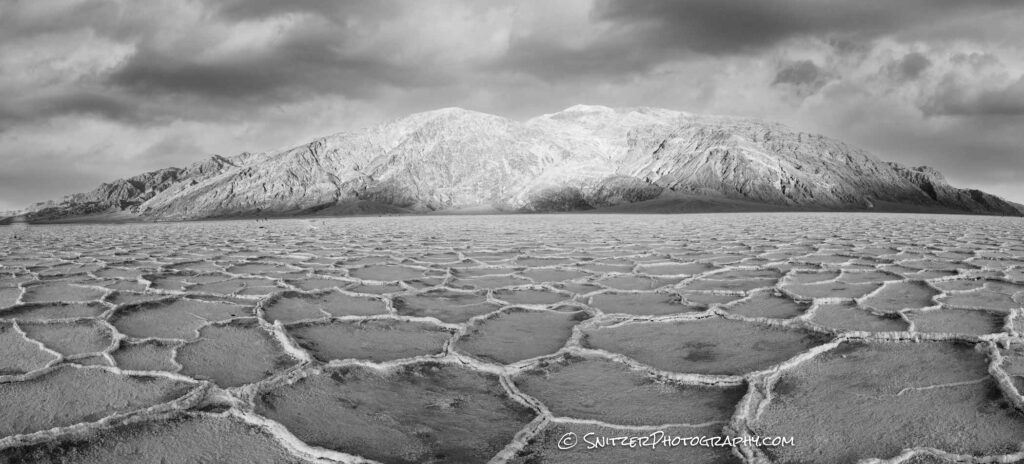
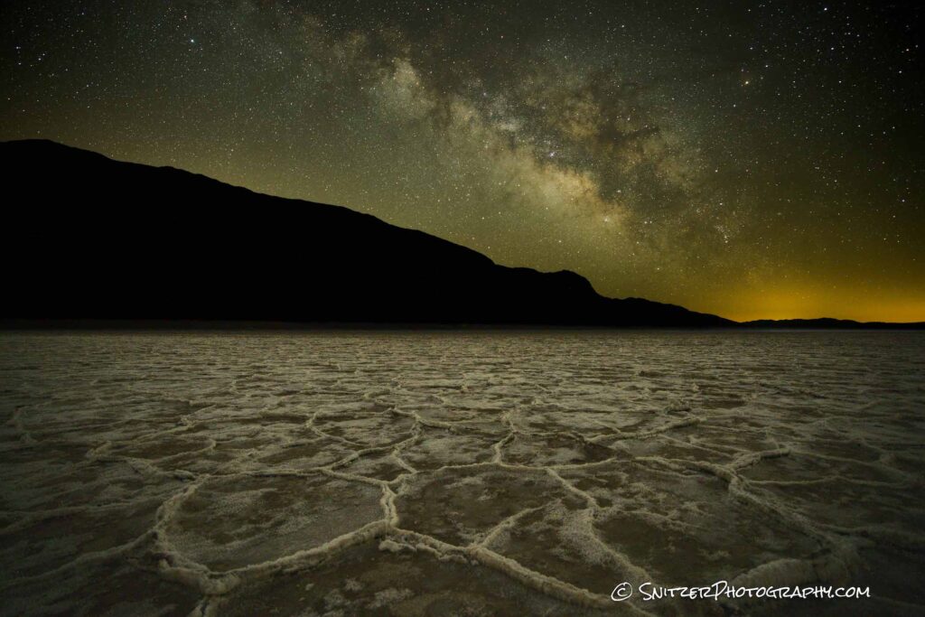
And finally, the main event: Death Valley. There are certainly some amazing sand dunes:
But also some otherworldly landscapes, like Badwater Basin (shown at dusk and under the Milky Way below).
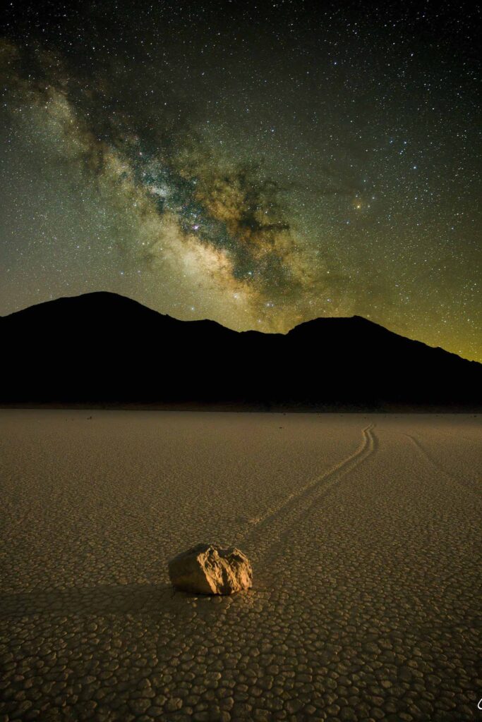
Talk about unusual, “Race Track” (NW corner of the park) is known for unique rocks that appear to be walking along the clay desert floor. In reality, ice forming under these bad boys, along with fierce winter winds actually cause the movement. To grab this shot under the Milky Way, a buddy and myself ventured out on the 2-hour drive to the destination at 1 am! Then we walked about 2/3rds of a mile to find a suitable rock. BAM.
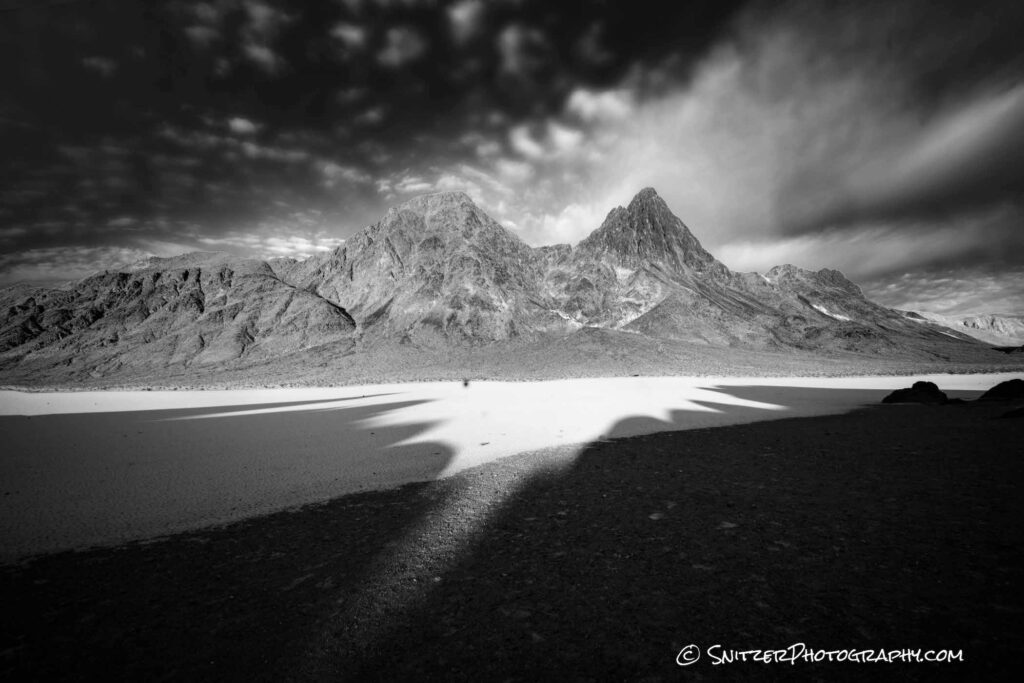
At sunrise, a few minutes down the exit road, we were greeted to this crazy image. The jagged foothills to our east formed the unusual shadows below.
Want to see more! Click the link for more images (full Death Valley Gallery): https://www.snitzerphotos.com/Nature-Travel/Galleries/Death-Valley-2021/n-Z2KGRD/
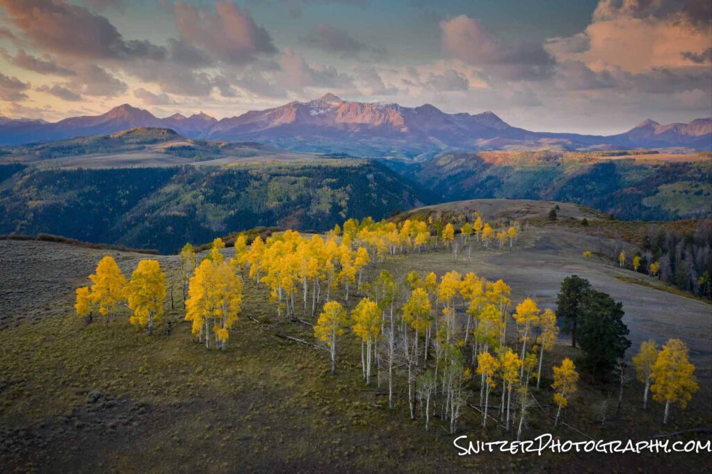
Fall color in the Rockies
The Rockies are usually awash with color in late September, especially in my favorite viewing spot, the San Juans! The towns of Telluride, Ouray, and Ridgeway are great launching pads to view the spectacular scenery.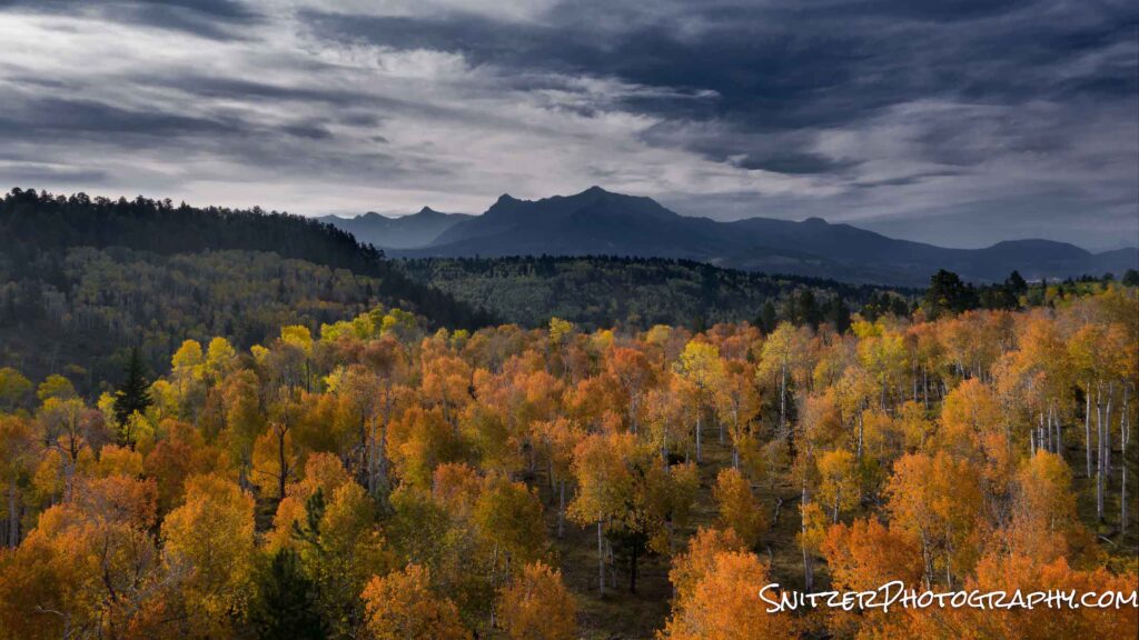
Telluride features the most impressive mountains which can be viewed from what’s often referred to as the San Juan Scenic Byway. There are also some amazing jeep roads, which while hair-raising to drive on, provide unique views. My favorite of the latter is called the Last Dollar Road which connects the town of Telluride to Ridgeway.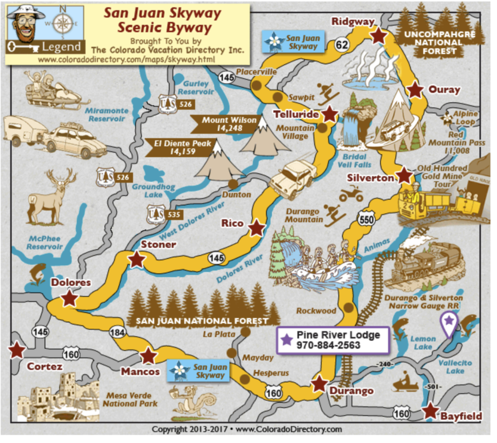
A new tool I’m using this year is an aerial drone. This game-changing device allows me to get in shooting positions only a helicopter could previously reach. A bomber vehicle for capturing remote fall colors. The drone can easily grab photos in locations over 2 miles away!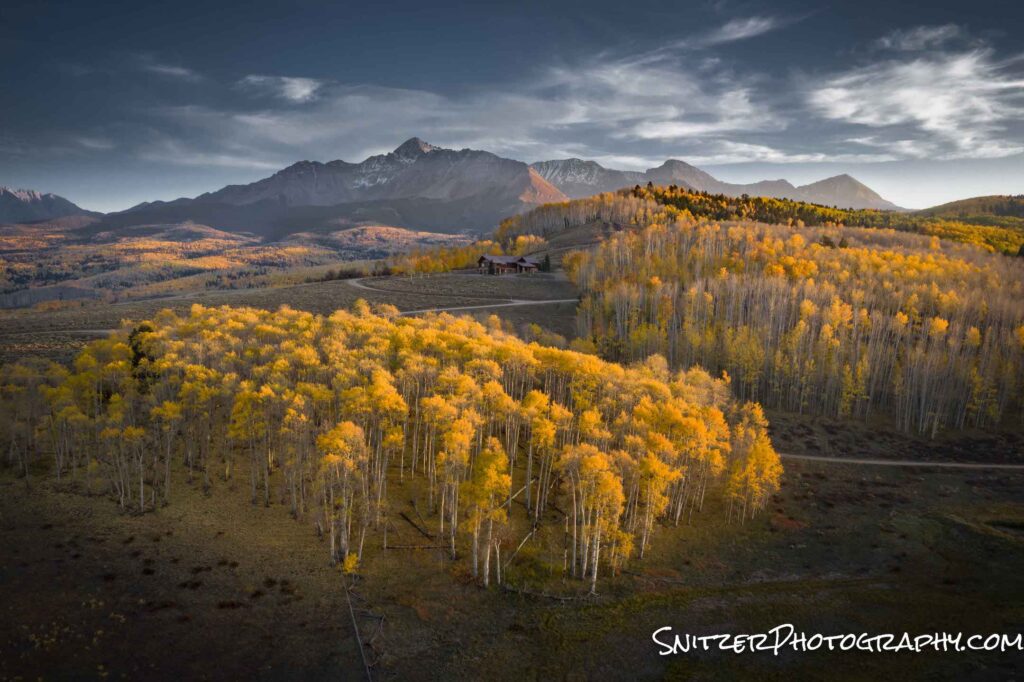
Did I mention the wildlife viewing isn’t half bad either!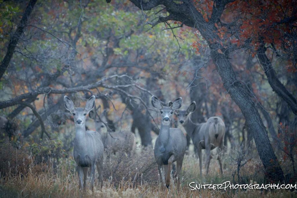
Speaking of animal viewing, I had the op to shoot at a ranch in Westcliffe, Colo! Early morning provided some spectacular lighting!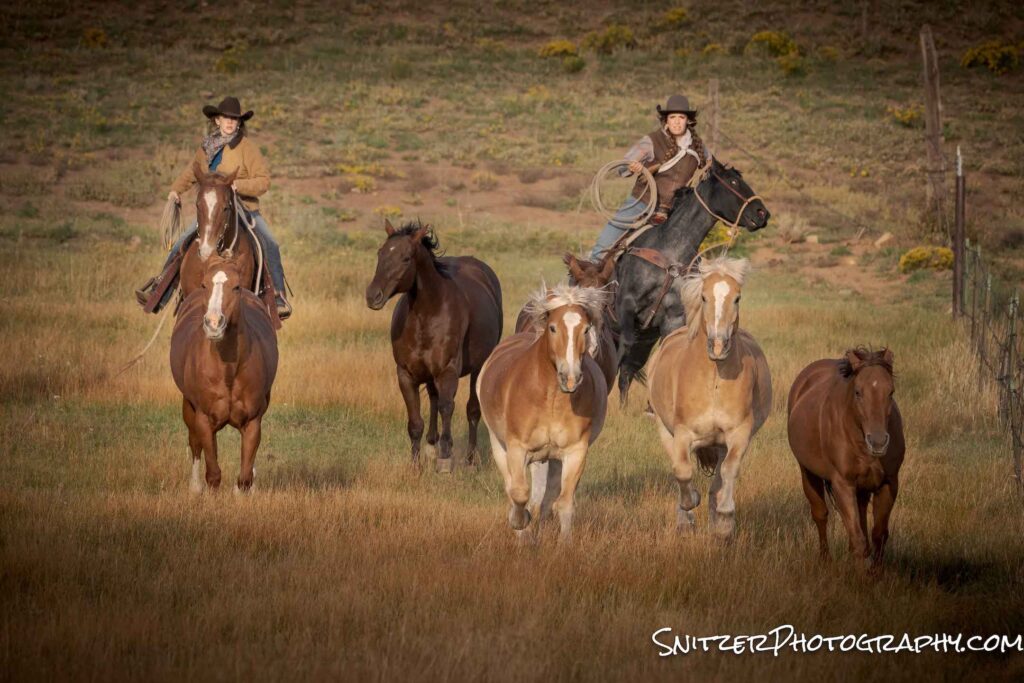
Click the link right for my full gallery of photos! Link for photos
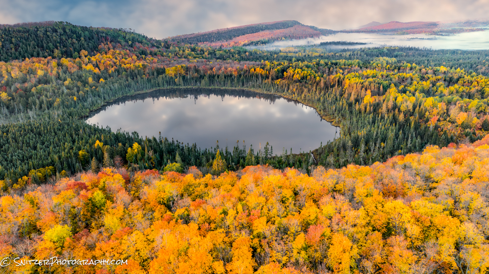
Steamboat Wildflower Invasion
For about two weeks every year, wildflowers explode along the upper elevations of the Rocky Mountains. This year’s crop was especially bomber as a plentiful snow pack finally melted. Lots of moisture means lots of flowers. Some recent rain storms didn’t hurt either!
Steamboat Springs, Colo is our home away from home. The hiking, biking and photog was spectacular.
Rabbit Ears Pass from two different vantage points.
Along the Continental Divide Trail
Evening hike up the West face of Steamboat’s Howelsen Hill.
Gilpin Lake, my favorite destination in the Zerkel National Forest (45 minutes NW of Steamboat).
I also had an opportunity to explore State Forest State Park (about 90 minutes SW of Steamboat). Lot’s of mouse this year (saw 7 on one hike).
Lots more photos to see! CLICK THIS LINK!
Snitz’s winter adventure
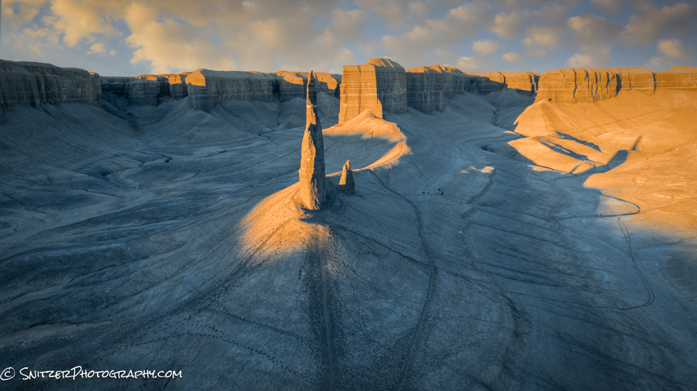
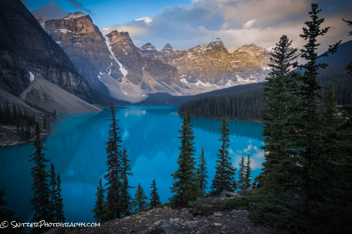
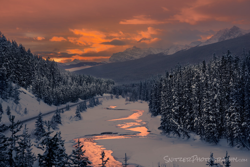
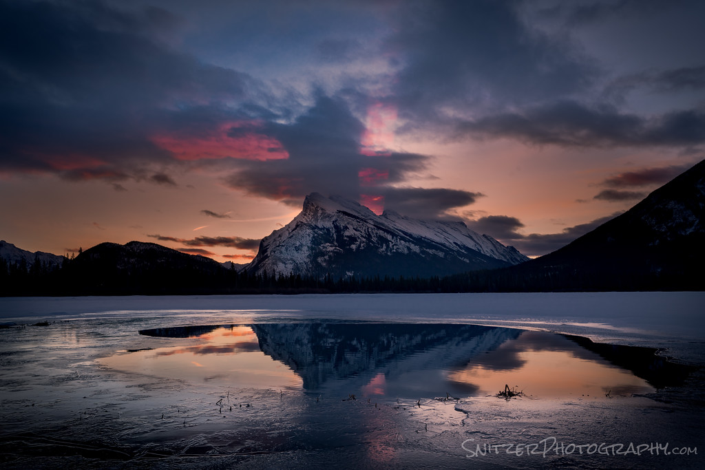
THE CANADIAN ROCKIES/SOUTHEAST UTAH
First off, if you love the American Rockies, see what they’re sporting up North! More vert, bigger, Alp-like! Did I mention crazy foregrounds leading up to bomber peaks?
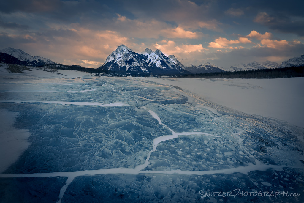
How about methane bubbles that form beneath the ice and rise to the surface?
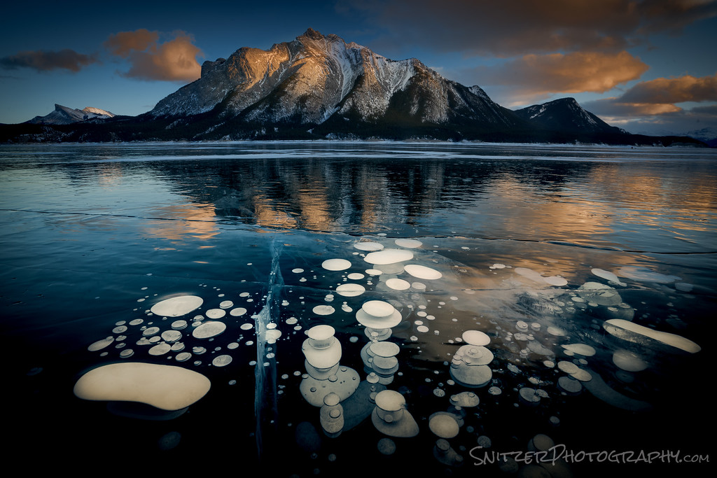
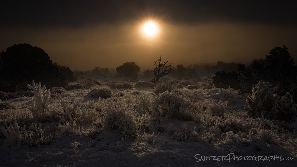
Or sunrises to die for?
Perhaps beams of red light projected into the heavens!
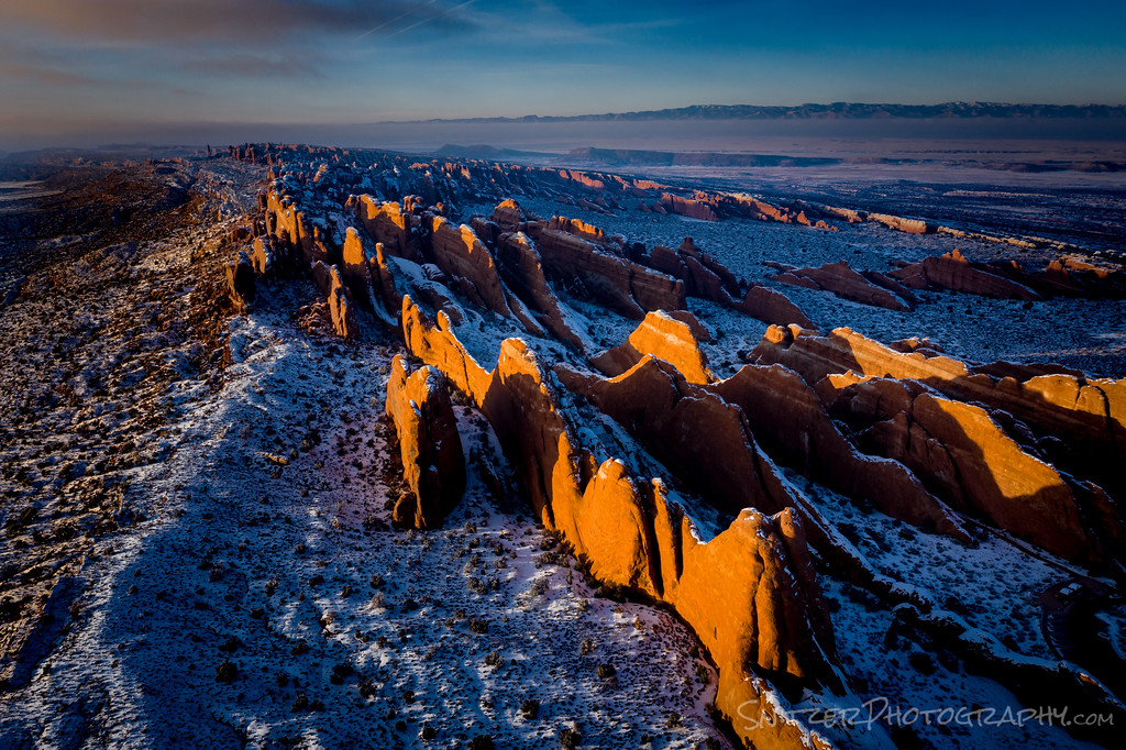
On the other hand, back in the states, the Moab area is competing for top billing! How about some 90 foot high fins at sunset?
I’m a sucker for canyon views!

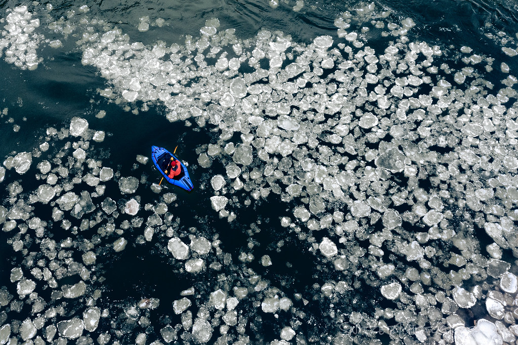
They even have lunatics paddling around in pack ice. This guy belongs in Belleview!
Canyonland’s version of dawn patrol.
Ok, I hear you. YOU WANT TO SEE MORE PICTURES! CLICK HERE!
Snitz Antarctica Q & A
Did you take thousands of penguin photos? Relax, you only get to view a few. 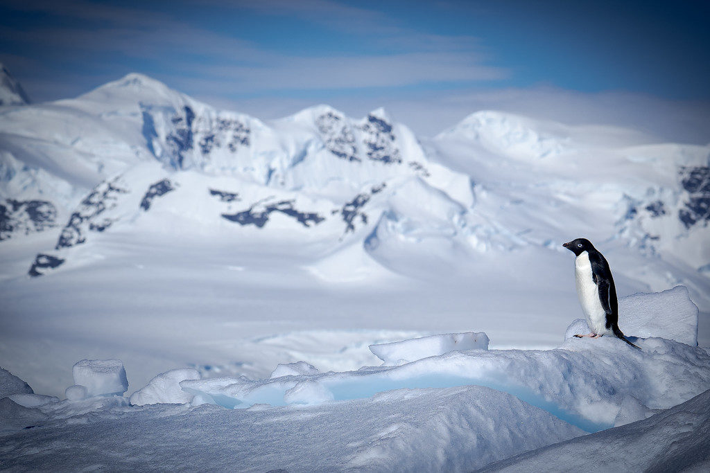 Are there any Alpha penguins who are natural-born leaders? Yah, the guy in front is the Douglass MacArthur of Sub Arctic Birds (a Gentoo Penguin, the Cadillac of birds). Actually, maybe it’s a she! The rest are Adelie Penguins. I now consider myself an expert in Sub-Artic wildlife. No formal training!
 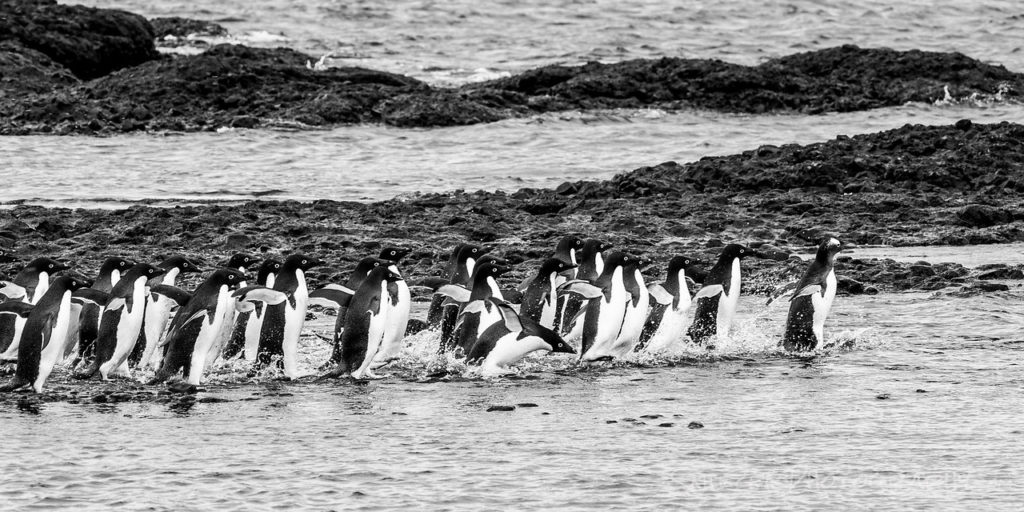 Are Penguins good swimmers? While awkward on land they’re guided missiles in the water.
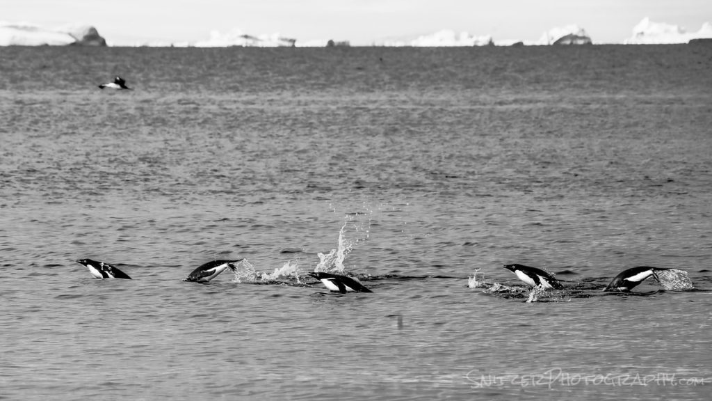 What’s the landscape resemble? Lincoln Nebraska with more water.
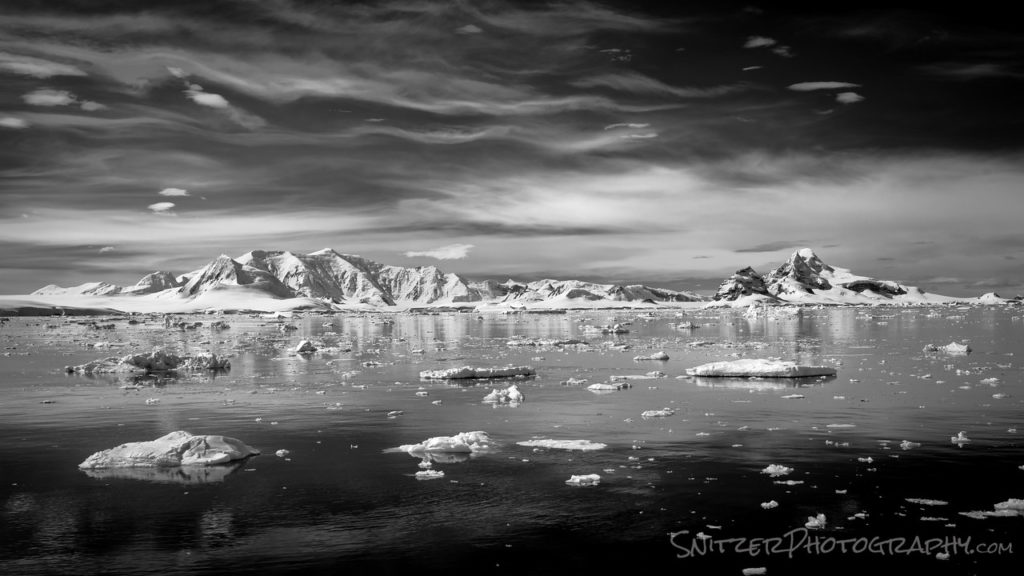 Are Elephant Seals funny looking? Take a look in the mirror.
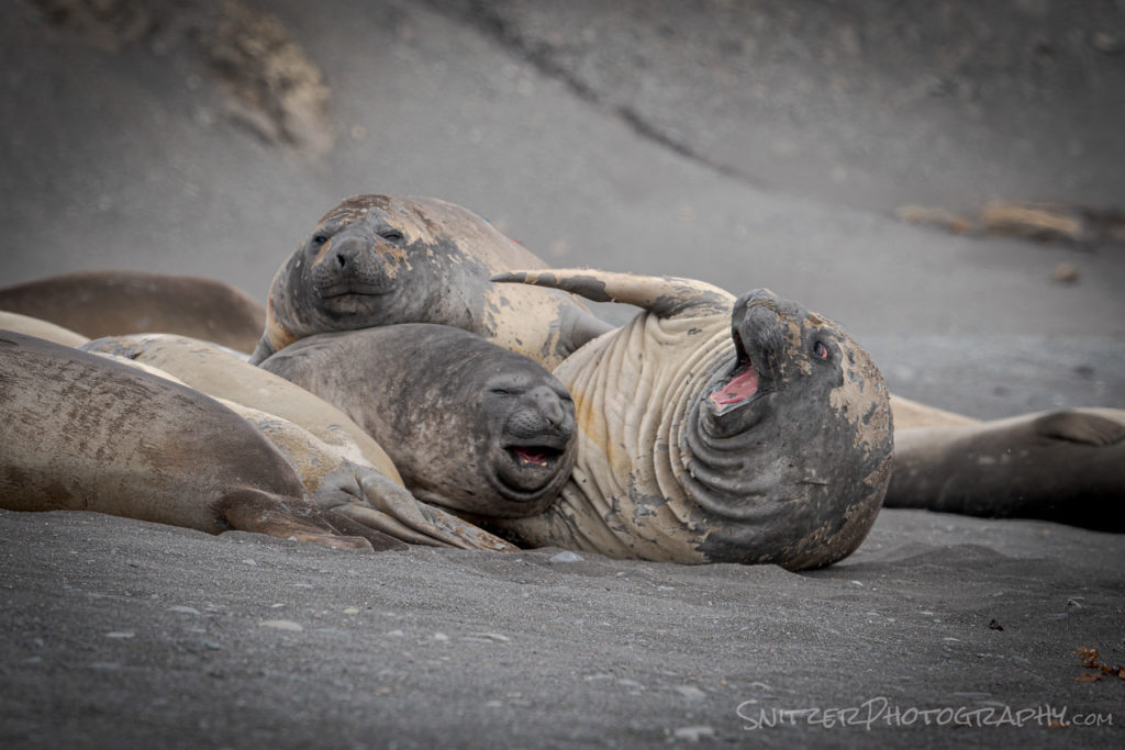 When is sunrise & sunset? 10:30pm and 3:30am. My motto is go with no sleep or go home!
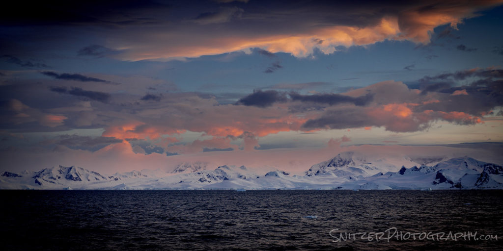 Is Antarctica far (like compared to Mars)? That’s about right. A quick flight to Buenos Aires, then 4 more hours to Ushuaia, the southernmost town in South America, followed by a 2 ½ day boat ride along the Drake passage to Antarctica. That’s our boat, a research vessel, used formerly by the U.S. intelligence service to spy on Cuba (not kidding).
 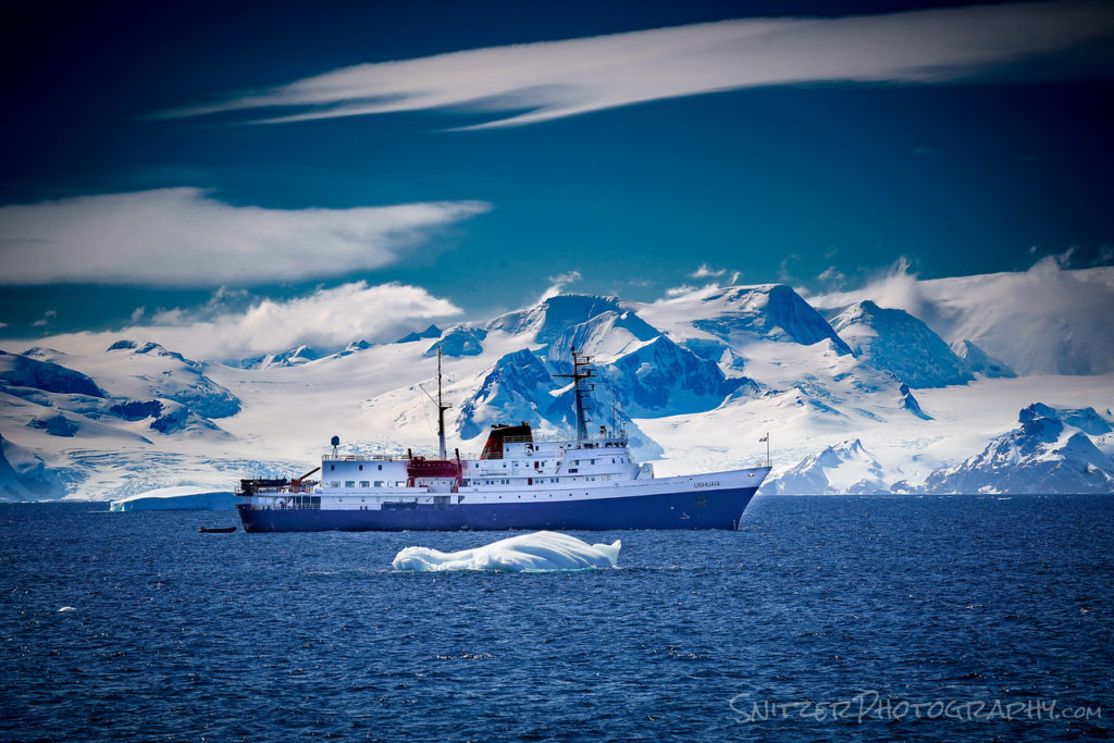 Is the boat ride rough? You kidding me! We took a small ship that sleeps about 100, which allowed us to land in remote places larger guys couldn’t access. My nickname for the ship is the Vomit Comet. Our home for 12 days shown against a normal-sized cruise ship.
 How did you get to shore? We used Zodiac boats, which are stowed in the rear of our ship.
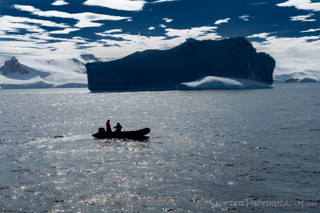
Can you be serious for a second? Was the trip worth it? Yes, seeing the “Far end of the Earth” belongs on your bucket list. I’ve traveled a bit and have seen nothing close to this. Sort of like plopping the Rocky Mountains in the ocean and sprinkling exotic animals aboard that have no fear of humans (aka you can view up close). A pain to get to, worth the effort.
Want to see more photos! Of course, you do! Click the link: https://www.snitzerphotos.com/Nature-Travel/Galleries/Antartica/n-Lz4wfQ/