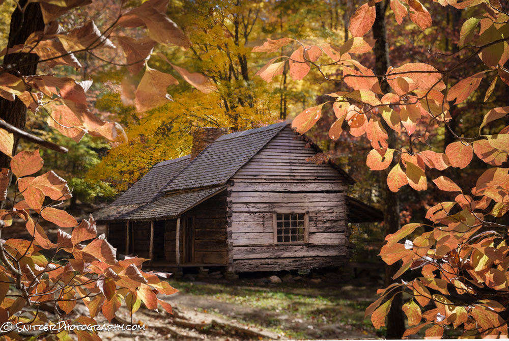
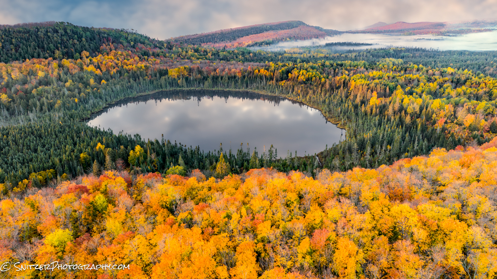
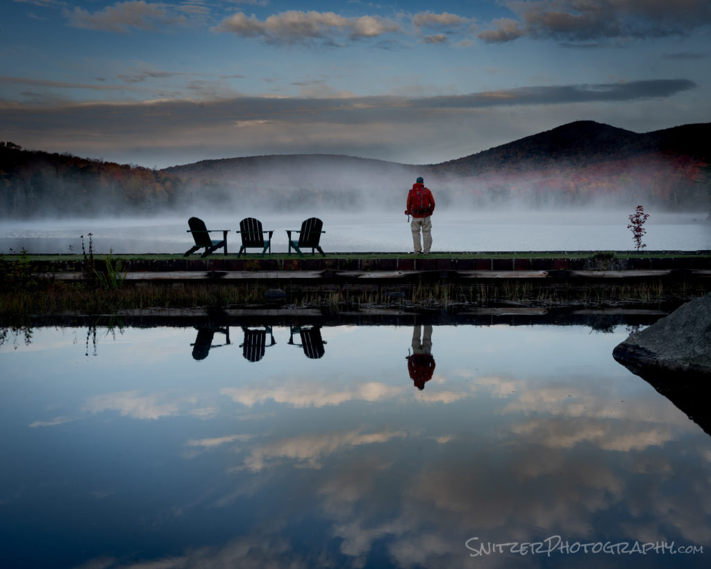
New England leaf peeping
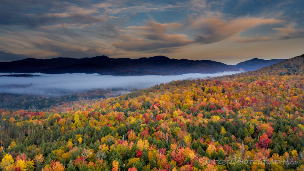
New England gets the prize this year for the best foliage I’ve seen…ever! Not kidding folks. I was lucky enough to spend two weeks shooting, based out of Montpelier, Vt and Bar Harbor, Maine.
Did I mention the leaves were changing color?
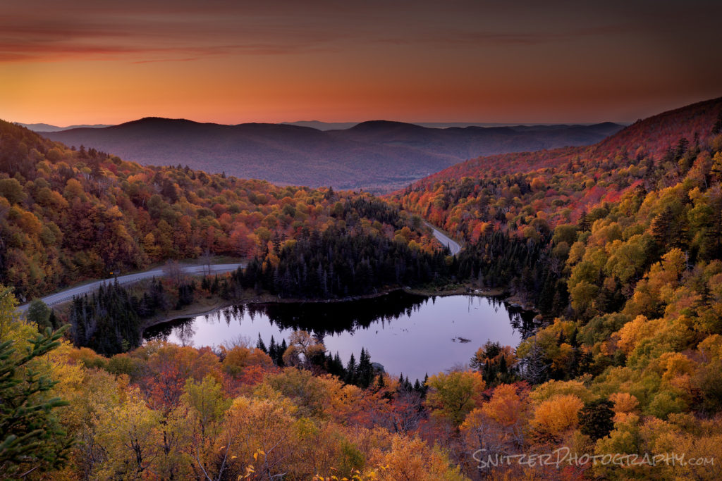
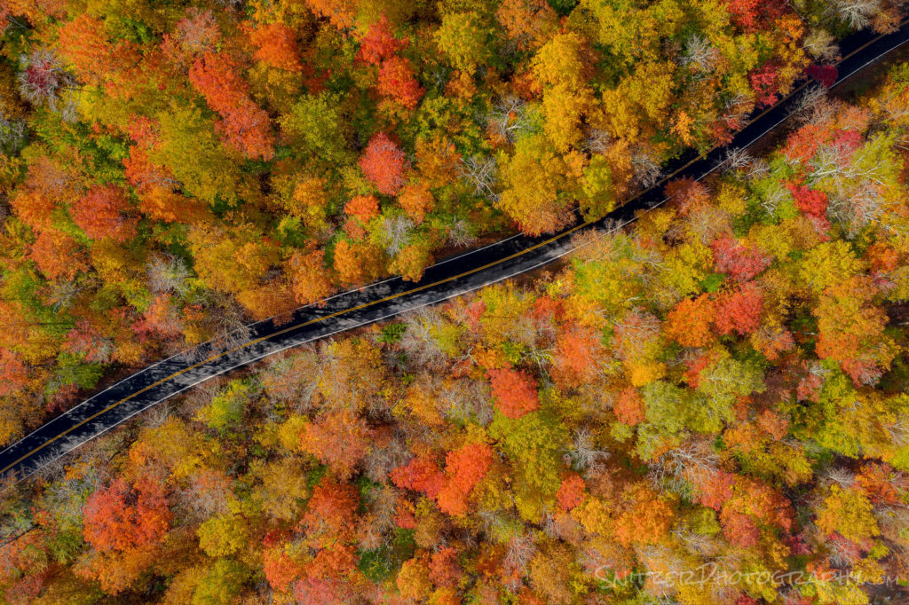
By the way, I’m now a drone pilot. I haven’t shot down any commercial aircraft yet, but I have been able to compose shots that were previously impossible. The changing canopy of the forest really shows off from above.
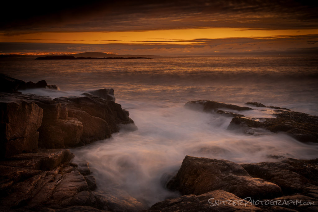
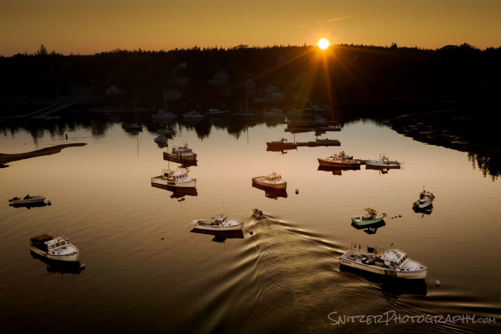
That’s not to say you can’t see some bomber stuff from down low. The view along Acadia NP’s coast isn’t bad either!
I love the smell of napalm in the morning!
Sunset from above Bass Harbor Maine. Buzzing the control tower from above.
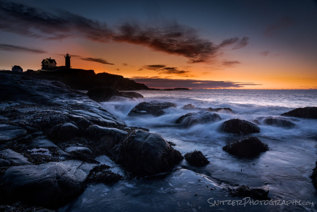
Dawn patrol at the Nubble Lighthouse, near Cape Neddick.
Click here to see more photos!!!!!
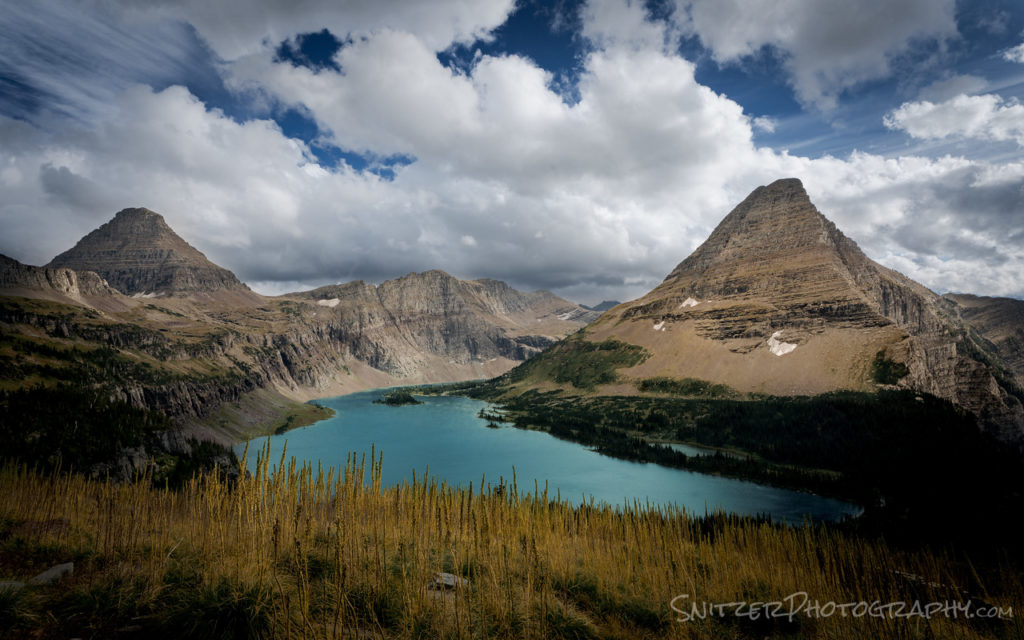
Glacier NP Fall Spectacular!
I’m a huge fan of Glacier NP! On my third visit to the park (last week), I had the op to revisit some of my favorite spots last week and was greeted by perfect weather/awesome cloud-filled skies.
I started the trip climbing over Logan Pass, which provides access to some great above timberline hiking looking down on Hidden Lake!
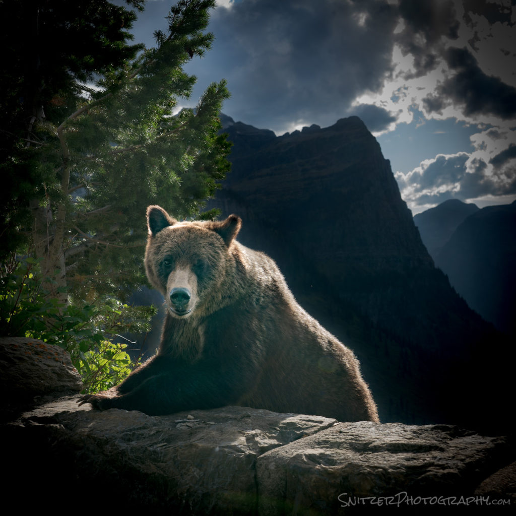
Along the drive, I ran into this bad boy. He appeared 6 feet from my open car window. Luckily I had my camera handy and he didn’t jump into my lap.
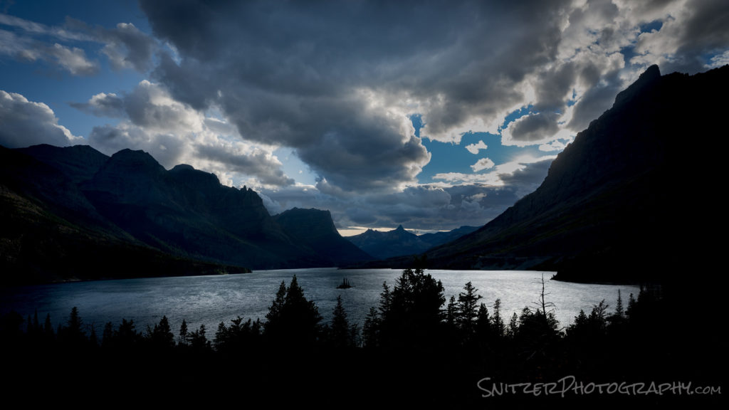
On route East towards my hotel (Many Glacier Lodge), taking a late afternoon break to view Wild Goose Island. This iconic pullout is also a great place to watch the sunrise.
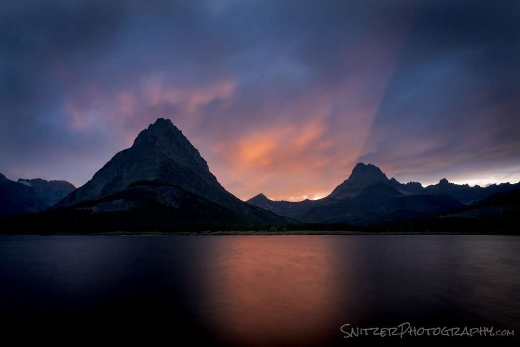
The Many Glacier Hotel looks West over Swiftcurrent Lake and Grinnell Point. Talk about a nuclear sunset!
Dawn patrol the following morning, about 200 yards from the lodge (looking in the opposite direction)!
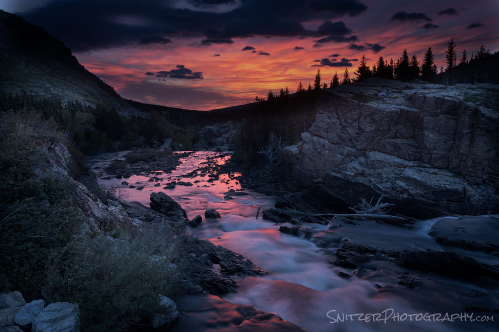
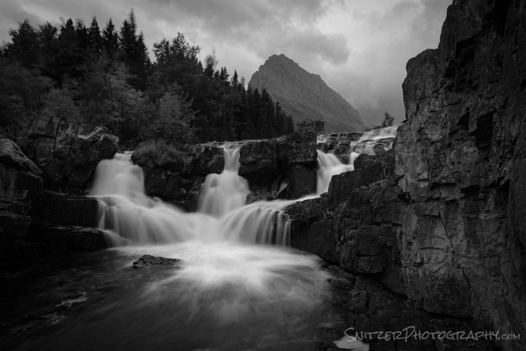
By the way, just downstream from this spot lies Swiftcurrent Falls, an overlooked but spectacular feature of the park.
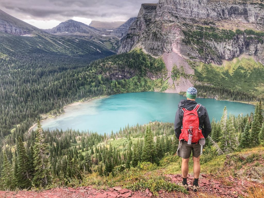
My first big hike, the 12-mile round trip up to Grinnell Lake.
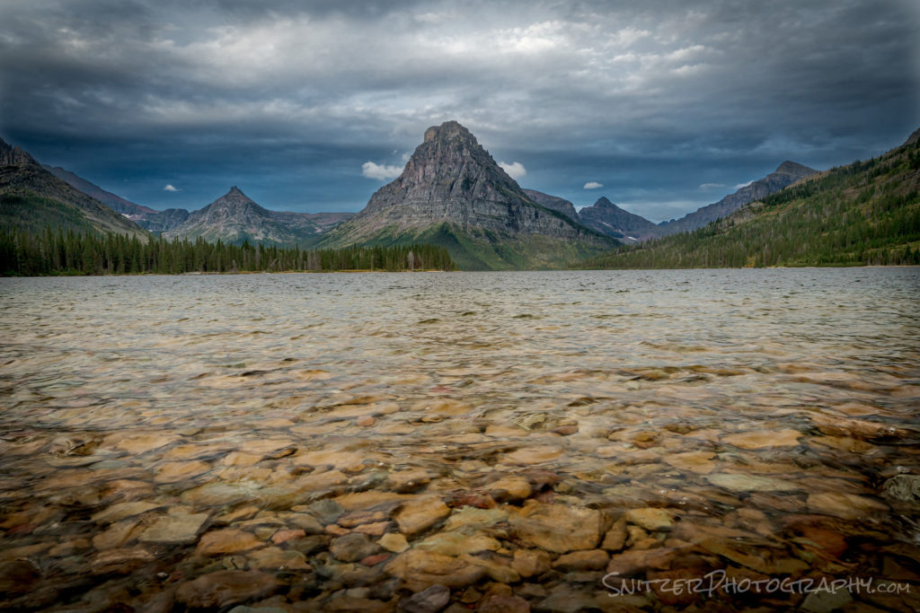
After exploring Many Glacier for several days, I ventured into the Two Medicine Area of the park (generally more remote/less crowded). Named for the lake below, the area provides some of the best views in the park for those will to hike a bit (ergo 10+ miles, not for the squeamish).
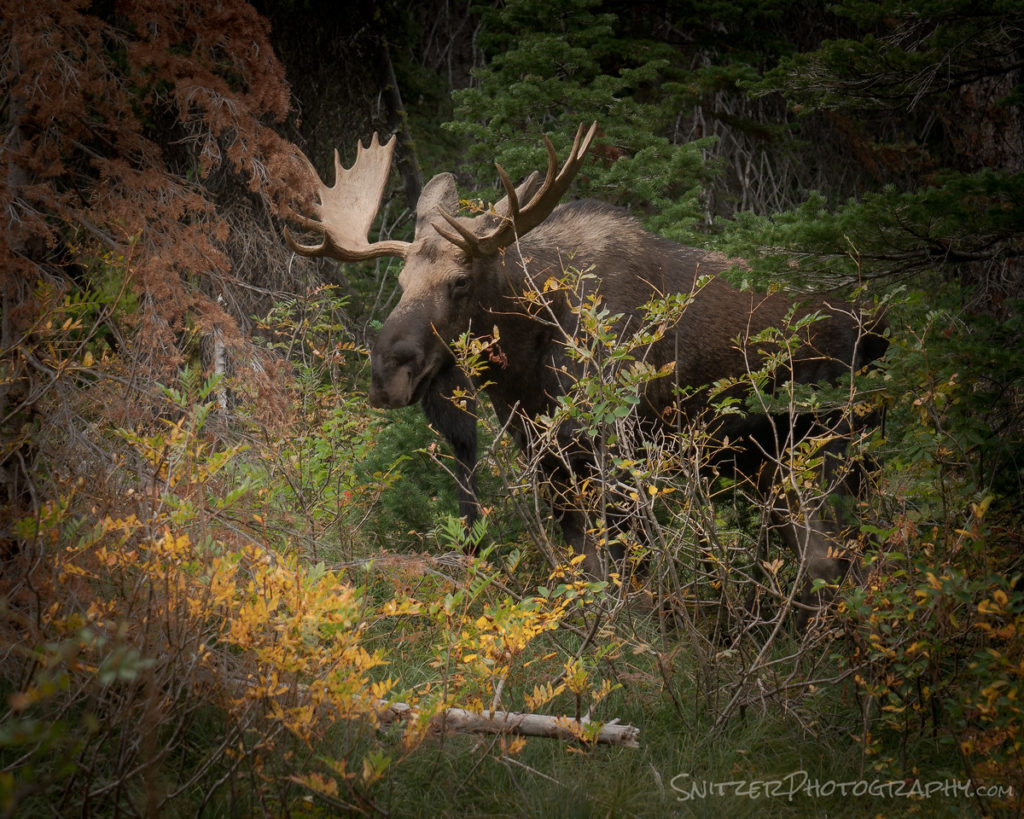
Along the trail, I heard some rustling to my right and rotated to find this Bull about 8 feet away! My 2nd close up encounter in only two days…eckkkk. Took a deep breath, slowly backed away, fired up the camera and thanked Allah I hadn’t been run over.
Click here for more photos from the trip!
Want to see more Glacier stuff from earlier trips? Click here!
Summer Monsoon At Grand Canyon/San Juan Mountains
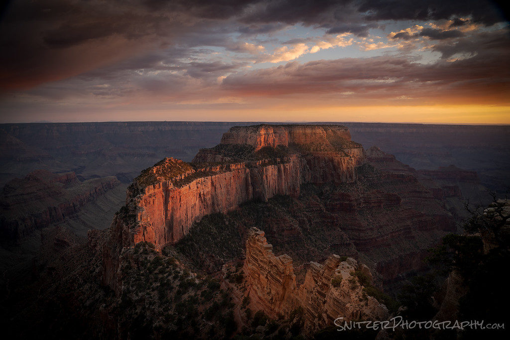
The Grand Canyon’s North Rim is bomber, especially now, with the monsoon season rolling in. You get amazing cloud-filled skies and sunsets to die for. Not kidding folks!
Did I mention that the North Rim is cooler (than the South) and wayyyyy less crowded? Being remote and offering only 300 rooms, if you’re lucky enough to “get a place to stay” you basically have the place to yourself! Cape Royal (below) just before 8 pm.
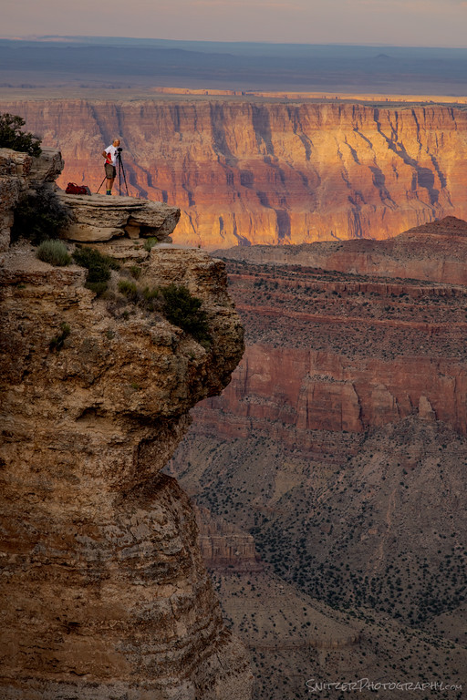
Your fearless leader on a 5 by 8-foot rock outcropping (taking the above shot). 500 feet down if I step backward.
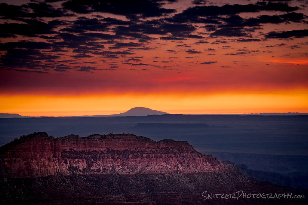
Sunrise isn’t half bad either.
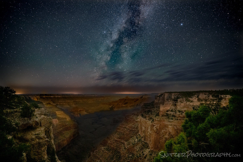
You’ve probably never seen this pic of the Canyon before? Drove out to Cape Royal after midnight (I need my head examined) to capture this. Why so late? Because the Milky Way lines up perfectly with the moon illuminating the canyon walls from my behind at precisely 3:30 am. Happens 5-6 days per year.
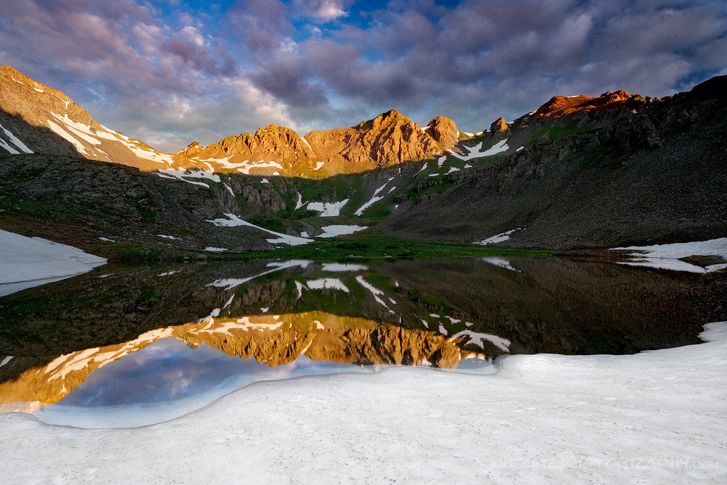
On to the San Juan mountains which were blanketed with a massive snowpack this past winter. That means the best wildflower bloom in decades and waterfalls/streams running wild.
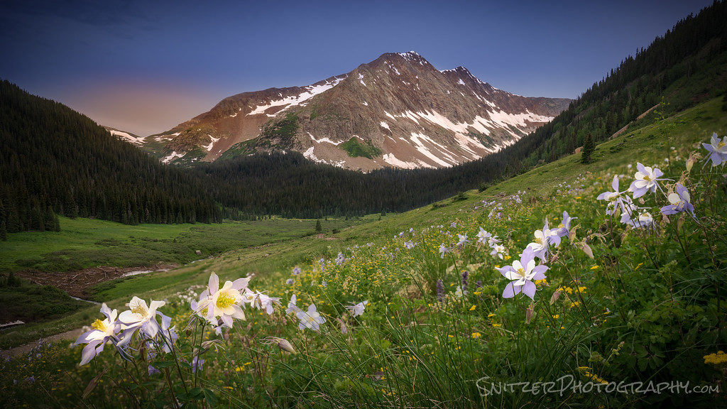
Even at this late date, there is plenty of snow to be found.
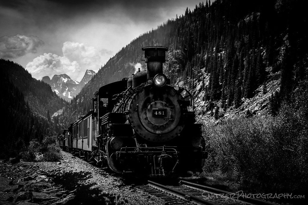
Below is the Silverton Narrow Gauge Railroad which runs three times per day ( a real steam engine)!
We also had a chance to visit Canyon De Chelly on the way home. Spectacular but hot (over 100 degrees…ouch)!

Got lots more photos to share folks!! Click to see the gallery. Click here for more photos!!!
Snitz’s Spring Expedition! Western US.
Your fearless leader has been busy exploring some bomber scenery this Spring. Much of it at night.
Monoliths, pictured below, near Monument Valley, Utah framed by the Milky Way Arch.
Speaking of no sleep, I started hiking in the dark (with a headlamp) to catch sunrise breaking over Zion’s Canyon Overlook.
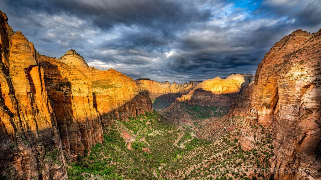
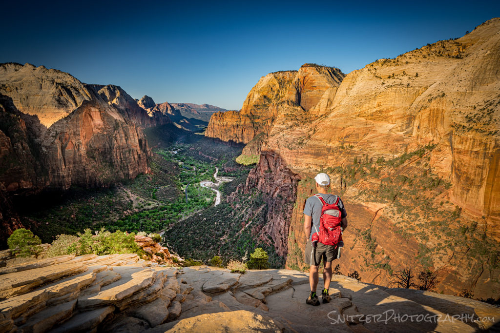
Zion is filled with extraordinary hikes, like Angel’s Landing which ends on a small table top with vertical slabs on either side falling away 1000ft! Eckkk…but the views are to die for. Err…didn’t mean that literally.
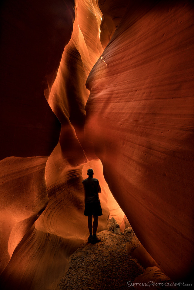
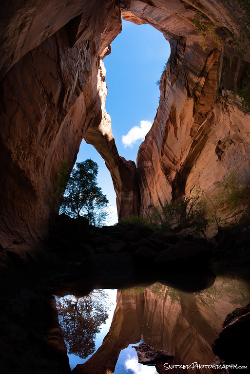
A buddy and I also had the chance to explore an infrequently reached slot canyon; literally had the place to ourself. During midday, the light hits the narrow walls “just right” to create a glowing landscape.
The camping portion of the trip started in the Vermillion Cliffs National Monument, home to White Pocket. This place contains some of the nation’s wildest geology (Mars on steroids).

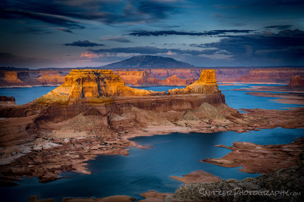
Then on to a spectacular campsite above Lake Powell (at Alstrom Point). The roads require some patience and a 4WD vehicle to reach. There isn’t a better place to view the lake from! Sunset below:
That’s not all folks! Click to view the gallery. Snitzer Photography Gallery Link
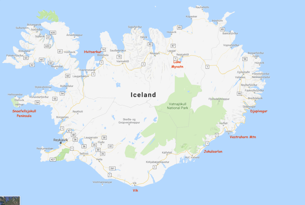
Snitz returns to Iceland!
I fell in love with Iceland last winter and vowed to go back see more of the Country including the more remote Northern Region. This winter I was blessed with great weather (unusual since its typically raining or snowing 60% of the days during the cold season).
The map below shows my journey around the island, starting with the Snaefellsjokull Peninsula and ending in Vik (after circumnavigating clockwise).
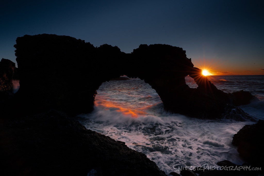
Snaefellsjokull offers some of the country’s most impressive coastal views. Shown below is the Katklettur Arch (which is accessed by a hike over the safety fence down an 80 ft cliff). Had the op to do this pre-dawn to capture that sun star!
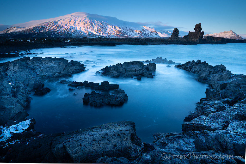
About 15 mins from the Arch (near Djupalonssandur) lies a remote stretch of Basalt lined beach (a bit of hiking to access) looking back on Snaefellsjokull Mountain. By the way, the mountain is famously immortalized as the access point to the Earth’s center in Jules Verne’s novel Journey to the Center of the Earth.
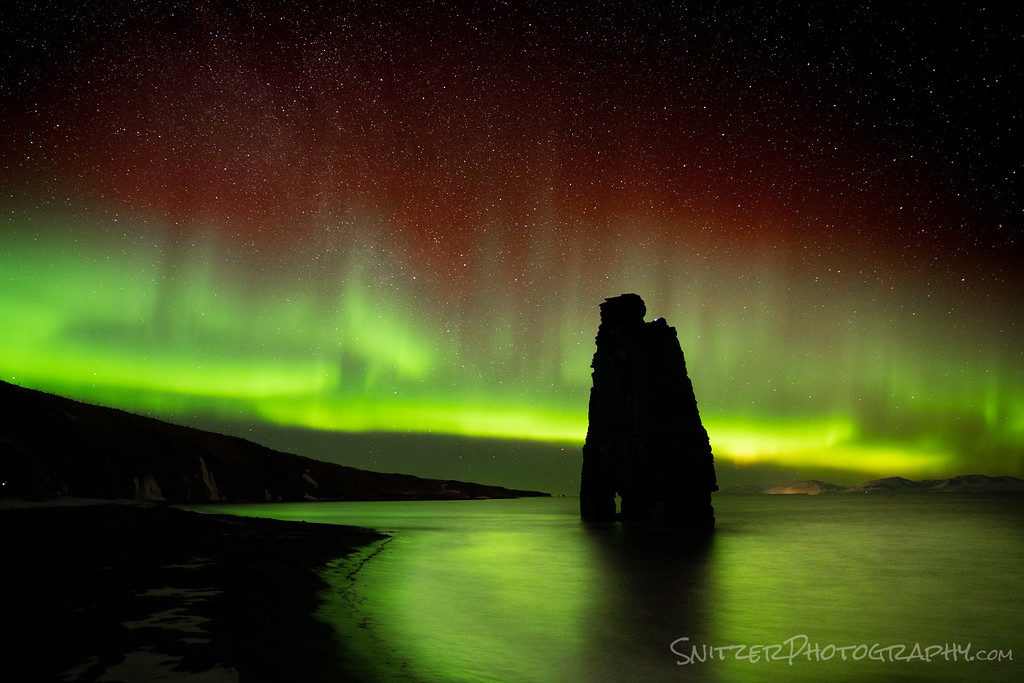
Winding our way up north I totally hit the jackpot. Not only do I get to check out the Hvitserkur Sea Stack, but view it back lit by some badass dancing Northern Lights. Did I mention the hike down the icy cliff to the beach (wearing micro-spikes) & a headlamp in the dark?
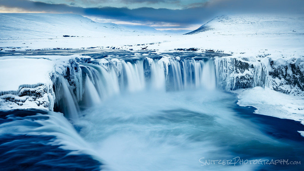
Back on the road heading due East we hit the Lake Myvatn region, home to perhaps my favorite waterfall on Earth, Godafoss. Its crazy blue color comes from water born minerals and the surrounding snow that reflects and accentuate the color. PS. In Iceland if it ends “foss” it’s a waterfall.
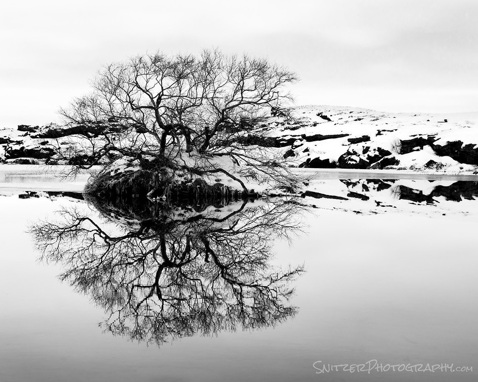
On route to the waterfall there are some great lakes/ponds to explore.
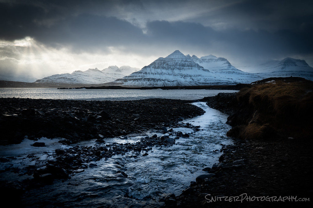
I’ve worked my way to Iceland’s East Coast. Driving towards Djupivogur at day’s end a clearing storm is looking pretty impressive. Jump out and run approx. 3/8 mile towards the shore line. The coast is littered with spots like this. Talk about a target rich environs.
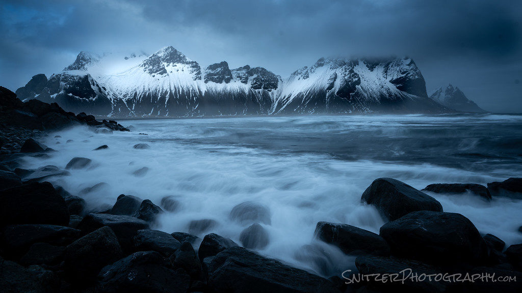
Vestrahorn lies about one-hour South. The mountain is framed by some treacherous rocks in the foreground. Easy to get grabbed and taken for a wash (along with your equipment) by the occasional rogue wave that washes up.
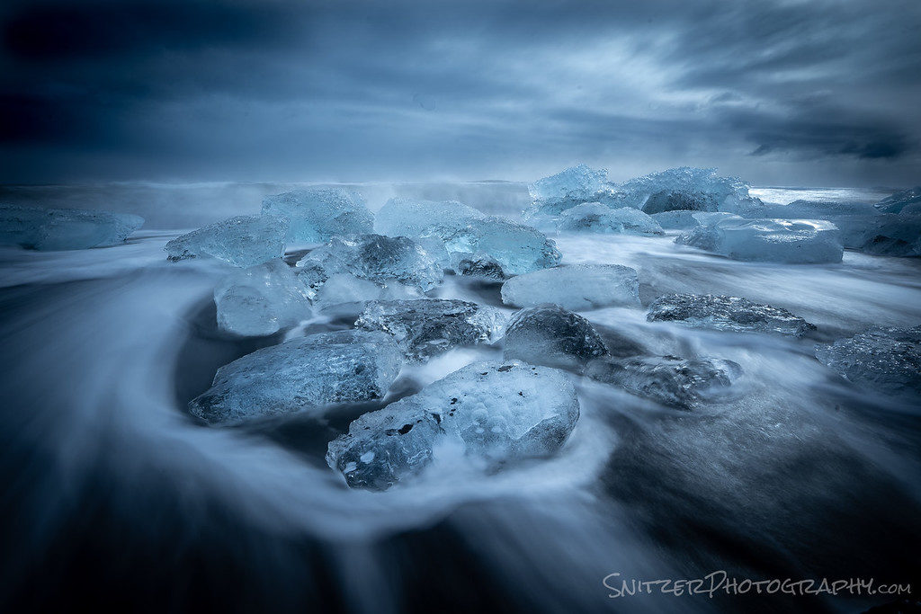
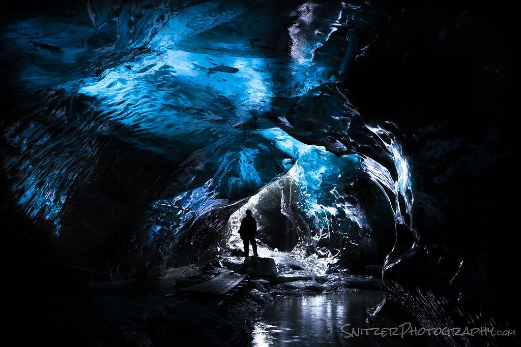
The following several days are spent in Jokulsarlon. The area hosts the well known and often visit Ice Lagoon as well as some amazing ice cave (which require jeeps with giant 42 inch tires to access. 40-minute climb onto a glacier).
Excited to see more! I’ve just scratched the surface here. Click here to see more images!
Happy Holidays: Best Snitz Photos of 2018!
What a bomber year! Honestly, I’m a very lucky duck to have explored some wonderful new locations and returned to some old favorites. Thought you might enjoy seeing a few highlights. (click on any of the photos or the link at the bottom to see the full gallery)
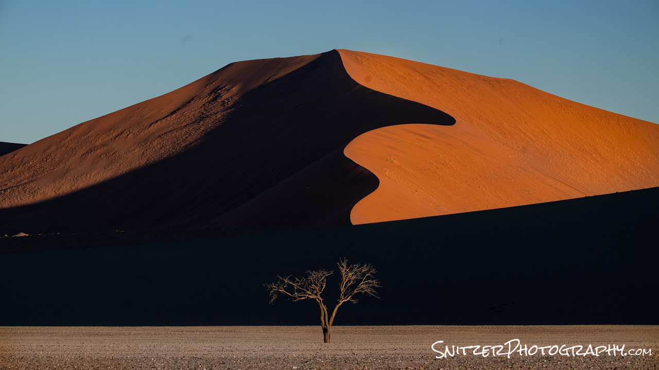
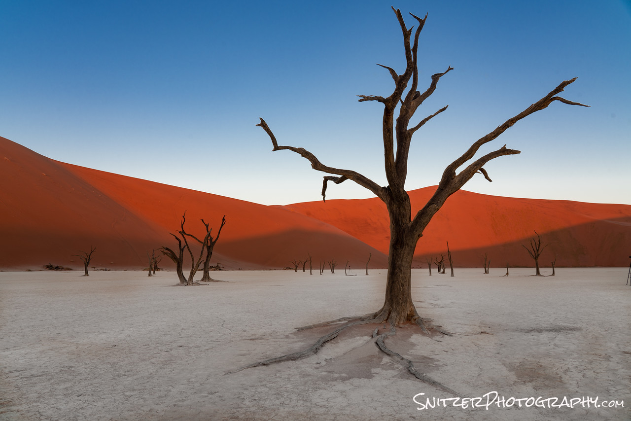
Stop #1: Namibia, located 2 hours north of Johannesburg South Africa. The combination of exotic vegetation, animals and the highest sand dunes in the world was …I’m at a loss for words folks!
That’s me in (up escalator) Sesruim Sossusvlei National Park! Fresh sand, zero footprints.

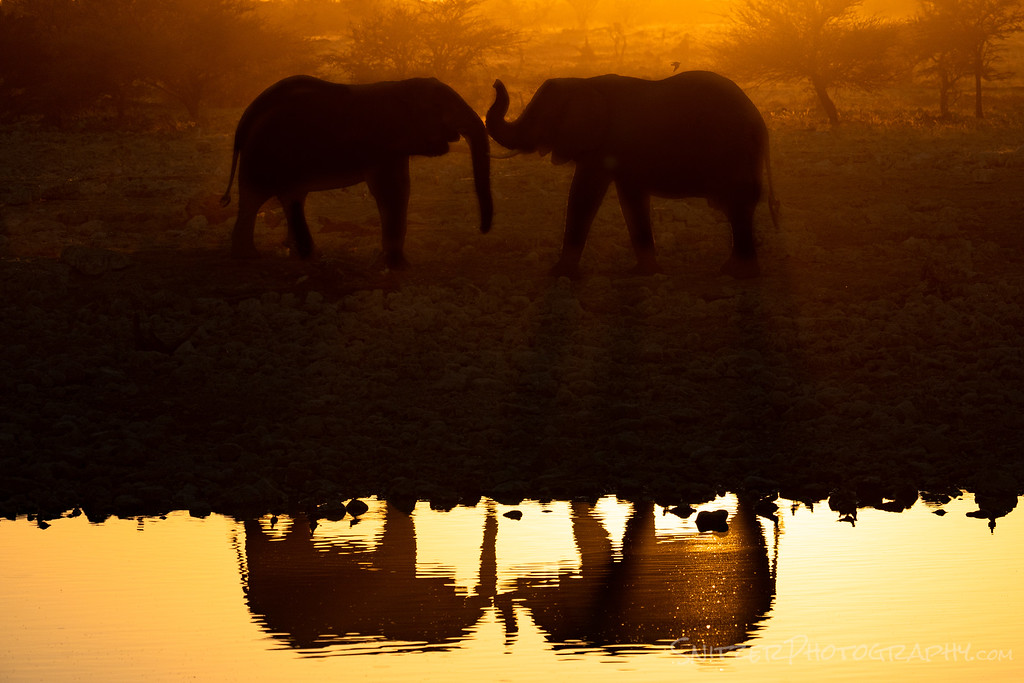
Pictured below are some Pachyderms (Etosha National Park) getting better acquainted. Love is in the air!
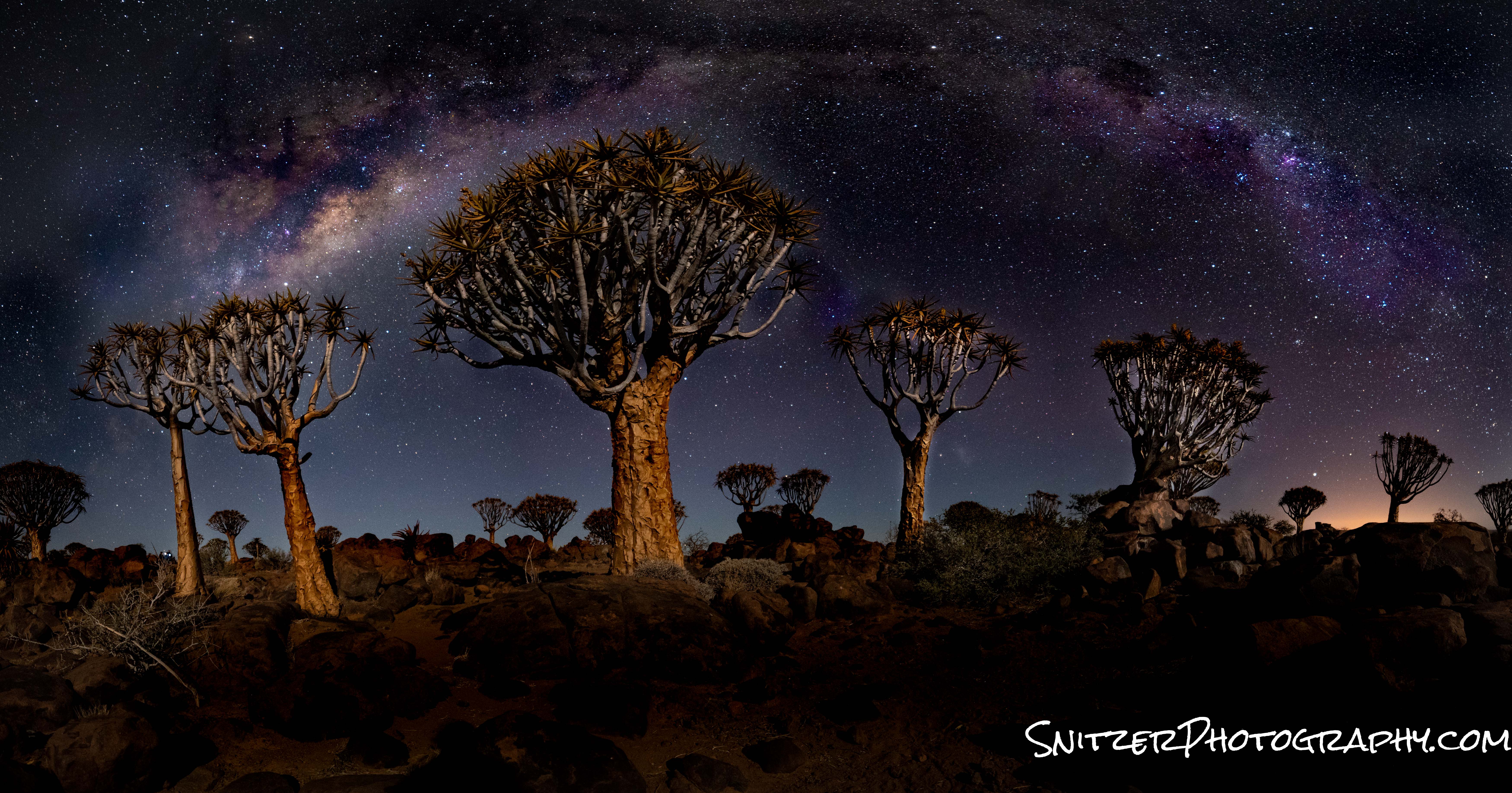
A Quiver Tree forest, lit by a small crescent moon and ringed by the Milky Way below. The shot is actually a 180-degree panorama accomplished by stitching 8 photos together.
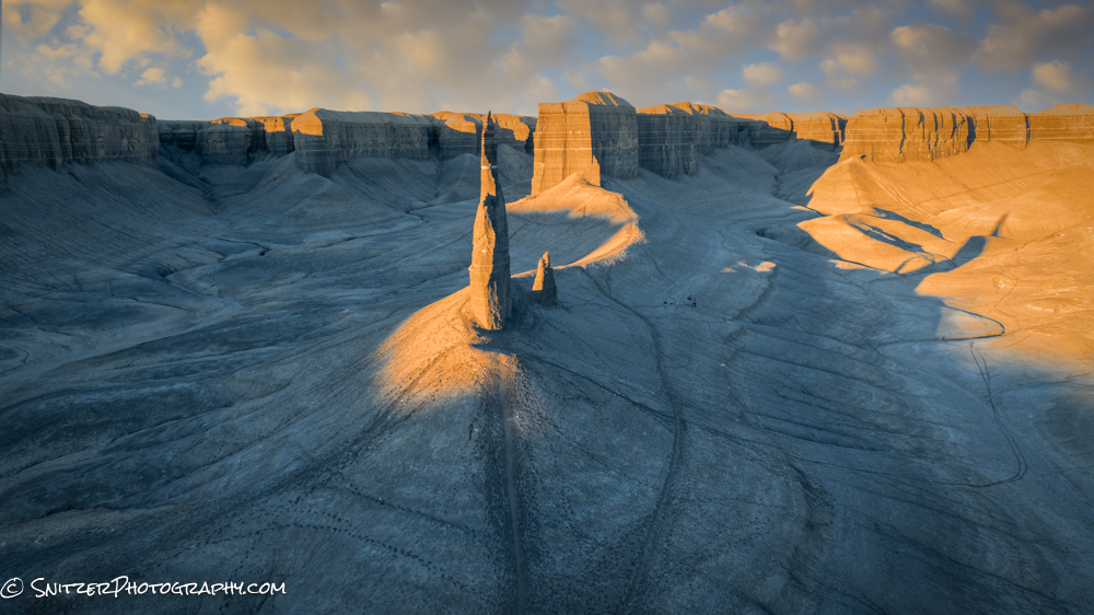
Back in the States, late September/early October brought some extraordinary foliage & color to the Rockies. My journey included Yellowstone, Teton, San Juan, Arches, Canyonlands, and Escalante/Grand Staircase National Parks.
The image below was captured while trying to outrun an approaching storm in Utah’s Castle Valley. Ten minutes after the rainbow appeared, I was being pelted by 1/4 inch hail and 40 MPH winds.

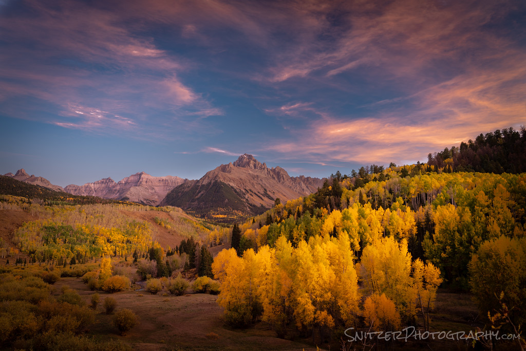
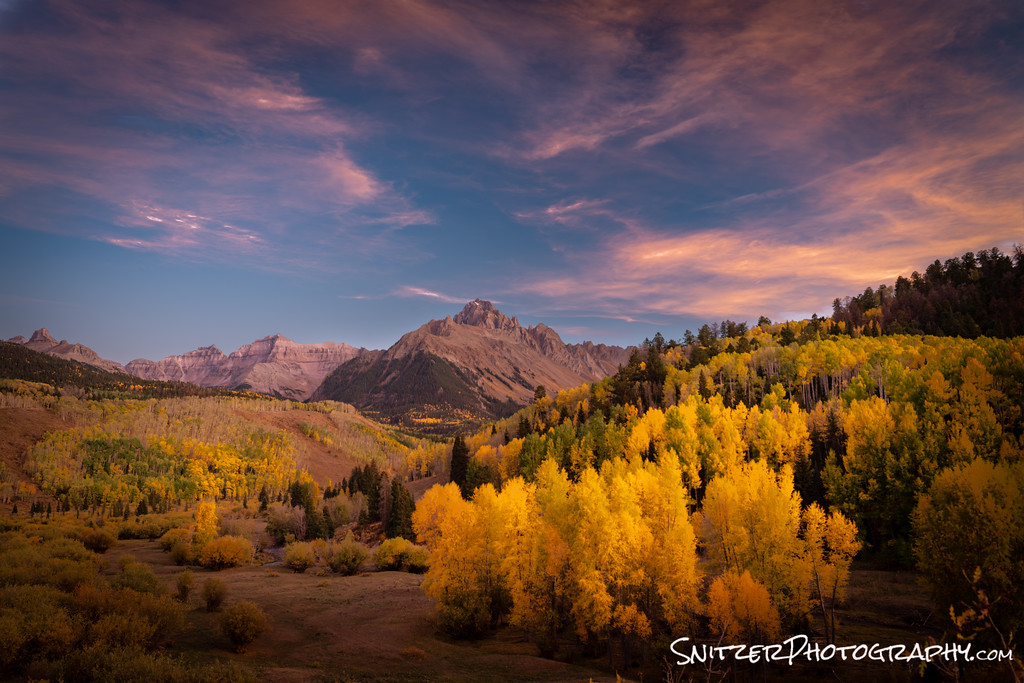
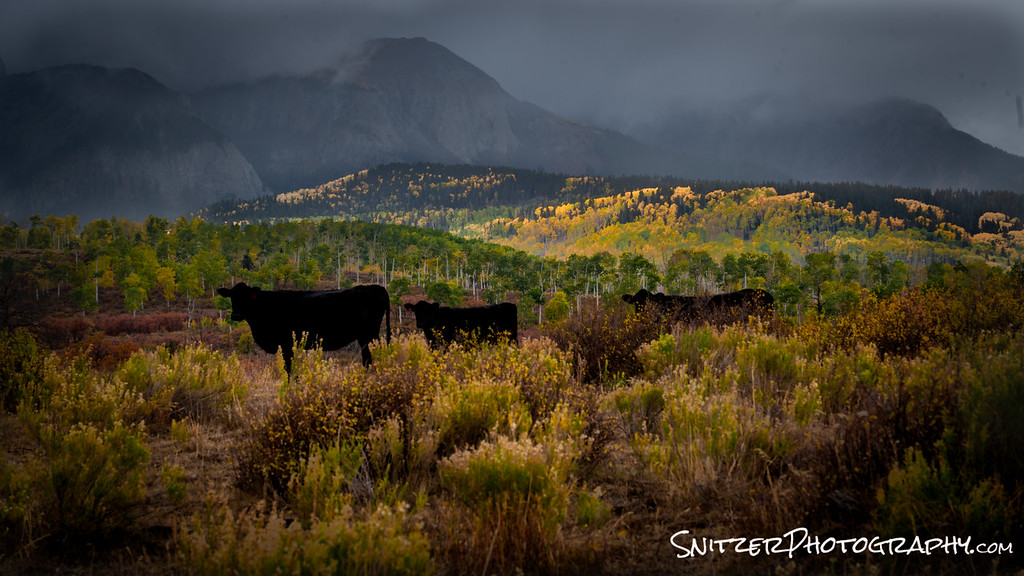
The San Juans, in Southern Colorado, featured this fall’s most impressive color. Starting in the town of Ouray, I ended up taking some extremely bumpy jeep roads to gain access to Aspen and Cottonwood groves ablaze in red, yellow and orange.
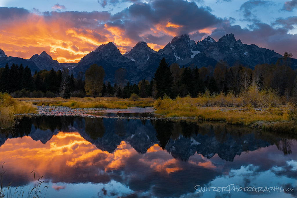
As for the most impressive mountains? Hard to beat the Tetons! Schwabacher Landing (below) is one of the area’s iconic photo locations! A clear window of blue sky under some low lying clouds at dusk created the perfect conditions for a fiery sky.
The most unique place visited? Visually, that’s got to be Iceland. Winter travel involved braving some high winds and a ton of rain. Totally worth it.
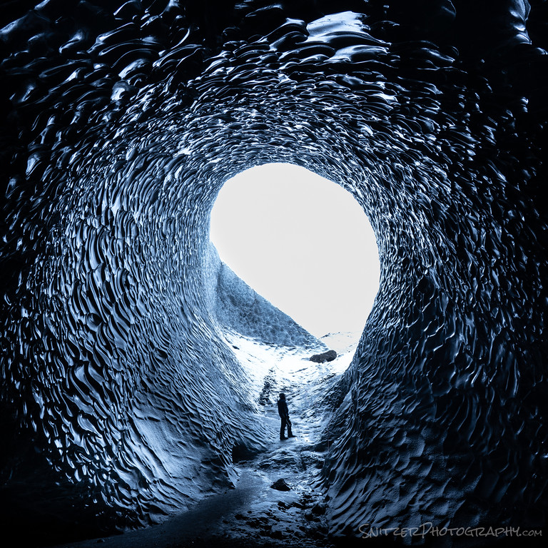
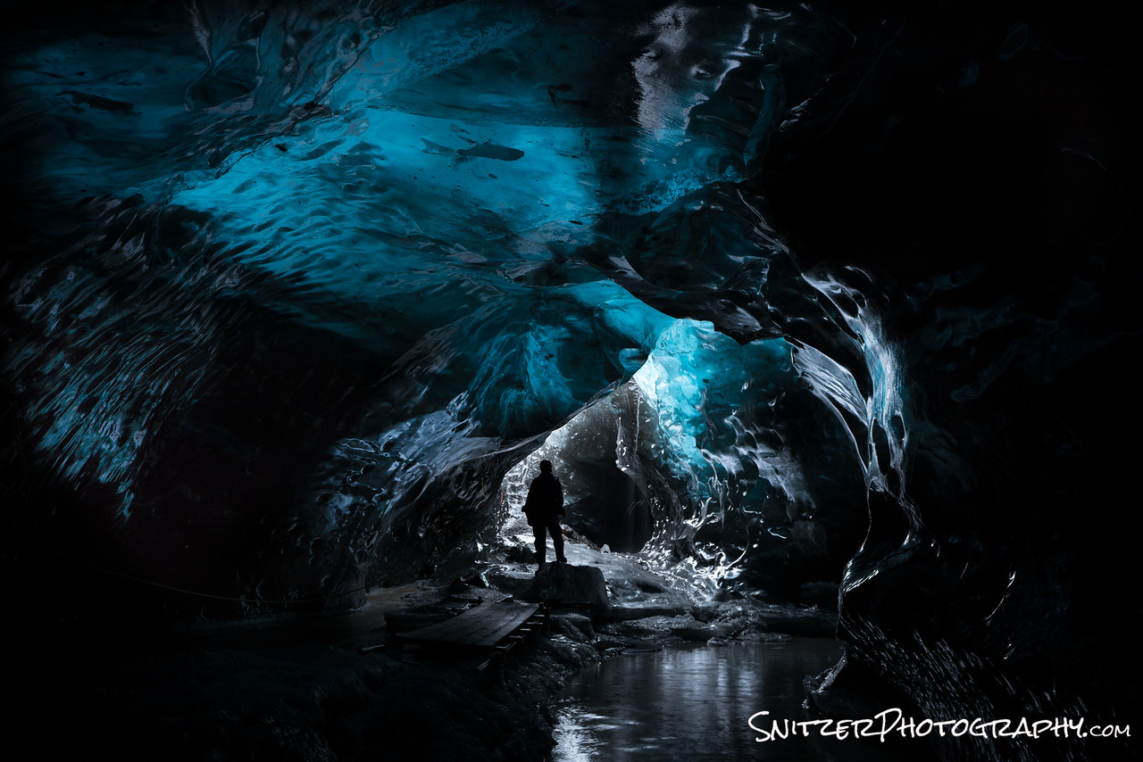
A self-portrait featured below in an ice cave located in Skaftafellsjokull. The bluish glow comes from sunlight overhead penetrating the ice that forms the ceiling of the enclosure.
The town of Vik is home to exotic black sand beaches and majestic sea stacks.

The above shots just crack the surface. Click the link to see some more of my favs! Link to best of 2018!
In the meantime, wishing you Happy Holidays and best wishes for 2019.
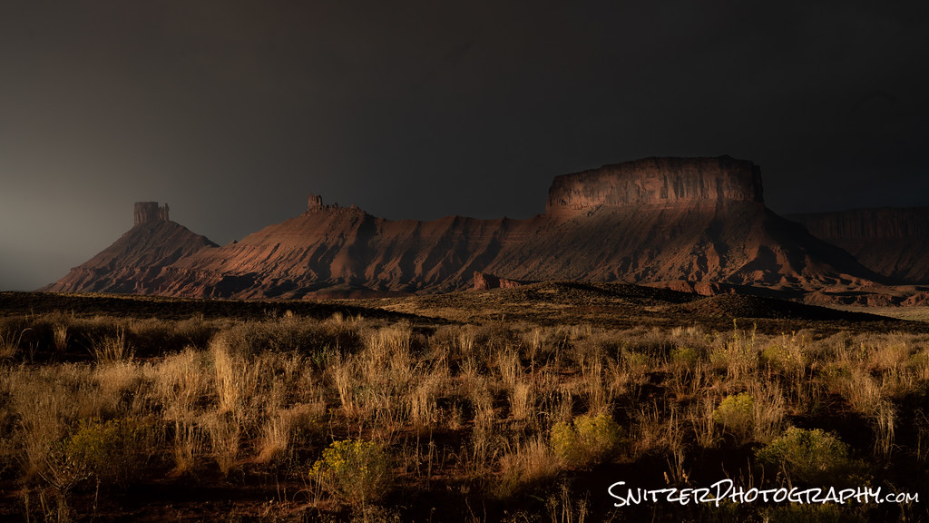
Chasing fall color out West!
Go big or go home baby! You want fall in the Rockies? How about Yellowstone, Teton Nat Park, San Juan Nat Forest, Arches, Canyonlands, Zerkels, Escalante/Grand Staircase! Did I forget to mention the Badlands? Four weeks, 6100 miles… What a trip!
I know. I need to quit chasing rainbows (Castle Valley outside of Moab Utah).

Fall pictures of mountains are a dime a dozen. Ho hum. (That’s outside of Ouray Colo, in the San Juans.)
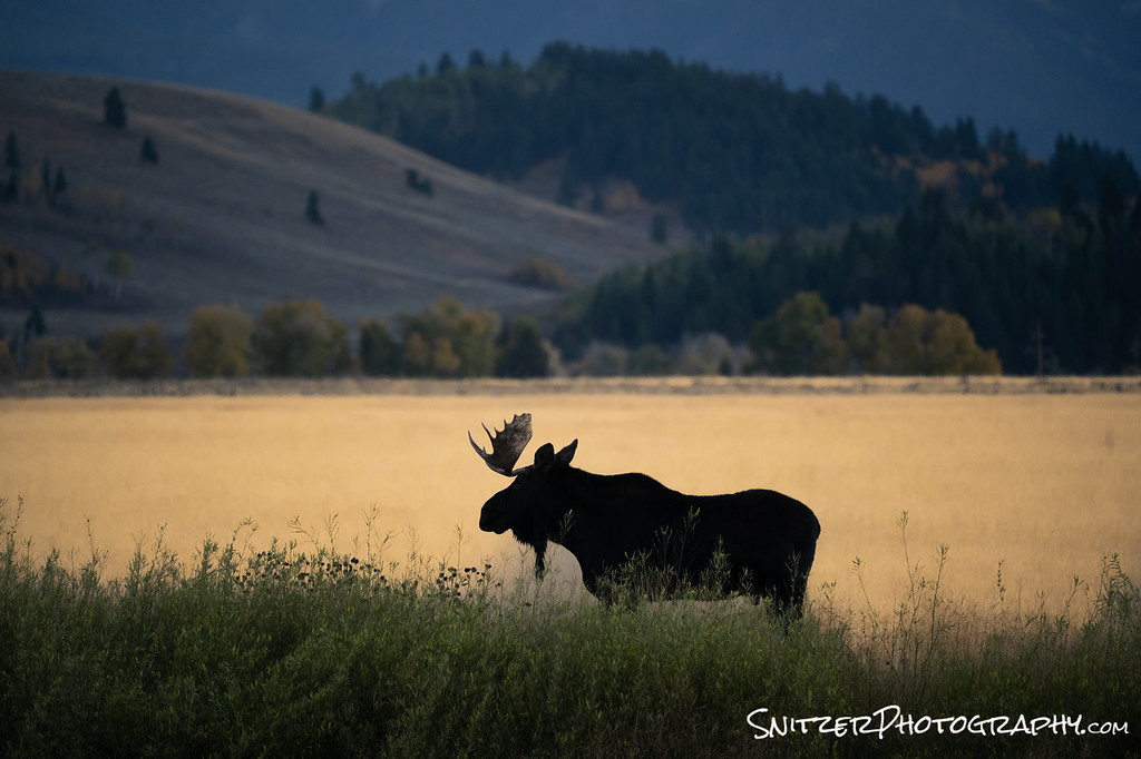
Ok, how bout Bullwinkle J Moose. He really has a great profile
Ok, now that I’ve got your attention, let look at the map. Where are all these places?
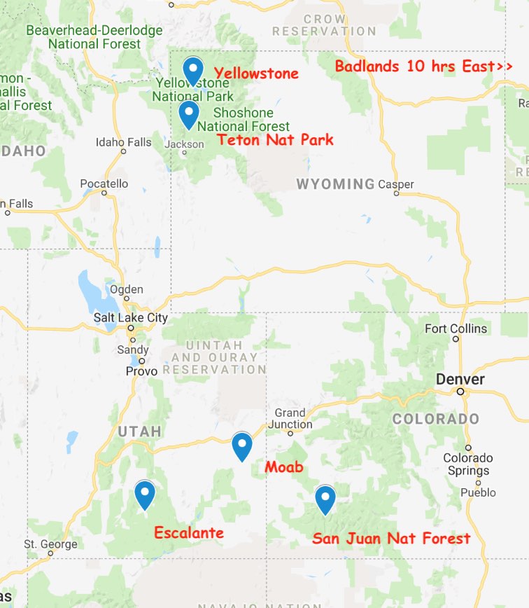
My photo expedition started in the Dakota Badlands on route to Yellowstone. This otherworldly moonscape is a great intermediate stop when heading out West (from Chicago) and can be combined with trips to nearby Mount Rushmore, Custer State & Theodore Roosevelt Nat. Parks.
Here I am surveying the lunar surface (I feel like Buzz Lightyear).

Want to see more photos. Click here to see the whole gallery.
Yellowstone is comparatively crowd free this time of year (kids back at school). It combines waterfalls, rivers, wildlife & geothermal wonders. Awesome variety sports fans!
That’s me checking out the water before I dive in. Took the photo with a remote shutter release. I know…I have the “gift”.

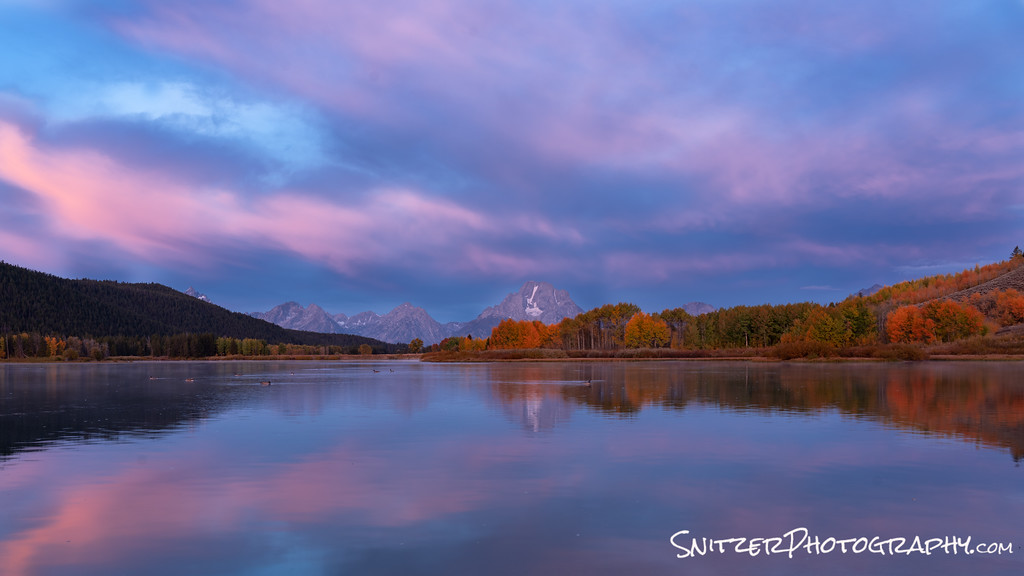
Approx 90 minutes South, lies the Tetons which rise majestically over a colorful floor lit by changing Aspens and Cottonwood trees. Pictured below is Oxbow Bend, an iconic view in the area.
Driving 7 hours South, we hit the small town of Ouray, nestled in the San Juan Mountains. To my mind, this offers the best op in the Rockies to behold kickass fall color. Also, a great place to have a T-Bone steak.
Must keep moving. Just North of Moab Utah lies the Castle Valley (another gem in the area, along with Arches & Canyonlands Nat park). I happened to be exploring the area as a morning storm unloaded it’s fury.
Ok, folks, it’s time to check out the full gallery. You haven’t seen anything yet. It gets better! I leave you with this pic of a little known secret spot somewhere in the Rockies (don’t try to pry the location out of me)! I’m sworn to secrecy.
Click link! Click for more photos!!!
Snitz’s Namibian Adventure!
Honestly, I just saw more “stuff” in the last 12 days than a Monkey’s Uncle. Overwhelmed folks! This small country sitting above South Africa offers a massive variety of imagery (& fun exploration ops).
First off, like many African nations, Namibia sports great wildlife viewing. How about this bad boy? He assumes I’m on the menu? Help!!!!!!!!

You want to be knee deep in Elephants? Bring it! Multi-generational viewing of trunk wielding grandparents, parents and kids.
Want to see the rest of the pics…click the gallery below or any of the photos!

Did I mention the highest sand dunes in the world? That’s right #1 baby!
Your fearless leader climbing Mount Everest (well it should be called that).

How bout a petrified forest (Dead Vlei, near the Sesriem Sossusvlei Dunes)?
Or some Umpa Lumpa trees under the Milky Way! Just kidding, they’re actually called Quiver Trees. Incidentally, the lack of light pollution and dry air make for the best celestial viewing I’ve ever seen. Wooooo!

Ok, time to engage the time-lapse video. Strap in. Here we go!
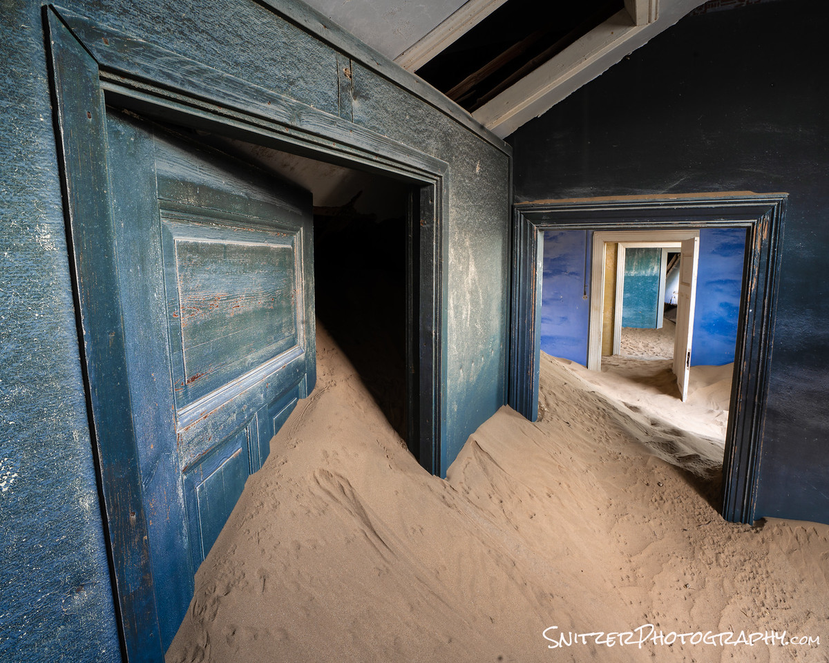
Did I mention the Circa 1920s Ghost town of Kolmanskop! The wall colors have been preserved perfectly by the dry air, which has blown in mountains of sand into the long-abandoned structures.

I know, your dying to see a map. Relax, it’s coming!
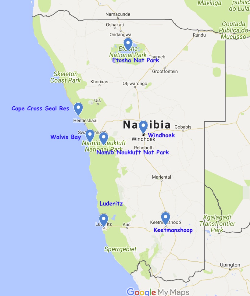
We start in Windhoek (the nation’s capital) and head out to the Keetmanshoop Quiver tree Forest. Next stop is the Kolmanskop Ghost town (near Luderitz). Yes, the country was settled by German colonizers. How did you guess?
Time to head North for some massive dune exploring in the Namib Naukluft National Park, followed by Flamingo viewing at Walvis Bay (a short drive West) & seal viewing at Cape Cross (a few hours North). You getting tired yet? Final stop…three days in the Etosha National Park for wildlife on steroids.
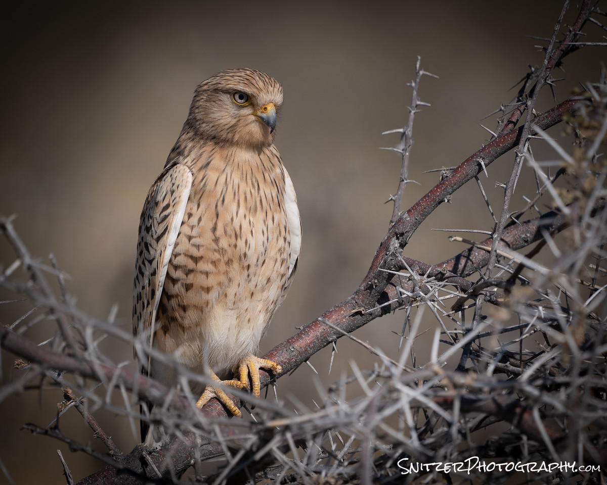
Ok, for the bird lovers in our group…don’t ask! No idea what this is…but it flies.
Ok, I’ve literally just scratched the surface here. Click below to see more photos! Woooo. Seriously, what are you waiting for?
Link for more awesome Namibia photos!
Surgeon General’s Warning: You may be loving the images and saying to yourself…I gotta bring the whole family to this place!!! Not so fast Magellan. Namibia is not an easy destination to reach. My itinerary: fly to NYC, with a quick 4-hour layover and follow with a 15-hour flight to Johannesburg, then another 4 layover and 2 hours by air to Windhoek.
After arrival plan on spending between 4-6 hours driving (2/3rds of the days) to navigate around or search for wildlife…about 50% of which may be on gravel roads. Ergo, if you don’t like driving…consider yourself alerted.
Third World Report
I felt safe traveling in Namibia. The people are friendly, make tourists feel at home and the vast majority of residents speak English. Generally, the streets & buildings are clean. That’s not always the case in some other popular wildlife destinations such as Kenya or Tanzania (which feel considerably more third world/have more poverty/crime/offer less to see outside of furry animals).
Our two local travel guides were well-educated college grads (funded by government grants), enthusiastic and most importantly entertaining. They also shared two chilling stories:
While driving into Windhoek, I noticed a huge field adjacent to the road filled with shipping containers. Something seemed awry? It turns out that 50% of Namibia’s urban population live in these container villages or tent filled shanty towns. These places operate with no electricity, plumbing or sewer system. And Namibia is considered prosperous compared to most of it’s neighbors!
Our main guide had 14 siblings. Three are from his biological mother, the rest are from 4 other women who are referred to as his mum’s sisters. They all celebrate holidays together. His father died when he was only 8 from AIDS. He describes a “promiscuous” culture that has been devastated by Aids (& has created a shortage of males/their death rates are higher). He also mentions in frustration, that most Namibians are Catholic and the Church refuses to condone the use of contraceptives to combat the epidemic.
Bottom line: as in many African countries, strong resilient residents fight to survive against the odds.
Iceland: Worth the hype?
Iceland’s hot! Errr…I mean the new “world’s most popular” destination. Easy to get to/navigate around, safe, folks speak English. Plus crazy scenery you don’t normally see at home.
Been in any glowing Ice Caves lately? Right I figured that.
Safe also to assume you haven’t run into any glowing icebergs sitting at your local beach? Yep, you want em, Iceland’s got them!

For those of you who love a map: Cave shot taken on the Vatnajokull Glacier, the beach is outside the Jokulsarlon Iceberg Lagoon.
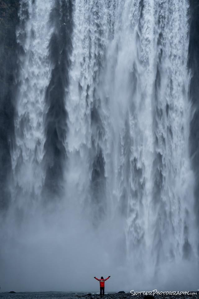
How bout a giant wall of water crashing down on your best buddy!
That’s the Skogafoss Waterfall.
You impatient? Want to take a sneak peak at my gallery of pics from the trip (click link below):
If you’ve seen one beach filled with black sand, you’ve seen them all. Actually, I’ve never seen one! This place (beach outside the town of Vik) is nuts.
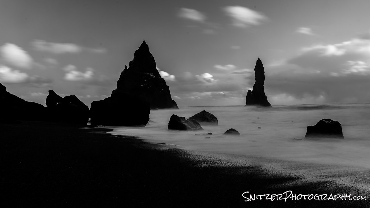
Lookout…here comes some rough weather!!!
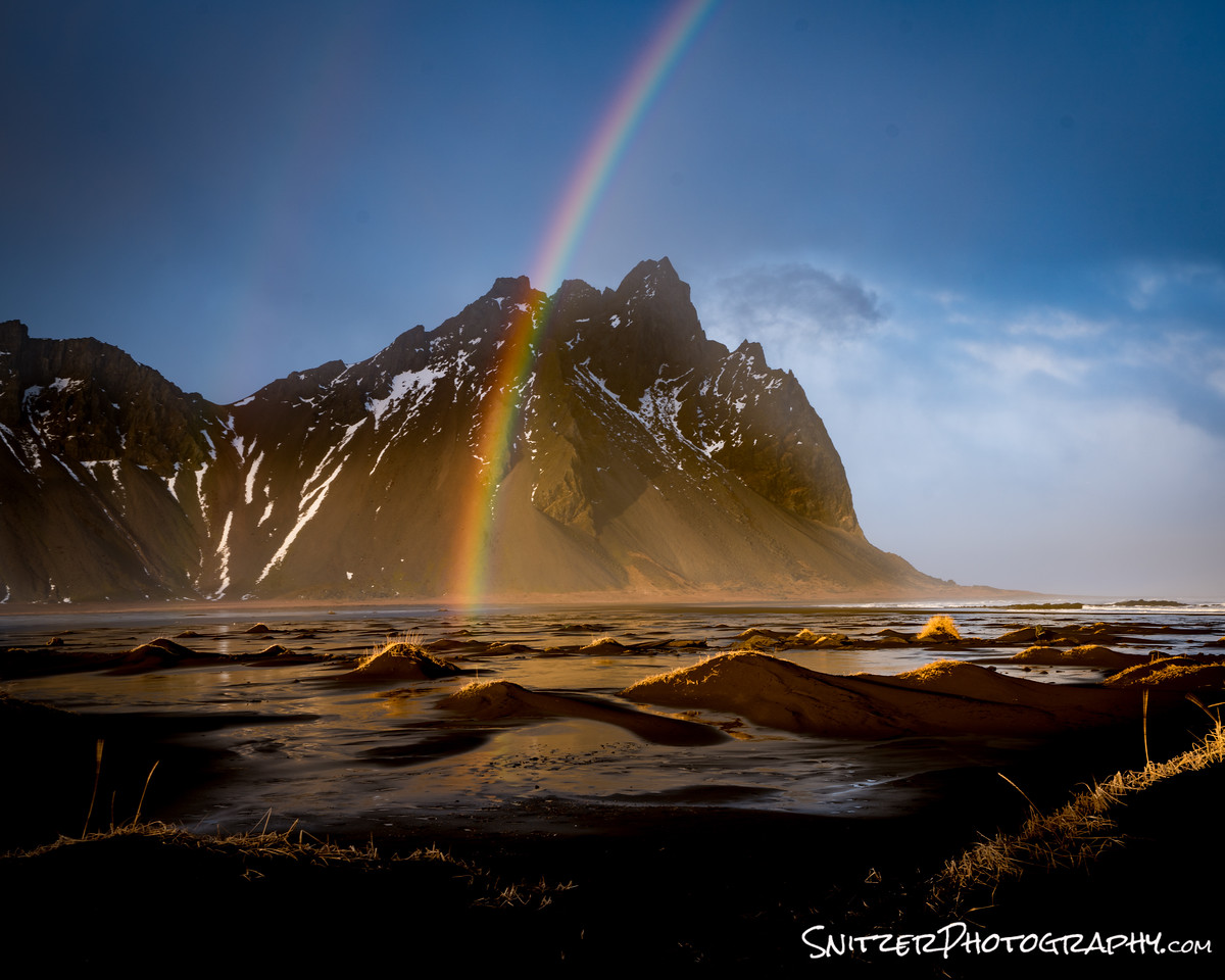
Once the storm passes…it’s time for a rainbow! Woooooo!
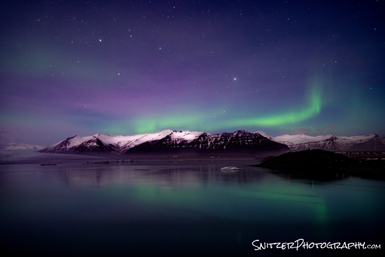
When’s the last time you saw the Northern lights in the U.S.? Err….unless you count Alaska.
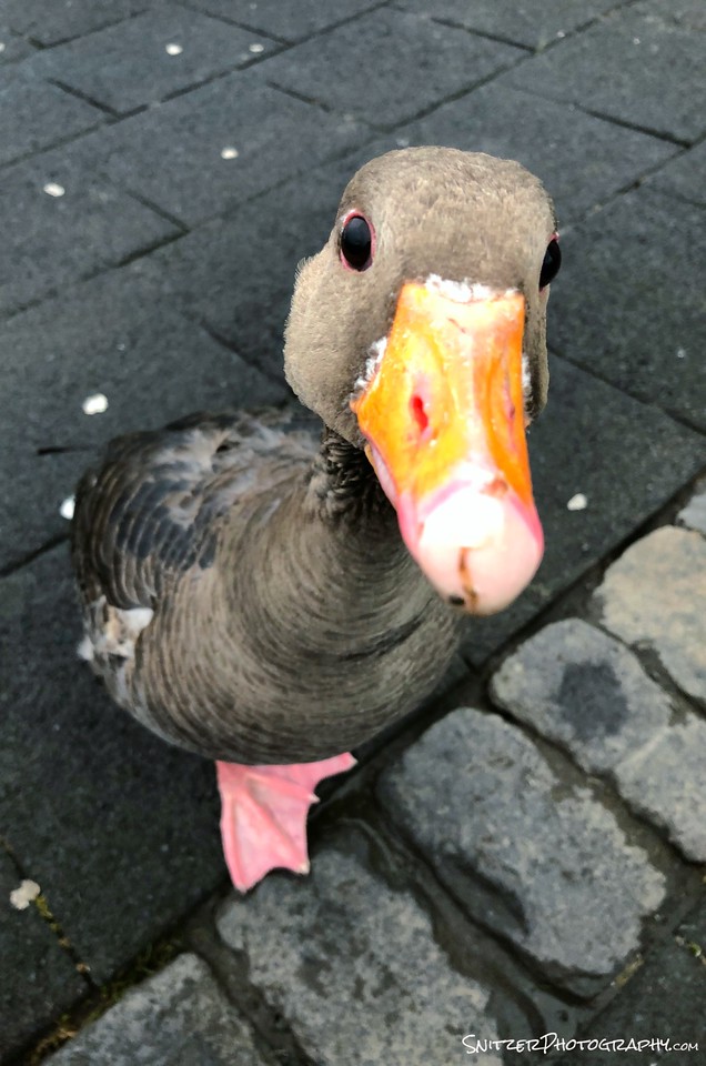
You can also check out Iceland’s largest City, Reykjavik. Not the world’s most exciting place, but home to the greatest duck ever.
We met at Hljomskalagadur Park. He’s now living in our guest room.
Bottom line: For out of this world scenery, this place is a must see. Winter is the best time for serious photographers. For muggles, suggest you avoid the summer rush and visit in Sept or October.
When I refer to “summer rush” keep in mind that this small island of 340,000 people had over 2 million visitors last year. Try to avoid the “high” season.
Fired up to see more pics from the trip (click right): Snitz’s Iceland Gallery
Visiting Arches/Canyonlands in Winter? Am I nuts?
Our national parks offer incredible scenery, well-marked trails & great park rangers. Ergo you’re less likely to get lost and left for dead while exploring. The bad news; others have discovered this! Want to avoid the crowds & get a little solitude! Go in the offseason.
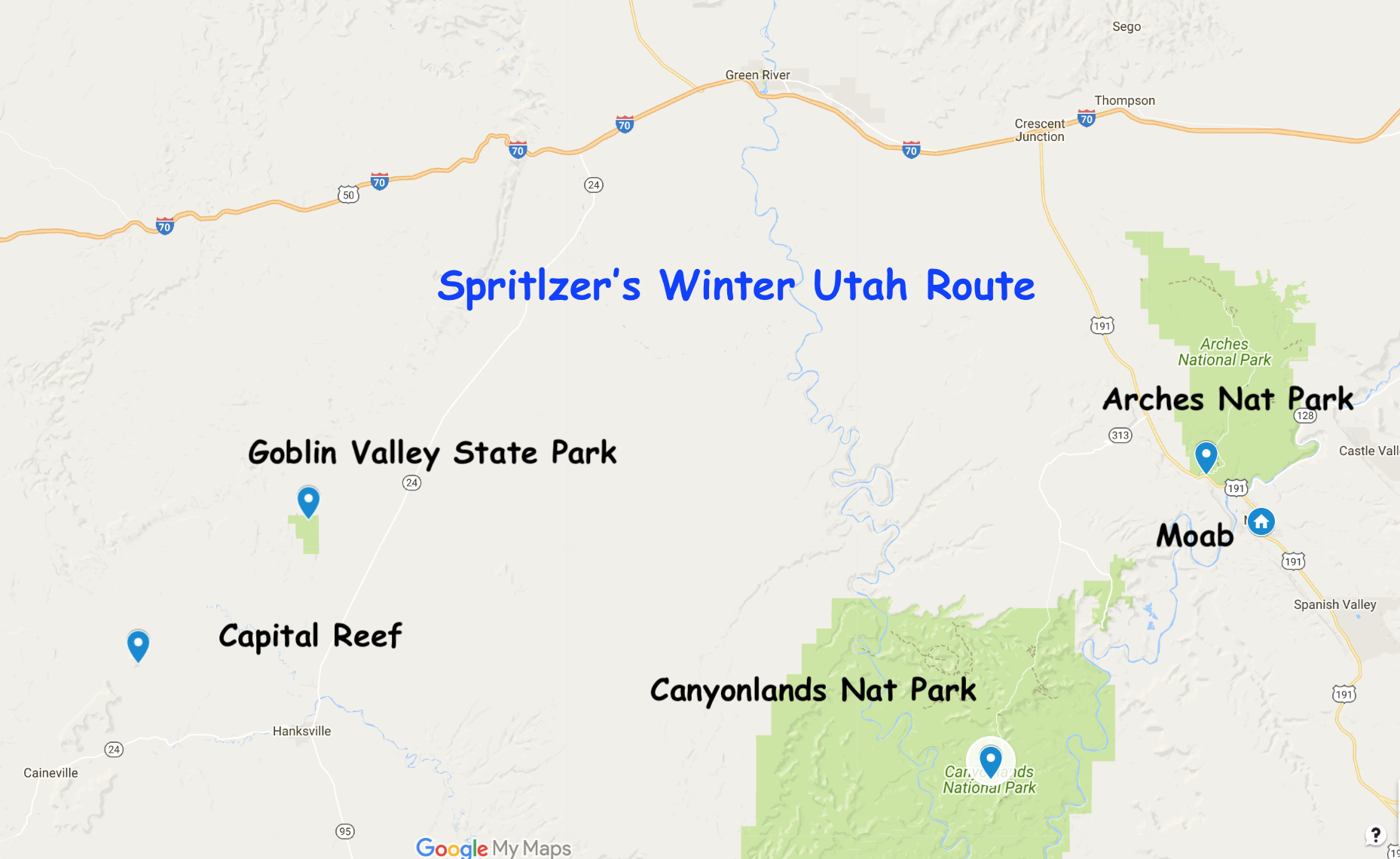
I just returned from Arches, Canyonlands & Capital Reef. Had the parks to myself. BAM.
Cold? Nope! I was mountain biking in a tee shirt last week (55 degrees)! Typically you see bluebird days with highs in the upper 30s.
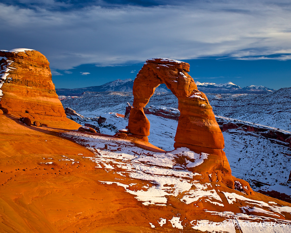
Enough talk, let’s fire up some pics. The Delicate Arch pictured below (Inside Arches Nat Park/absent the usual mob scene). Having some snow on the ground improves the photog!
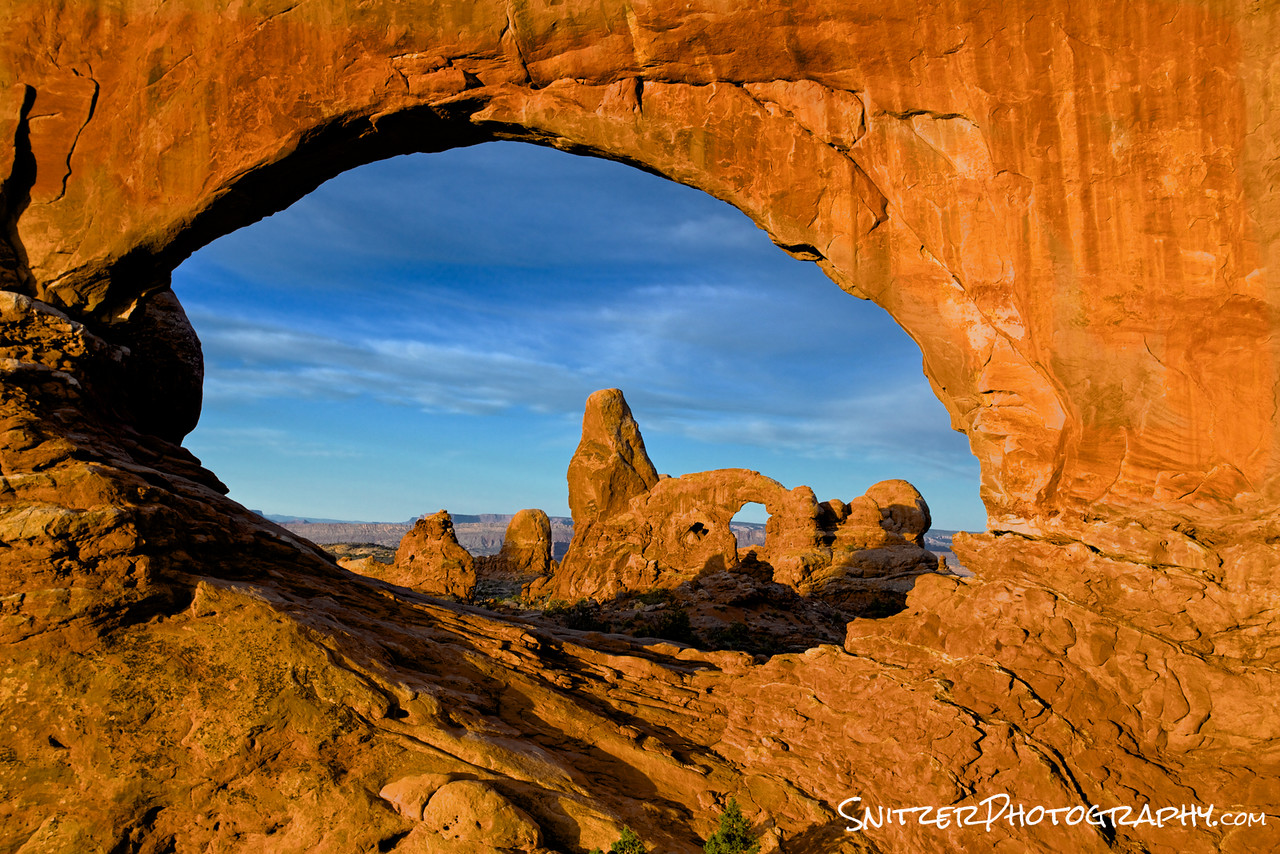
Snow or not, Arches National Park has lots of great stuff waiting to be explored. How about the Mobius Arch viewed thru the South Window? Pic gallery from my recent trip!
Wondering where all this stuff is? Wondering where I’m going next?
Having spent several days at Arches Nat Park I’m about to head over to Canyonlands. By the way, I’m staying in nearby Moab (close to both parks).
Eventually, I’ll be exploring Goblin Valley and then on to Capital Reef Nat Park.
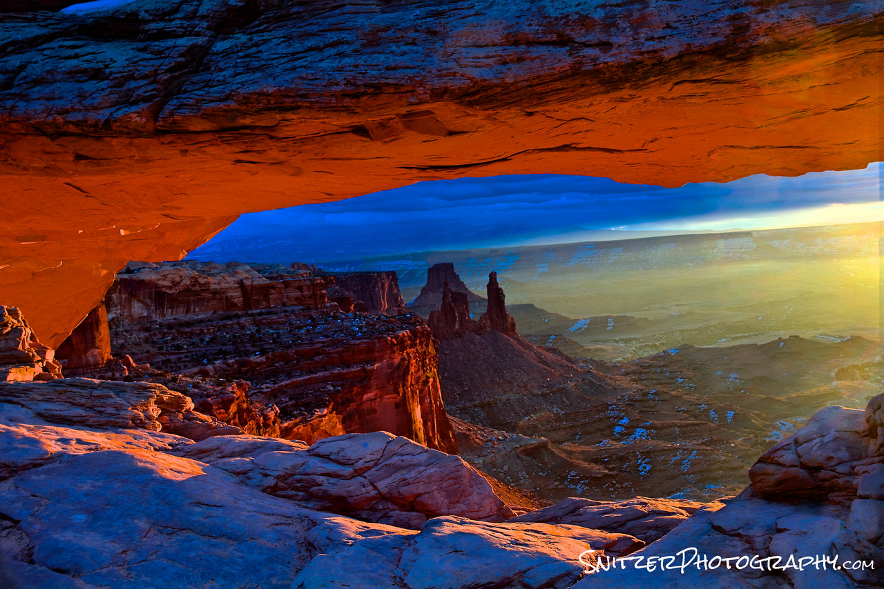
First stop at Canyonlands: the iconic Mesa Arch. The scene at sunrise is typically Viet Nam. 40 photographers fighting for position (in a space that holds 8). Not in the winter!
Want to get a feel for how the sun actually rises to light the underside of the Arch? Timelapse to the rescue!
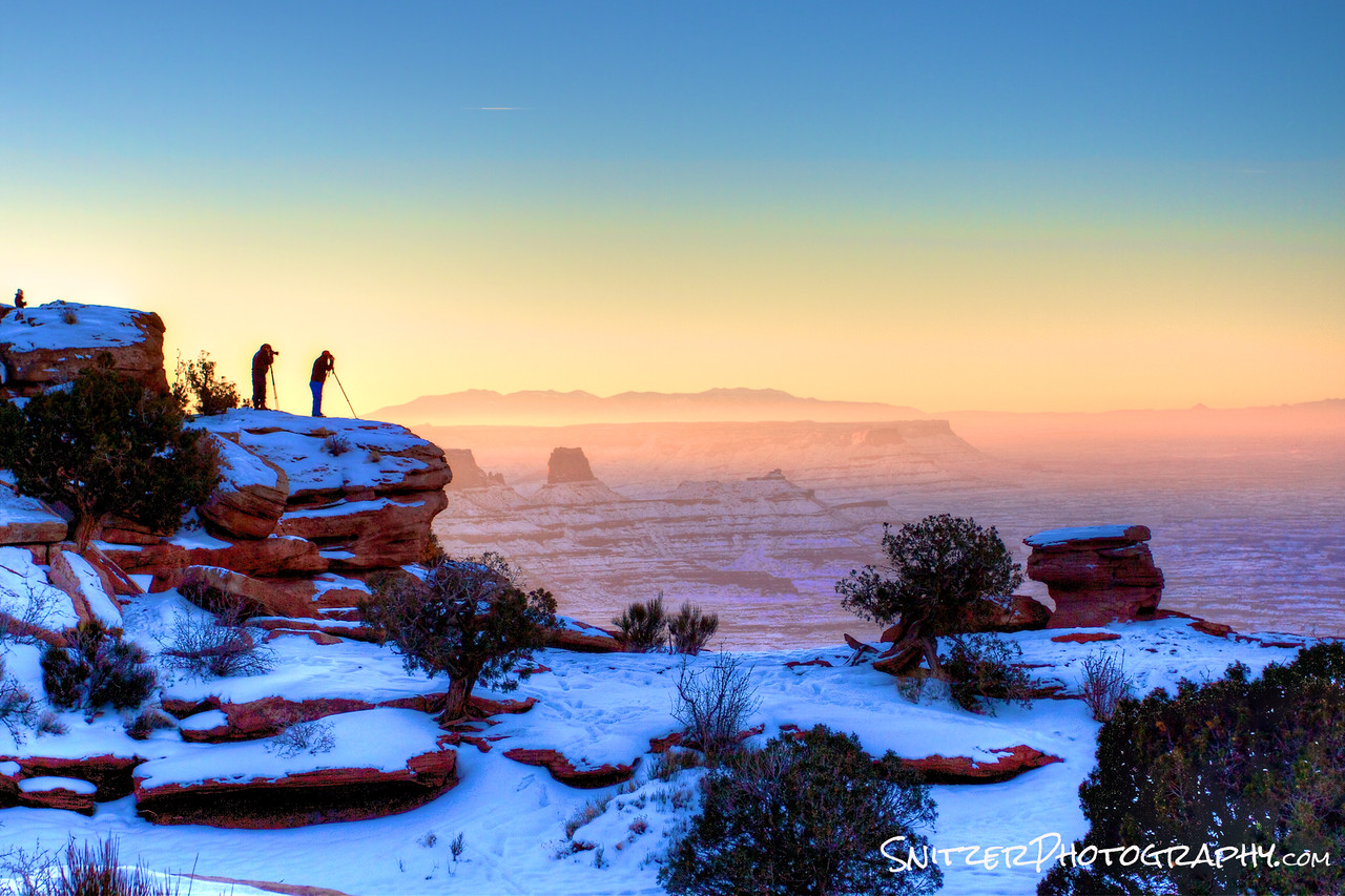
Two vacationing park rangers from Zion National Park and I share the sunrise over Dead Horse Point (Canyonlands). No one else in sight!
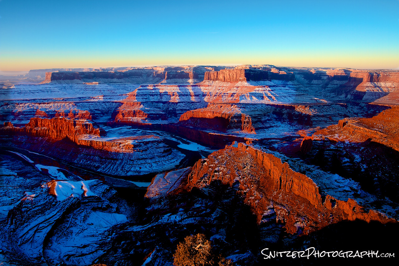
The lingering snow from an earlier storm really kicks ars. Improves the image!
I know you want more time-lapse. I’m on it!
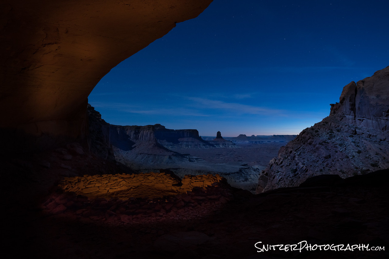
Or how about the seldom viewed False Kiva, said to be an ancient meeting place of the Anasazi Indians. This baby is cut into the side of a massive cliff. The access route is unmarked (hint…GPS directions avail on Google).
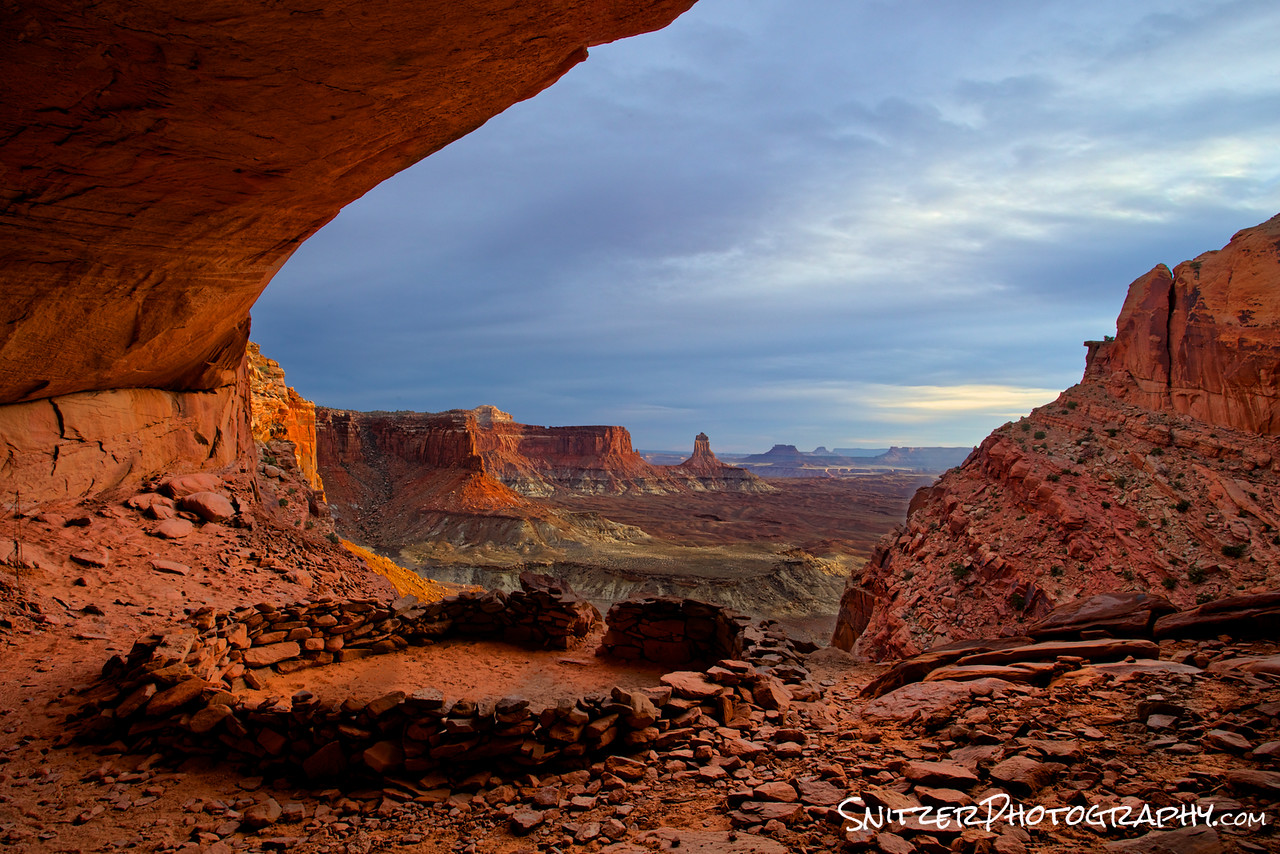
Here’s the view if you’re dumb enough to stick around at night. I shot this with a full moon providing backlighting and a gelled flashlight to create some color inside. I know, I’m a genius. Speaking of genius, luckily I didn’t get killed doing the 45 min climb out after dark. Brilliant.
No dumbass. I didn’t forget the time-lapse.
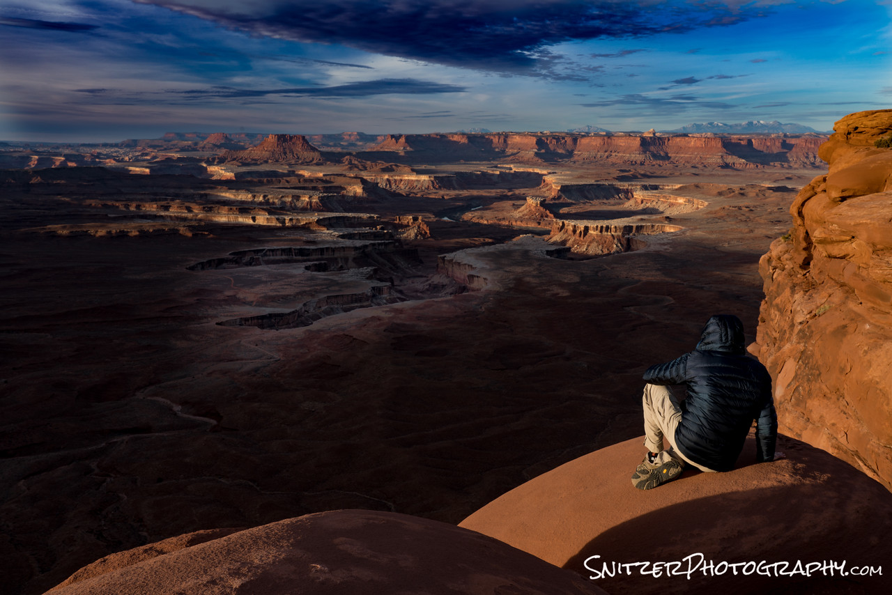
Green River Overlook BABY! There’s T Snitz Esq. pondering the meaning of life as I look out over the great divide. I should have been a philosophy major.
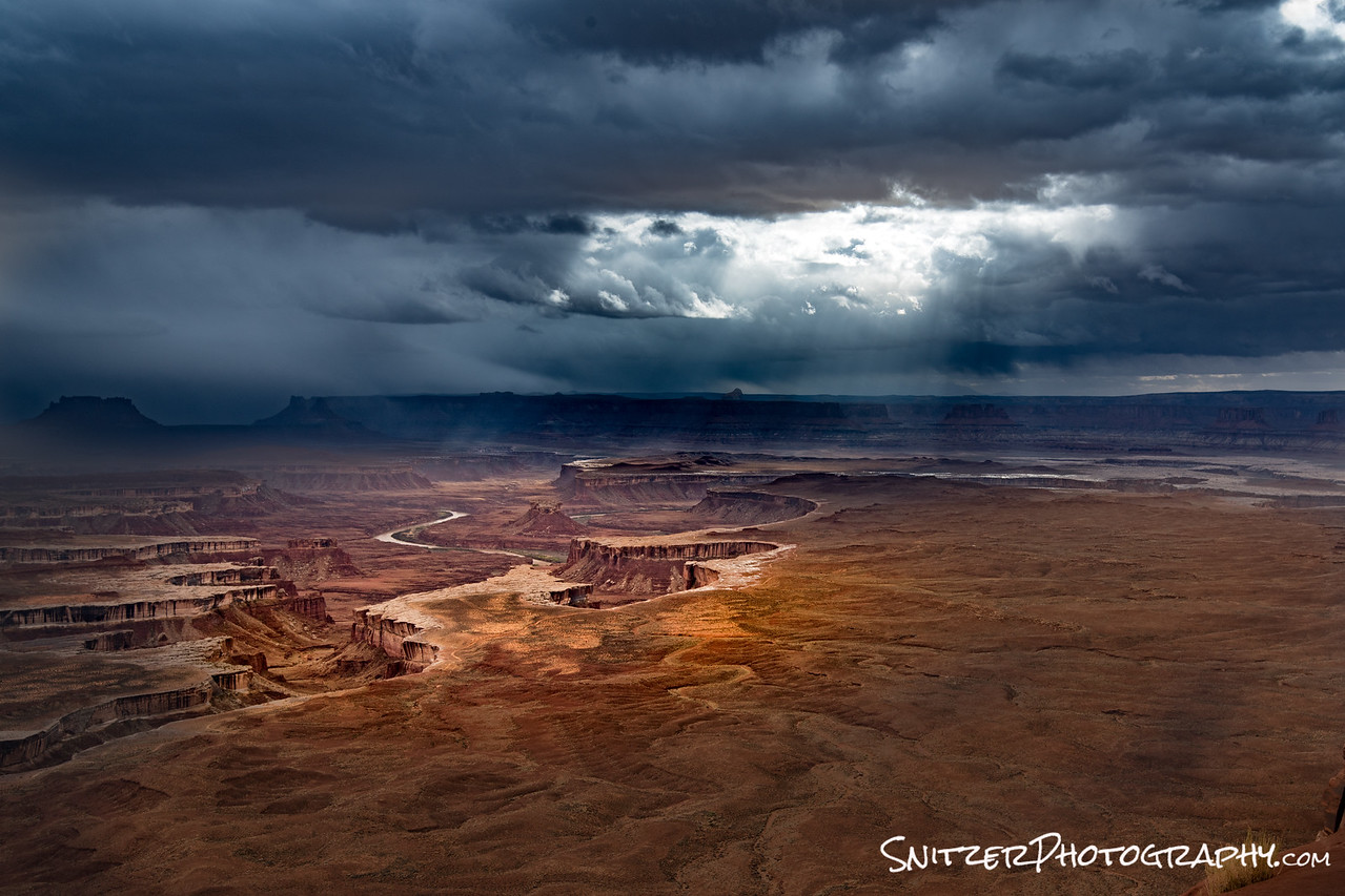
Moving along 15 mins South to Grandview Point! Ahhhh…I can just feel the stress melting away. Who needs to meditate up here.
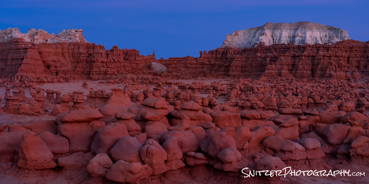
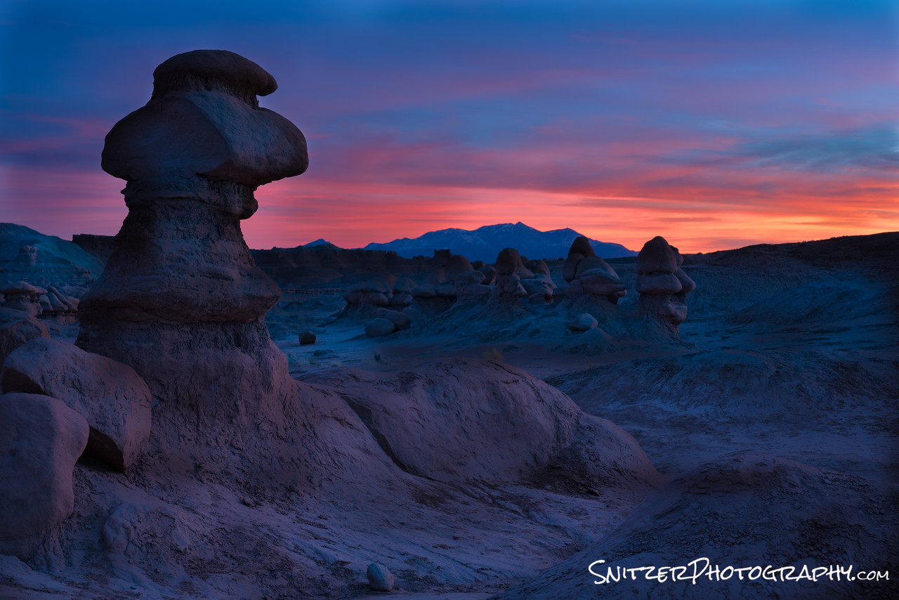
Goblin Valley houses some stuff from a science fiction movie. Seriously, Galaxy Quest was filmed there.
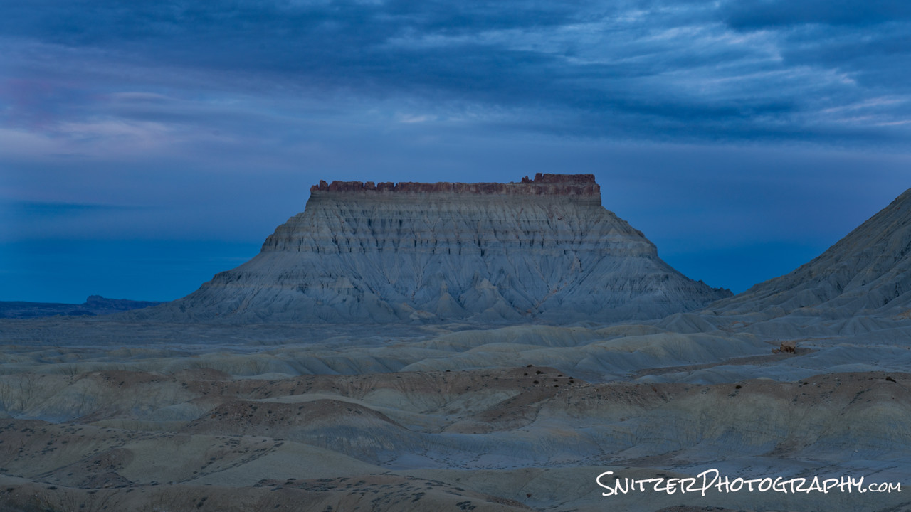
Next stop, the East boundary of Capital Reef National Park. Wow. This place looks like the moon.

Ok, you planning your winter trip to Utah? Seriously! What are you waiting for? You’re not getting any younger!
Want more pics before you commit? Check out the images I took last week (click here)!
Still hungry! Ok…more of my stuff from Utah(click here).