Patagonia Dreaming!
Ever toyed with the crazy idea of visiting Patagonia? The long 9,000-mile trip yielded amazing photos and world-class trekking!
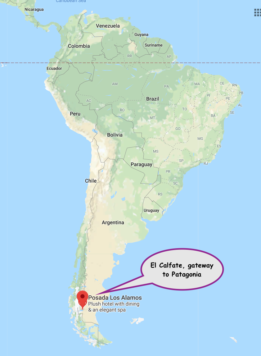
Patagonia is located at the southern tip of South America. Go any further and you’re practically atop the South Pole.
My 12-day trip started with a flight to Miami, connecting in Buenos Aires and finally landing in El Calafate, Argentina, the entry point to this amazing National Park.
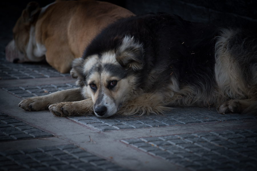
The small town is home to a bunch of climbing shops, small hotels and a large population of homeless canines. They’re friendly and ironically pretty well fed.
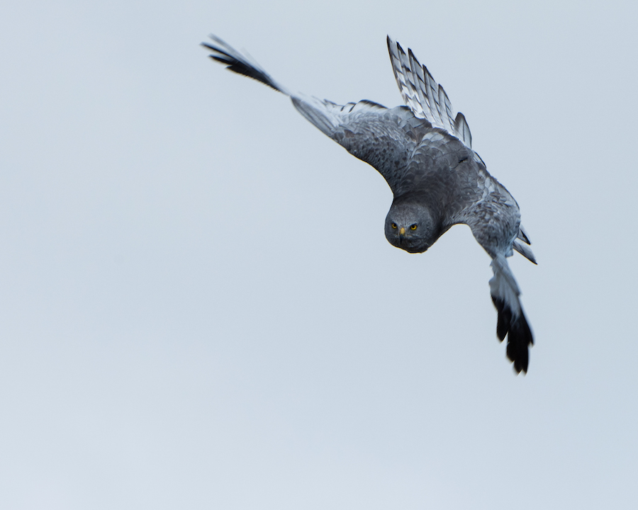
A few blocks from the center of town; hawks patrol a local wildlife sanctuary (an unexpected treat). I wasn’t sure if this guy was about to dive bomb me!
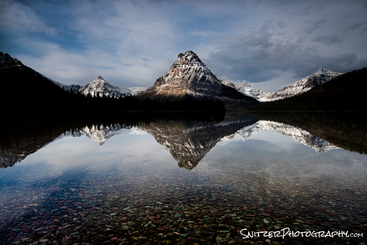
My serious exploration, started the following day at the Perito Moreno Glacier. The 200 foot tall wall of ice descends 5+ miles from the mountains eventually terminating into Lake Argentina. The frozen mass ice has an eerie blue cast and dwarfs the occasional viewing boat that ventures in for a closer look.


Below I’m pictured getting ready to grab the shot!
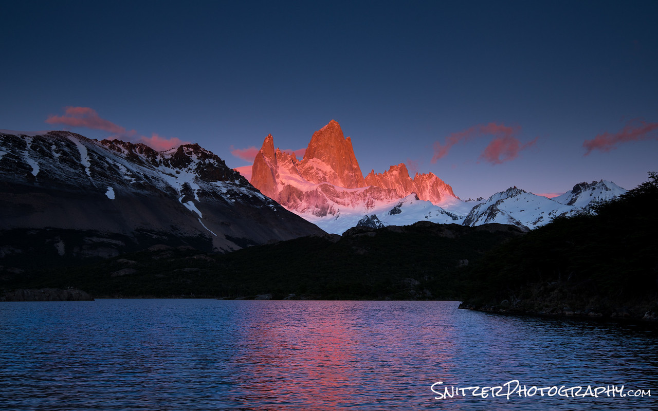
Fritz Roy is also an iconic peak that looms over the park and stands as one of the world’s most famous and challenging technical climbs. At 4am we start hiking up to view it from the small town of El Chalten. We reach the Laguna Capri just in time to see the first light spill over its main spire.
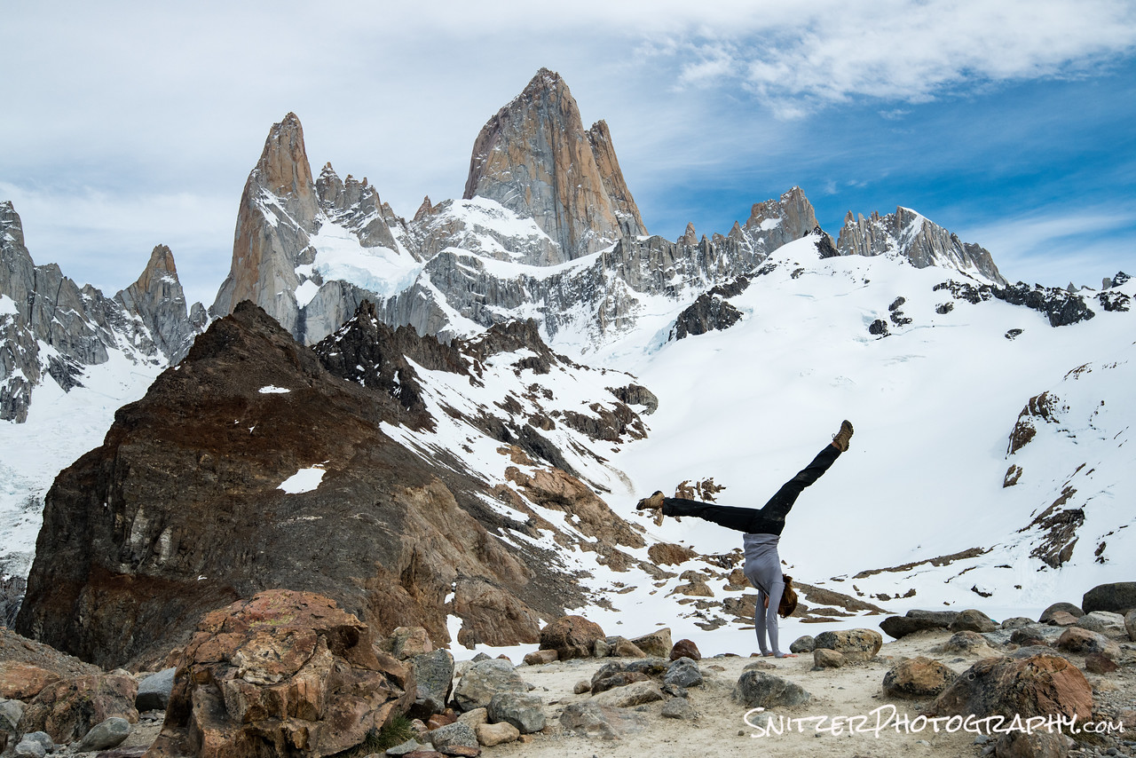
2 hours later…we’re still going & getting closer to the base of Fitz!
I’m hiking with two other photographers from NC, one of whom (Sharon) was a collegiate gymnast. Great op for a hand stand!

We’ll be exploring the Fitz Roy area for the following 3 days. Lot’s of great hikes, mountain views and crystal clear water. In fact, with no pollution or animal grazing, it’s totally safe to drink out of any stream.
With day 6 comes phase II of our trip, passing thru the border from Argentina to Chili allowing our exploration of the Cerro Torre area.
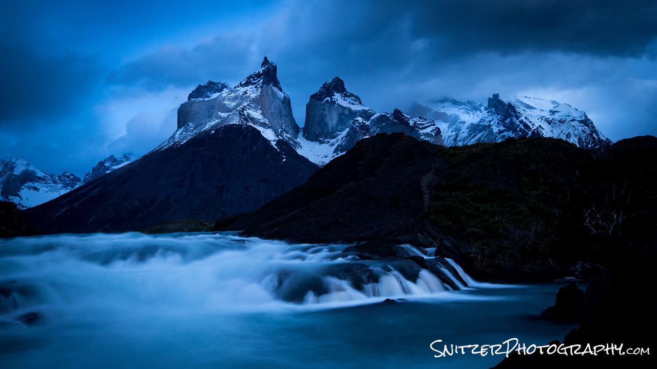
Our hotel, The Hosteria Peho, is located on an small island (pictured to the left in the photo below) in the park which overlooks two mountain peaks rising over 8,000 feet from the lake floor (The Paine Grande and Los Cuernos del Paine).
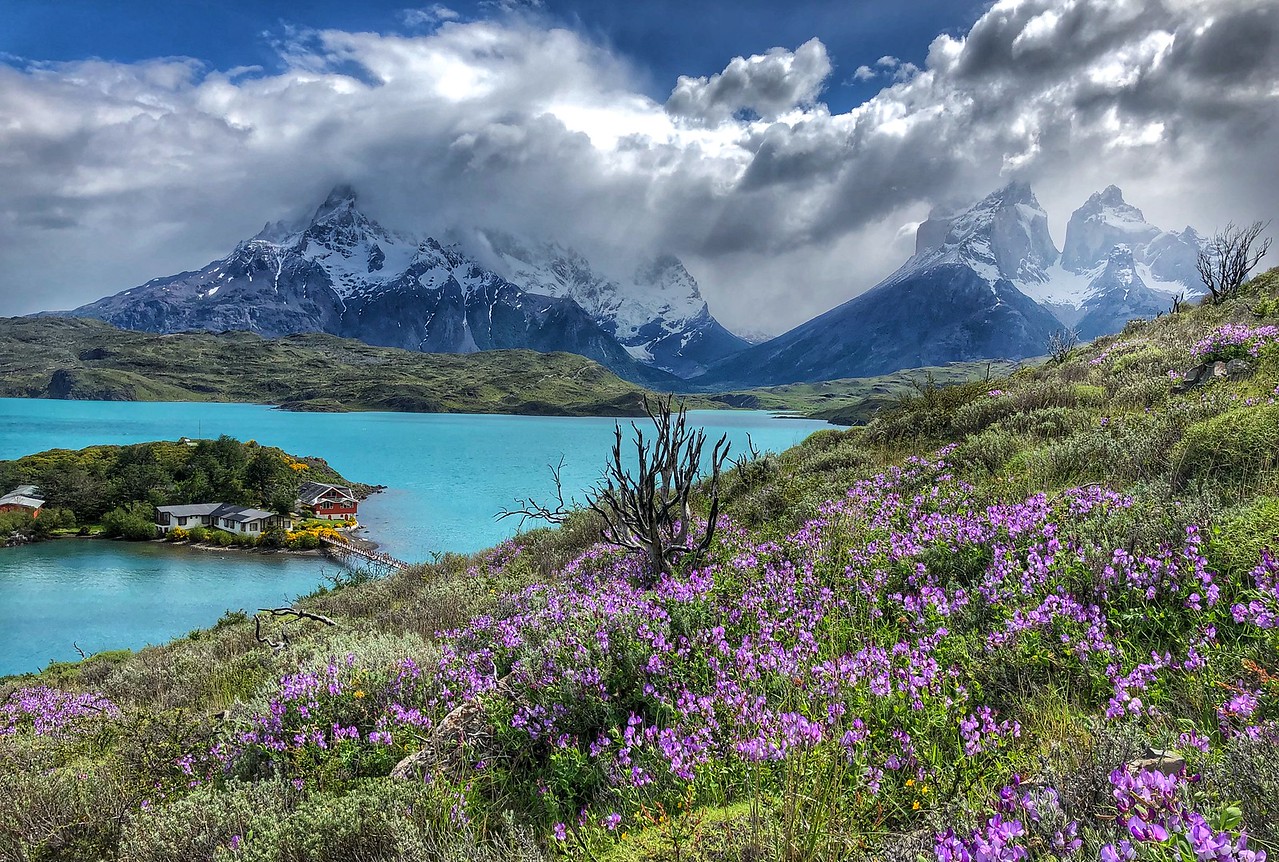
Check out the view from behind the hotel. Not bad!!!!

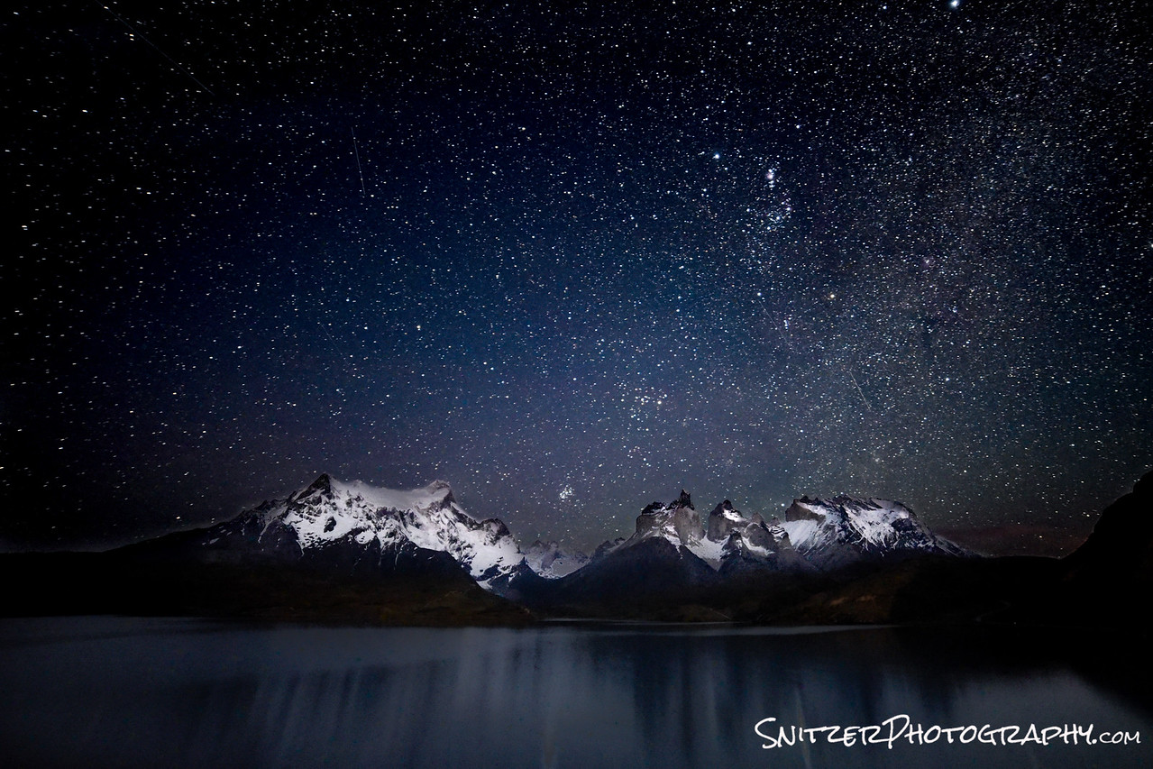
Like that? It looks even cooler at 3am allowing me to catch the stars overhead…with a little moonlight reflecting off the snowcovered peaks!
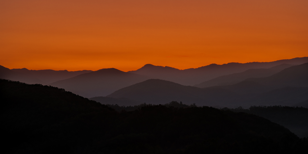
The terrain and variety of scenery in Chili are inspiring. We’re typically up each morning around 5am so get into position for great pre sunrise light.
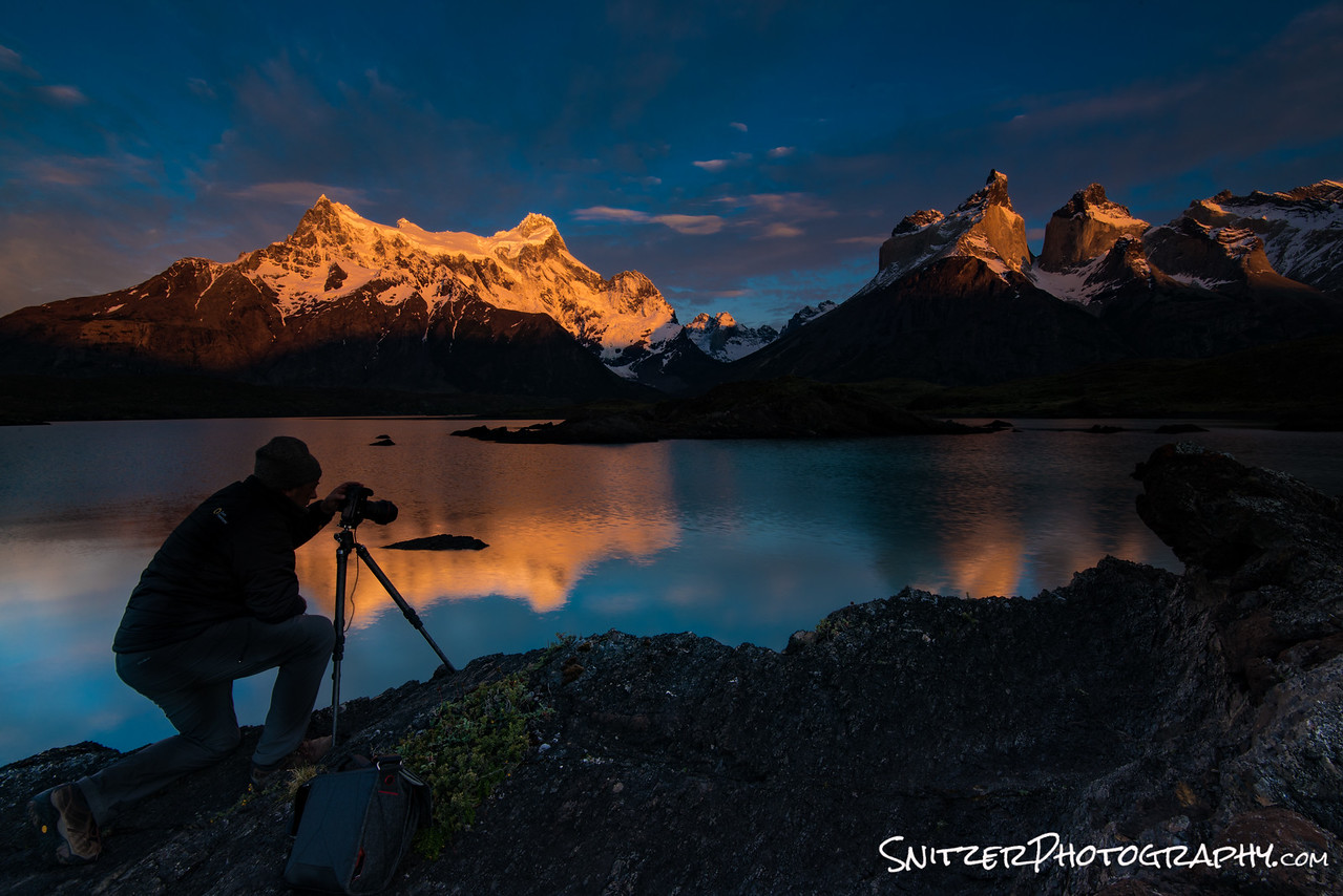
The next day brings completely different weather. The shot below was taken while perched on a mid-stream rock outcropping as a storm front moved in. Fortunately we had 15 minutes to shoot before the rain hit.
So the really important question: Is Patagonia worth visiting? Yes! For photography and hiking, there’s nothing like it I’ve experienced. It’s an unspoiled, generally uncrowded mountain local that’s unmatched in our country. Will the tranquility last forever? Don’t think so…more tourists are discovering this gem every year.
Click the link below for more photos from my trip!
https://www.snitzerphotography.com/Nature-Travel/Galleries/Patagonia-2017/n-jW68rv/
Great Fall Color In The Smoky Mountains
October is a magical time to travel to Townsend Tennessee, a gateway to the Great Smoky Mountain National Park. Happily, this year the leafs decided to change colors literally as I was pulling into town.Lucky break!
I had the opportunity to combine photography with exceptional road biking. My typical day consisted of a morning shoot around 6am as first slight spilled over the mountains. The image below was captured on the Foothills Parkway 20 minutes before the sun made it’s appearance.
Once the sun emerged, it was time to re-group and start riding up the 2,500 ft. elevation gain to the summit of the parkway. Oh my burning legs!
Over the next few days when not on the bike, I had the chance to explore a myriad of uncrowded streams that traverse the National Park. The view below is just off a gravel road leading to the small town of Tremont.

Seems like there’s a waterfall around every turn!
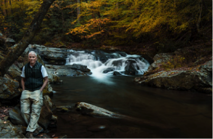
The author taking a break.
Ok, now to photograph that scene behind me!
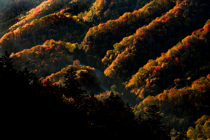
One of the park’s main attractions is an area called Clingman’s Dome. The drive from town to this vista takes around 70 minutes. Lot’s of vistas emerge as you weave your way up the park road…showcasing the fall color change.
The best view in the park has to be a sunset atop the Dome! The low lying clouds created the backdrop for the glowing rays of light to backlight the scene. Pretty special.

Want to see more from the trip? Click the gallery link below:
https://www.snitzerphotography.com/Nature-Travel/Galleries/Smoky-mountains/n-QzDf8q/
Is Glacier Nat Park the best?
I’m sick and tired of folks asking…”Spritzler…what’s your fav, National Park. You’re a nature photographer…seen them all. So?”.
I can’t possibly begin to answer that. Each park is an individual snowflake, special, unique with features that set it apart…errr…Ok. It’s Glacier Dagdamit! There I said it.
But seriously folks, Glacier combines amazing lakes (with mountains prominently featured in the background …poetic aren’t I!), out of this world hiking and the opportunity to view this stuff in solitude. I love Yellowstone, but not seeing it with 1,000 of my closet friends. Did I mention waterfalls…Glacier has that too!
The trick is knowing when to visit (hint: fall, specifically mid-Sept the last week the park hotels are open) , being ready to hike a long long way (for the good stuff) and being on the trail at first light (to beat any others to the punch).
I’m the map, I’m the map, I’m the map (Dora the Explorer…dont you watch cartoons)?
Ok, Glacier has 4 main areas to explore. Lake McDonald to the West, Logan Pass, Many Glacier and Two Medicine. The first three areas are connected by the Going to the Sun Road, one of the countries most iconic (aka bomber!) drives.
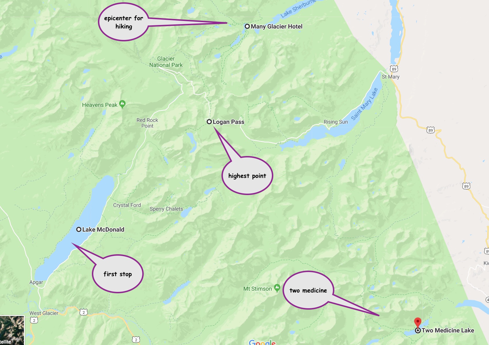
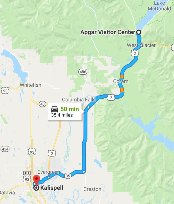
The easiest way to access Glacier is by flying into Kalispell, the nearest airport (45 mins away). Your first entry into the park is Lake McDonald.
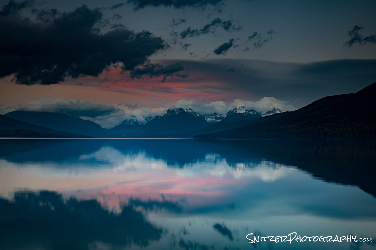
The lake area is beautiful, but probably only worth one day of your time.
Lake McDonald at sunset, from the Apgar pier.
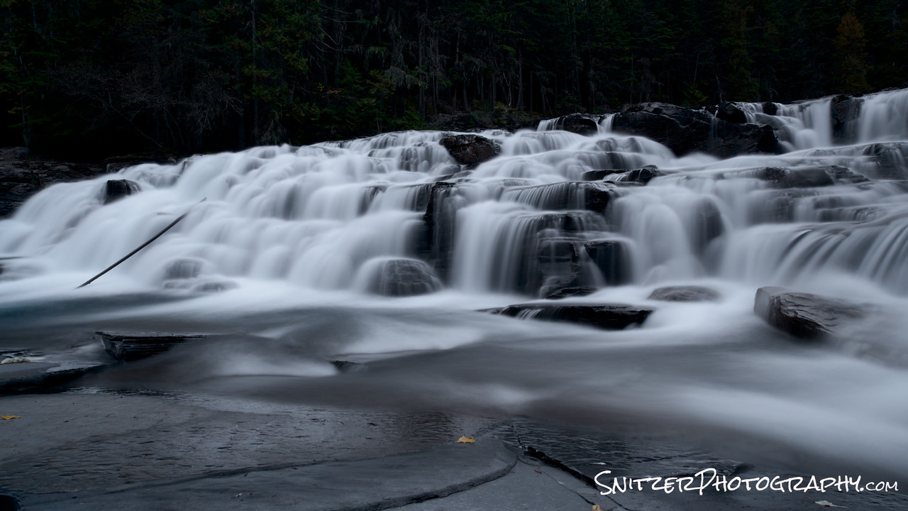
The real fun starts as you begin the drive up toward Logan Pass. A few minutes after you reach the Lake McDonald Lodge, you hit McDonald Falls. Feel free to hike down like I did….watch out…very steep.
The views continue to improve as you wind up the road!
Eventually, when you reach the top of the pass, pull into the parking lot and hike up to Hidden Lake (takes about 75 mins one way). There’s a pretty good chance you’ll see some bighorn sheep!

After returning from Hidden Lake, you’ll continue along the Going to the sun road now losing altitude, having crested the pass. Eventually you’ll arrivie at the Many Glacier Lodge. This is the epicenter for the park’s best hiking (plan to spend at least 3 days here). The hotel fills up fast, reserve wayyy in advance.
Swiftcurrent Lake sits immediately in front of the lodge.
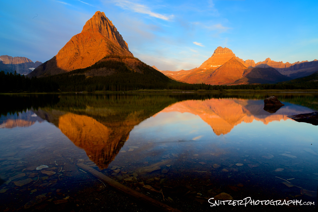
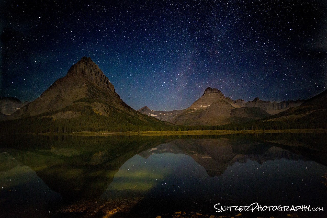
The view of the lake at night isn’t half bad either. I took this image at 3am with a small crescent moon behind me illuminating the mountains ahead.
Ok, enough talk, let’s get to hiking.
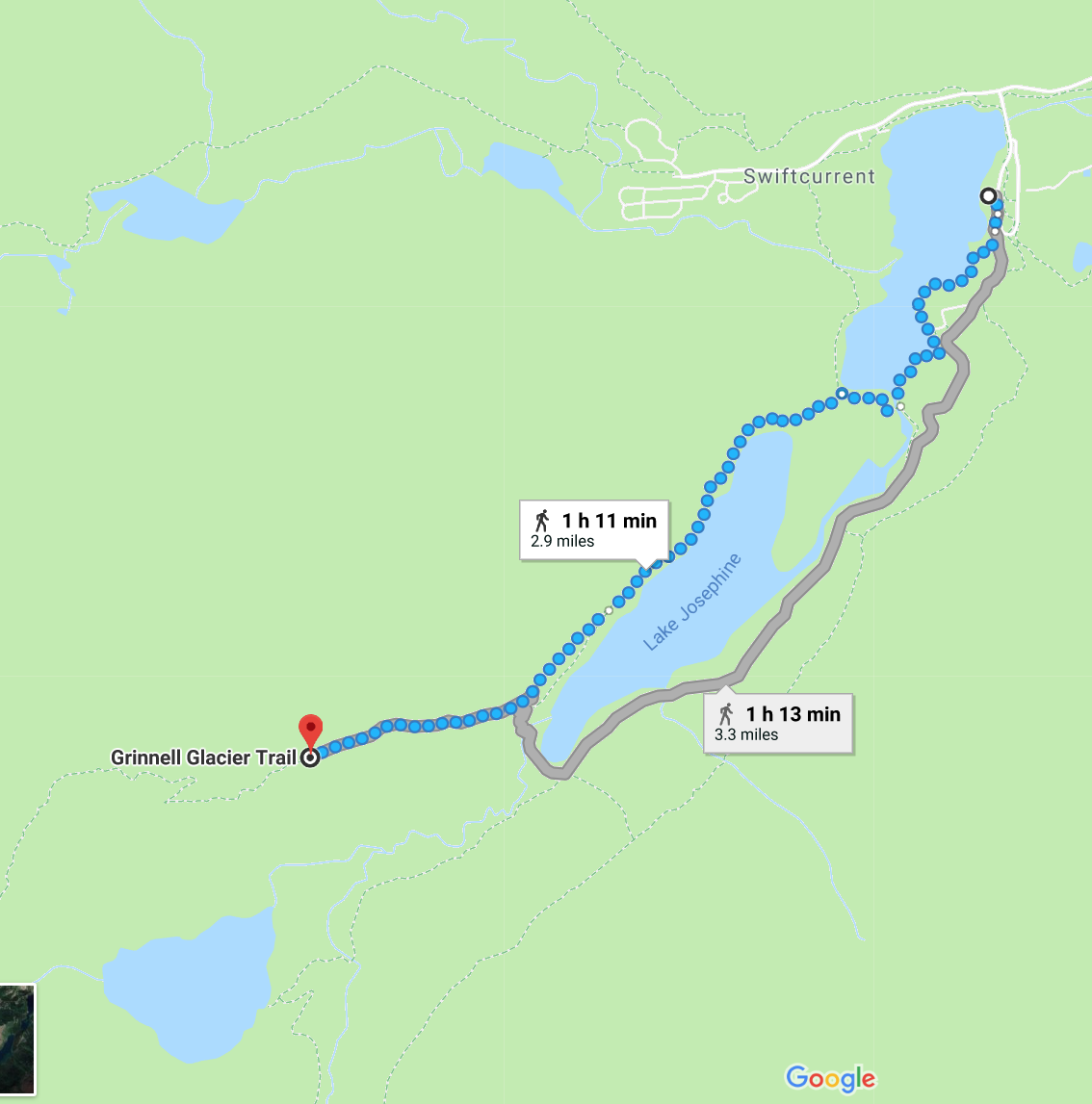
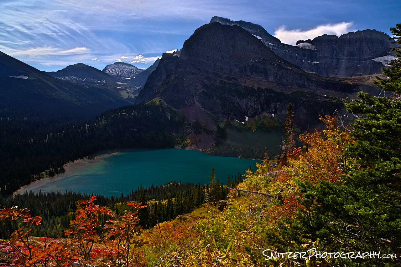
My favorite place to start: the trek up to Grinnell Lake. Actually, the best way to see the lake is to take the traverse that climbs above. As I mentioned before, start hiking about 20 minutes before sunrise. You’ll have the entire place to yourself and the lighting (for you photo bugs) will be spectacular as you ascend.
http://www.hikinginglacier.com/grinnell-glacier-overlook.htm
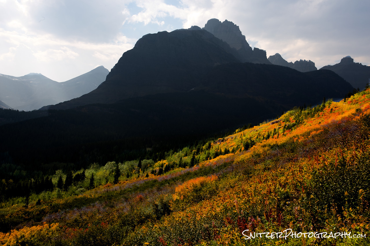
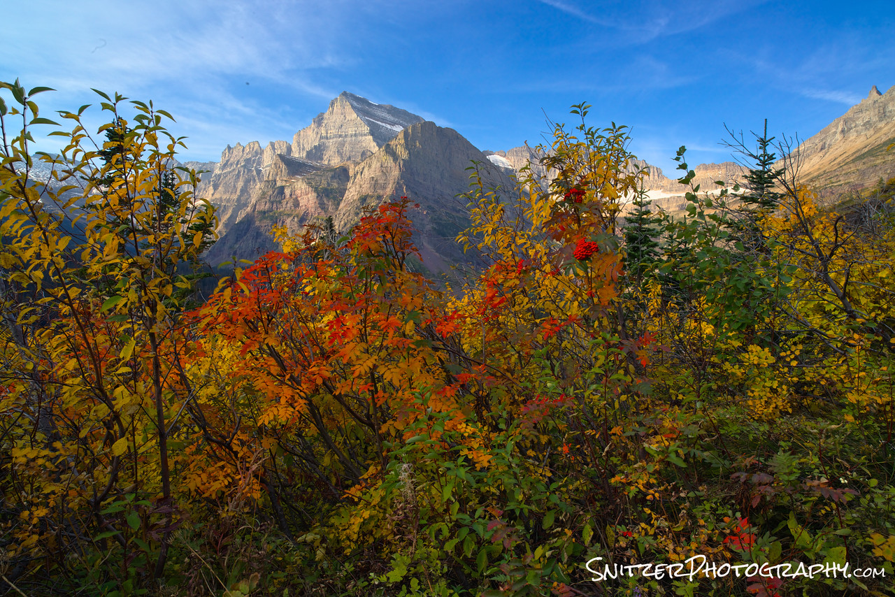
Pictured below left is the view about 30 minutes into the hike. Check out the fall colors (Woooooo!!!). Below right is one of the great viewpoints (there are about 100) as you traverse your way up the mountain.
BAM! There’s Grinnell Lake. I told you it was worth it. Yes, you’re climbing almost 2,000 vertical feet. Quit complaining and enjoy the view. Besides…no once else has made it up there yet Earlybird! Pat yourself on the back. SOLITUDE BABY!
Ok, day 2! You loved Grinnell lake and are ready for more Cowbell!
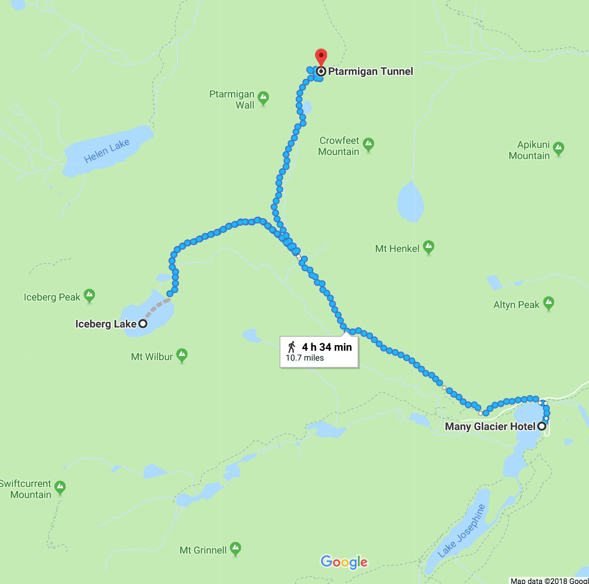
Your in for a double treat…you can either hike to Iceberg Lake (an awesome hike by itself…below left)…or you can combine with a hike to the Ptarmigan Tunnel. Doing both hikes involves about 3,400 verticle feet of climbing (if you’re in shape do both….Wooooo!!!).
http://www.hikinginglacier.com/iceberg-lake.htm http://www.hikinginglacier.com/ptarmigan-tunnel.htm

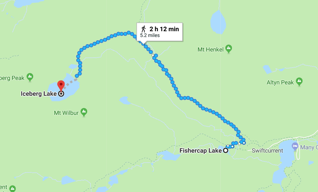
On your way back from Iceberg Lake, I strongly recommend you take a brief (1/4 mile) detour off the trail to visit Fishercap Lake.
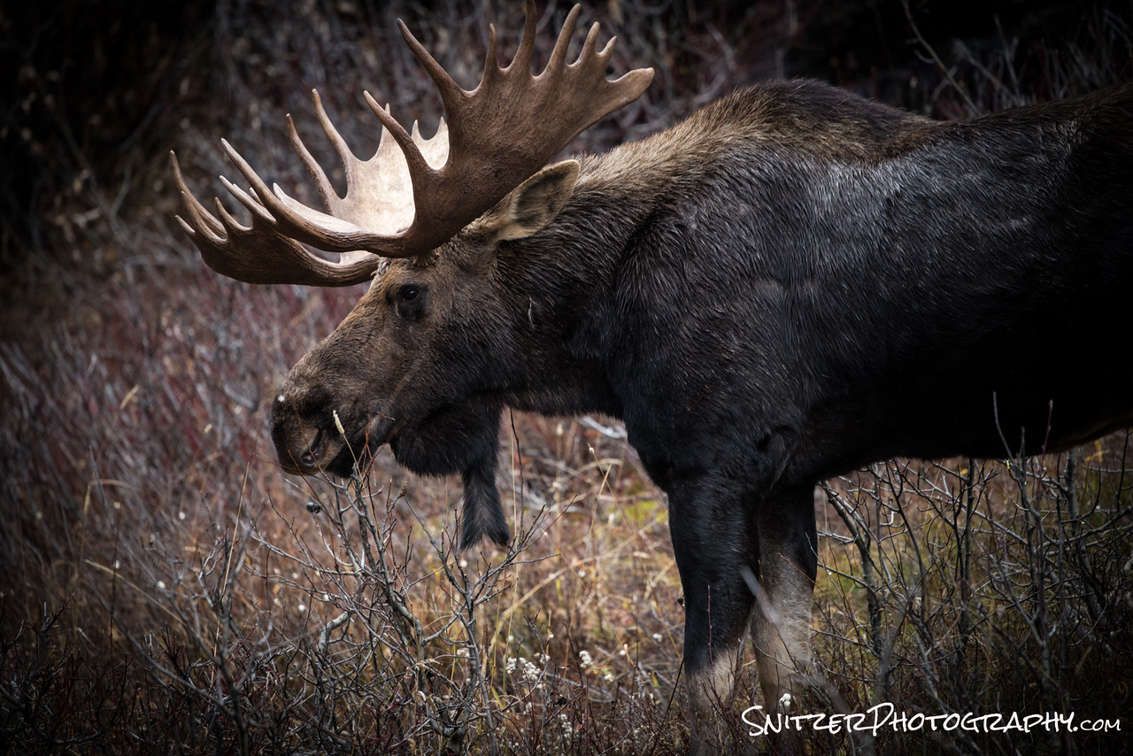
Nice to look & NEWSFLASH: its a great place to view moose and deer feeding. The lake has a high salt content on its bottom and attracts all sorts of critters.
You thought I was kidding about the moose? I’m serious…go to the lake….see a funny animal with big antlers. Don’t get too close..their actually more dangerous than Grizzly Bears.
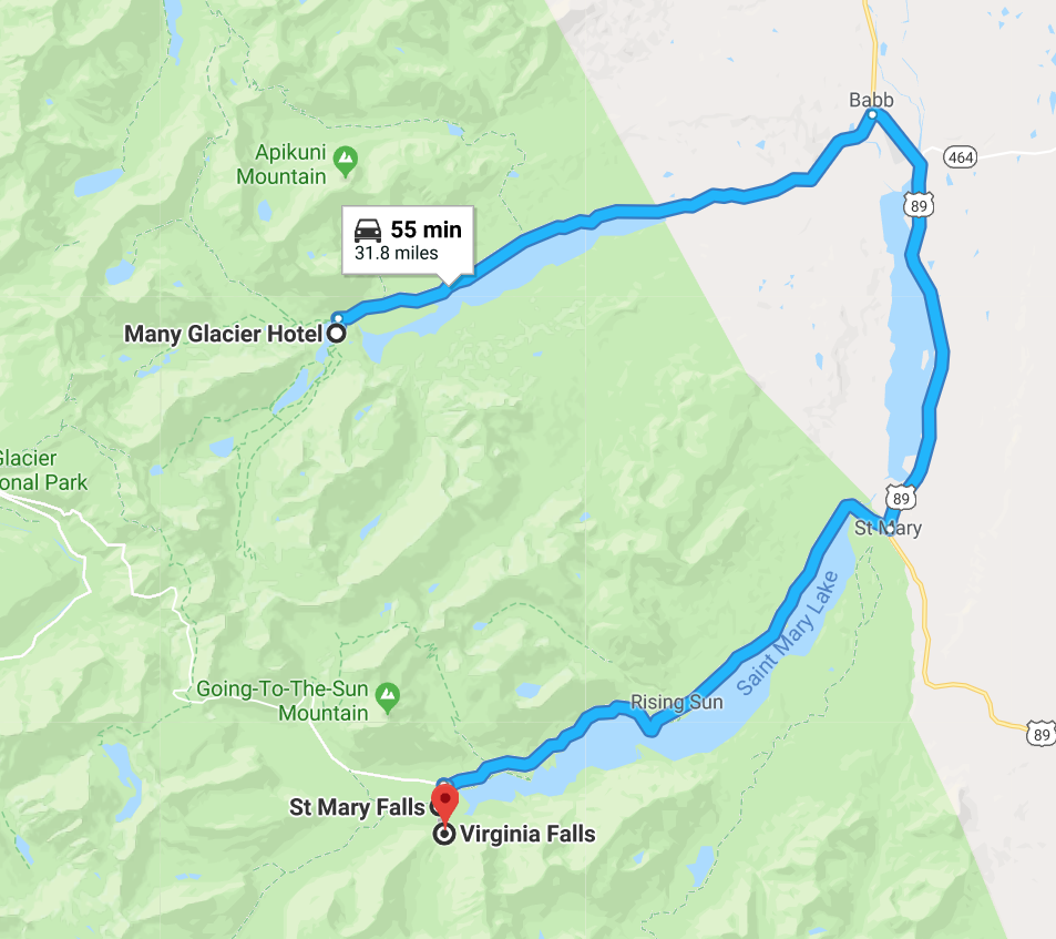
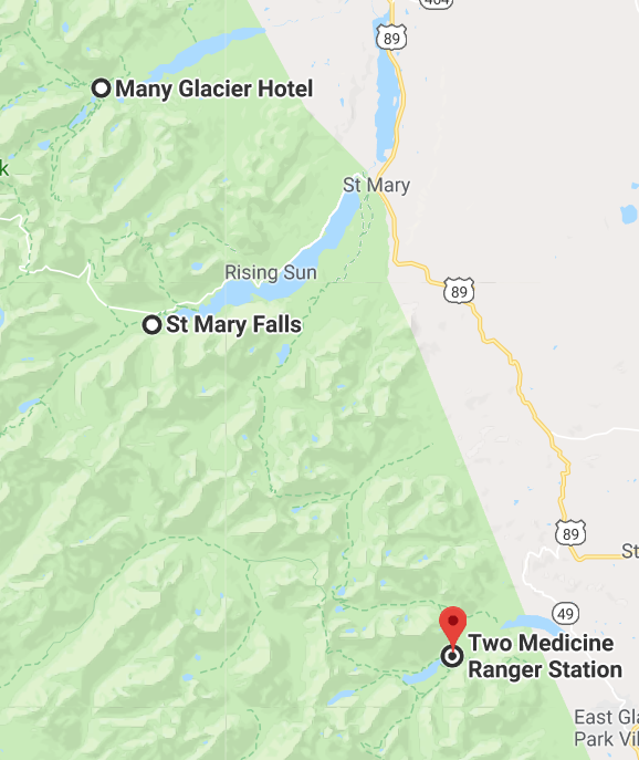
Ok, once you’ve exhausted the Many Glacier area, I strongly suggest you go down to visit Two Medicine. Along the route down there is a detour to hike to explore Virginia & St Mary’s Falls (map below left). The detour takes about 20 mins in and out. It’s well worth the effort….great hike.
http://www.hikinginglacier.com/virginia-falls.htm
http://www.hikinginglacier.com/st-mary-falls.htm
Once you’ve completed the waterfall trek, then backtrack to route 89 and continue on to Two Medicine.
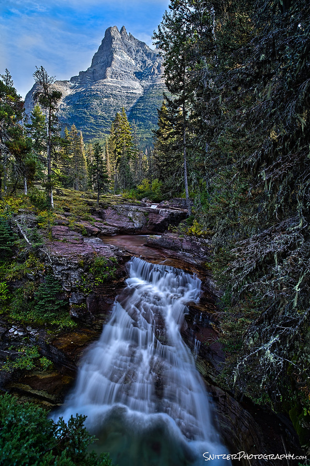
Wooops…forget to show you what some of the waterfalls look like on the hike. Behold!!!
When you arrive at Two Medicine, the view is!!!!!…Yes I’m crushing it behind the lens. Hint: Want to get the reflection of the water and the cool rocks underneath the surface…two words: Polarizing Filter! Enough said.
Hiking options: you can enjoy the view or take one of several amazing hikes. My #1 favorite is the Pitamaken Loop. It’s 15.4 miles and takes you through some magnificent scenery and great climbing. Again…not for those who are out of shape. Start at first light….it’s an all-day event.
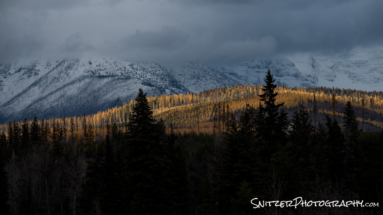
Other stuff in the park I haven’t yet mentioned? Yes, in the fall, the larch trees begin to turn yellow. This is typically in early October after the park concessions have all closed. If you’re lucky enough to stay in nearby Whitefish you have the opportunity to explore some amazing areas that are hitting peak color.
One of these it Bowman Lake. The drive to the lake is along a lousy 4 wheel drive dirt road. It’s a bitch to navigate (very bumpy) but the lake is amazing, particularly at sunset. Don’t attempt without 4WD!
Pictured below is a view along the drive in.
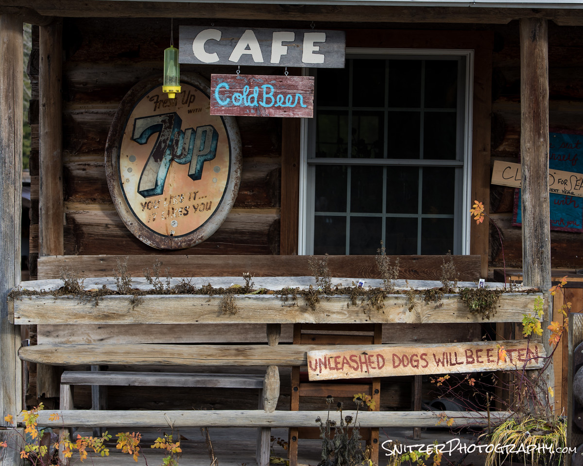
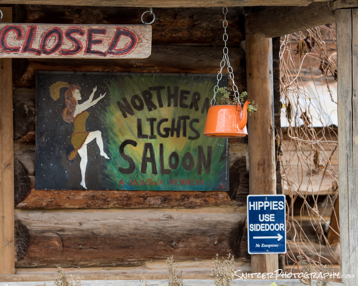
Along the route is the small outpost of Polebridge. There’s a great country store with A+ baked goods. Stop, check out, have an Elephant Ear.
After a nasty nasty drive…here is Bowman Lake. BAM
So is there other stuff to see outside the park? You bet. The town of Whitefish is surrounded by interesting roads to explore (also some great biking).

We done yet? Not by a long shot. It’s a short drive up to Canada, the Waterton district and Banff/Lake Louise. If you can spare an extra 2-3 days (or more), I highly recommend tacking that on to your trip!
Pictured left is Mirror Lake on a hike high above Lake Louise.
My favorite park in the USA…like I said…it’s hard to say…can’t think of anywhere I like better!
Glacier National Park Fall 2014
I’ve been been chomping at the bit to explore Glacier for many years. This September seemed like the perfect op as the park was starting to show it’s fall colors and the park’s summer crowds were subsiding. In fact with only 2 of the park’s 10 hotels open, I had the place all to myself. An added bonus was some spectacular weather…cool mornings, mid 70s during the afternoons.
That’s not to say that storms can’t hit without warning…the park received 14 inches of snow the week before I arrived.
The first part of the trip started in the Many Glacier section of the park, which is considered to be the best single spot for hiking. The view below is right in front of the Many Glacier Lodge perched above Swiftcurrent Lake.
Swiftcurrent Lake at Daybreak
Some great “water” pics near Steamboat Colo.
Mount Zirkel
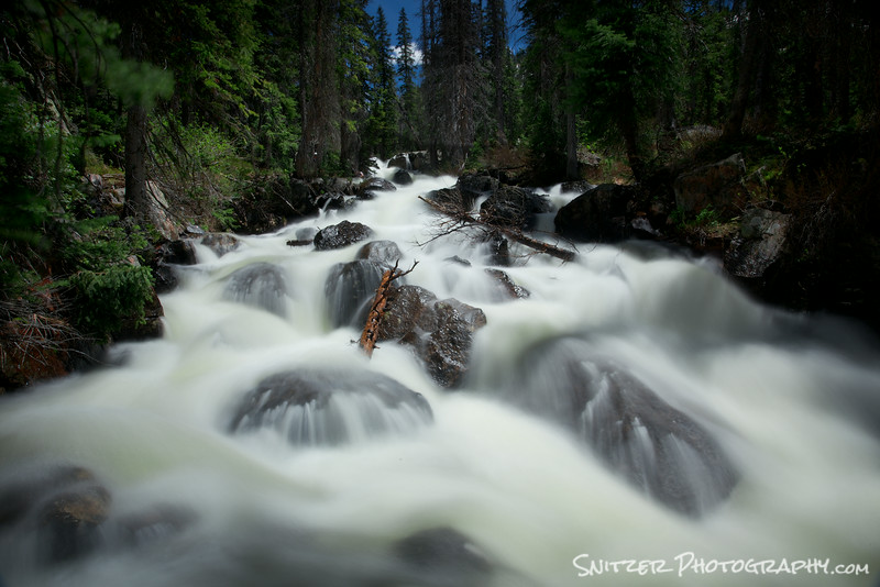
I recently had the opportunity to hike the Mount Zirkel Wilderness Area (located about 40 minutes from Steamboat, Colo.) in late June. Many of the high elevation lakes were still covered by snow & frozen over. Three Islands Lake, however, had recently thawed and the 2.5 hour hike to it afforded some great flowing water shots along a stream bed running a “full bore” with the Spring runoff.
The silky effect for the water was achieved by using long exposures of between 10 & 25 seconds (camera mounted on a tripod). I also used a polarizing filter to cut glare.

Looking downstream on route to Three Islands Lake
View upstream a few miles further along the trail.
Rabbit Ears Pass
Later that evening, we enjoyed a great sunset at Rabbit Ears Pass.
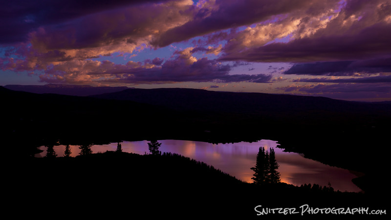
Sunset on Rabbit Ears Pass, looking down upon Lake Catamount.
Fish Creek Falls
One of our final stops was Fish Creek Falls, one of the favorite hiking spots near the ski area…also heavily travelled.
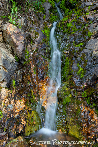
A small trickle of water on the hike down to the falls
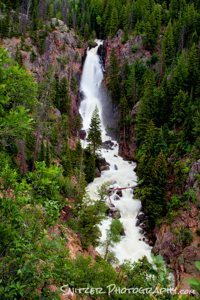
Fish Creek Falls viewed from above.
Celestial Photography at Arches!
Just returned from 10 day biking/hiking trip to Steamboat Co. Had the opportunity to do a great side trip to Arches National Park (outside of Moab Utah) and grab some great shots of the spectacular/iconic rock formations against the backdrop of the Milkyway Galaxy!
I started shooting about 10:30pm when twilight had receded and the night sky was in full bloom. For you tech-heads out there….here’s how I grabbed these images:
- I used a full frame SLR with a very fast fixed focal length lens (Canon 6d and Rokinon 16mm f 2.8).
- The Camera was mounted on a tripod, with the lens held open for approx 25 seconds (F2.8 @ 2000 ISO). Long enough to get a proper exposure, short enough to avoid star trails. Ie. the stars rotate around the North Stars….if you leave the lens open too long…you get streaks.
- I illuminated the rock formations using two techniques. A. I started using LCD flashlight with colored gels…to bring out the natural color of the rock. I typically positioned the camera in front of the arch, then painted the arch with light from the side. I trigged the camera using a remote blue-tooth shutter release. B. When the moon came out later in the evening, I used that as the additional light source.
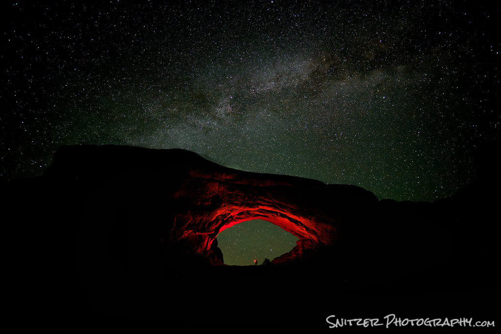
North Window. Snitz standing beneath with gelled light.
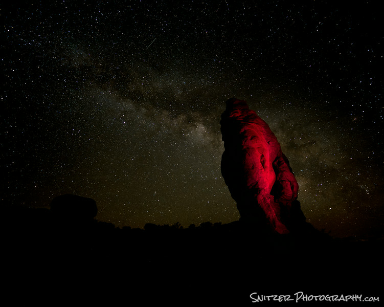
Milkyway Galaxy creates a great backdrop!
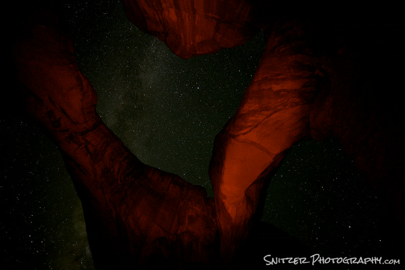
Looking up through the Double Arch
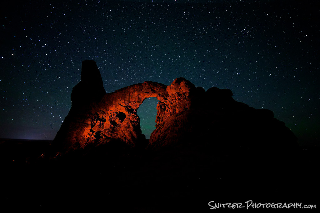
Author providing side illumination for Turret Arch.
-
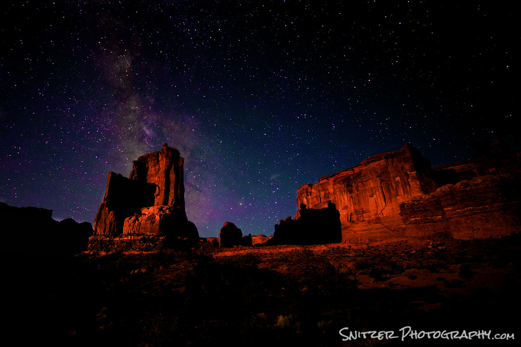
The Tower of Babel, moonlit later that evening.